For the last seven years, I’ve been very fortunate to have traveled to some amazing places–both on work assignments and on vacation. From Amsterdam to Valetta, Anchorage to Kotor, Athens to Verona, Agrigento to Ephesus, and Agra to Edinburgh, I’ve often shared photos on Facebook with a bit of history or some interesting perspective. Friends have said “You should write a travel blog” so many times I lost count.
Which brings us to “Postcards from the Road Not Taken.” In many ways, like Robert Frost’s poem, “The Road Not Taken,” I’ve often faced difficult choices in life and each time, I too was sorry I could not travel both roads and be one traveler. In looking back, I usually chose the road less traveled by. Yet I always wondered about the road not taken, the one I had kept for another day. I suspect many people reading this blog have at one time or another, thought someday we’ll go to Paris, someday we’ll make the trip to see the cherry blossoms in Washington, D.C., someday I’ll go to Bali.
After I survived heartbreaking losses and setbacks in 2010-2011, I decided it was time to explore the roads I had not taken in my 20s, 30s, and 40s.
Travel touches us in ways often difficult to explain. There are no words to describe the emotions I felt standing on the stern of a cruise ship gazing at Mount Vesuvius hovering above the harbor of Naples, gilded by the late summer sunset, until it faded away in the distance, a violet shadow on the horizon. The same view my grandmother would have seen more than one-hundred years earlier as a fifteen-year-old girl sailing to America on the steamship SS Weimar. She would never return to Italy; yet in the last six years, I’ve been there eight times. Each time the language and the food transporting me to my grandmother’s kitchen in the 1960s — a place that now exists only in memories, some still vivid and full of color while others grow hazier with each passing decade.
If we let it, travel makes our world smaller and our hearts fuller by showing us how we are all not so different in our shared hopes and fears on our beautiful planet.
I hope you will enjoy the journey with me as I stake a claim to special places and special memories. Perhaps they will inspire you to explore your own roads not taken.
The hum of our generator wakes me. I can hear Chris making coffee and he’s already pulled in our shore power cord and the two spring lines. I climb down from the snug bed in the forward V-berth and pull on a turtleneck, pair of leggings and fleece sweatshirt. It’s still pitch black, but our last leg in this amazing journey will take twelve hours or more so he’s getting the boat ready to leave just before first light. Dew still clings to our deck and windows, so I grab a cup of coffee and head up to the pilot house.
Although a frequent stop for refueling and provisions for small boats and fisherman, Bella Bella remains a frontier town. In 1876, a Canadian reporter for the Toronto Globe described the settlement at Bella Bella: “The Indian houses situated on the very edge of the water were built of roughly hewn cedar planks about 15 or 18 feet square. The planks are made by splitting cedars which have grown to an enormous size and smoothing them after a fashion. Posts are stuck in the ground and the planks are nailed around them. A plank bark covered roof is then put on with an aperture in the centre for the escape of smoke. Round the enclosure in several different corners were small rooms which were doubtless the dormitories of the commingled families. In the centre of the main floor a fire smoldered, over its smoke hung lines of dried salmon and other fish, together with berries, skins, bark or any other article of household use that required drying or seasoning. Round the common chamber, squatting on the packed mud floor, were women smoking their pipes and busily engaged in making baskets and mats. They seemed quite content to be visited and the elderly ones made light and amusing jests at our expense. In every house, there was at least one slumbering papoose and an endless variety of dogs. There was a very ancient and fish-like smell about these dwellings…”
As we leave civilization behind, the water is a gray silk mirror. We thread the narrow channel between Denny Island and Campbell Island, then skirt the north side of Hunter Island. Sailing down its eastern shore, the channel widens along Nalu Island and Hecate Island. The fog and rain only add to the beauty of this place.
In 1987, British Columbia established the Hakai Protection Area to safeguard the marine and wildlife in the Hunter Islands archipelago, as well as the beautiful, long, sandy beaches on Calvert Island. Orca, humpback and grey whales, porpoises, dolphins, sea lions and river otters flourish here. The intertidal zone hosts a wide variety of mollusks, crabs, starfish, anemones, and sea urchins. On the islands of the Hakai, you’ll find black bears, wolves, black-tailed deer, and mink. Chinook, Coho, Sockeye, Chum and Pink salmon all swim through here on their way back to mainland rivers and streams. Halibut, lingcod and rock cod are common. More than 100 species of birds have been spotted in this rich environment: bald eagles, kingfishers, osprey, cormorants, sandpipers, loons, gulls, auklets, murrelets, oystercatchers, even black and ruddy turnstones.
Here we enter Fitz Hugh Sound where the ghost town of Namu lies to our west. At one time, Namu had a population of 400 cannery workers, office personnel and their families. The cannery was started in 1893, followed by a sawmill in 1909 to provide lumber for the cases of salmon. As with most canneries at the turn of the century, labor, working hours and housing were segregated into groups of First Nation natives, Japanese, Chinese, and Caucasians. The British Columbia Packers Ltd, the largest fishing and fish processing company in B.C., took over operations in 1928. By 1970, structures included several two-story bunkhouses, dozens of family cottages, recreation and mess halls, along with the fish processing facilities, an electric power plant, and a large pier—all connected by a maze of boardwalks.
In the 1990s, declining fish stocks and improved refrigeration on fishing boats eventually forced BC Packers Inc. to sell the facility. Purchased by a developer with plans to build a sportfishing resort, the idea was later abandoned. Many of the original buildings were torn down or lost to fires; however, the large fish processing facility, pier and a few homes that remain are slowly rotting away. There are dozens of these abandoned canneries along the Inside Passage—something that makes the daily bounty of fresh frozen fish displayed in the glass case at my local grocery store seem all the more miraculous.
The water is an evergreen color this morning and a row of sea gulls on a floating log looks more like an impressionist’s painting.
Queen Charlotte Strait between Vancouver Island and the mainland of British Columbia connects Queen Charlotte Sound with Johnstone Strait to Discovery Passage, the Strait of Georgia and eventually Puget Sound—an important link in the Inside Passage from Seattle to Alaska used by the men who sought their fortunes in the Klondike gold fields a century ago.
The swells are gentle as we enter the open water of Queen Charlotte Sound and we use binoculars to view a few whale spouts in the distance – most likely Orca whales off to their favorite hunting grounds for seals in the Queen Charlotte Islands offshore.
I photograph a family of playful sea otters in the kelp beds, but we are both surprised not to spy more wildlife this afternoon.
As we enter Johnstone Strait at the northern most tip of Vancouver Island, miraculously the clouds and fog begin to lift.
An hour later, we pass a BC Ferry bound for Port Hardy. Port McNeill, sheltered by Malcolm Island, was originally a base camp for loggers and didn’t become a settlement until 1936. Not surprisingly, another town named after a Captain in the Hudson Bay Company (William McNeill).
A barren sandspit on the southwest corner of Malcolm Island, Pulteney Point marks the separation of Broughton and Queen Charlotte Straits. Named in 1846 after Admiral Sir Pulteney Malcom, a Scottish-born British Naval Officer, famous for chasing the French fleet all the way to the West Indies following the Battle of Gibraltar. Kwakiutl legends say the island rose up from the water and someday it would return to its watery grave. For this reason, the natives never inhabited the island although they did harvest cedar for ceremonial masks and totem poles.
In 1900, a group of Finnish immigrant coal miners in Nanaimo petitioned Canada for a piece of land to escape their miserable working conditions and create a Utopian community. They were given Malcom Island. Sointula—the Finnish name of the island’s main town—means “a place of harmony.” The Finns petitioned for a lighthouse to be built at Pulteney Point in 1905 and their descendants served as lightkeepers for the next 100 years. In 1942, the nearby Estevan Lighthouse was shelled by the Japanese, and all lights along the West Coast were ordered to “go dark.” With no light to guide her, the Alaska Steamship Company’s Columbia ran aground on the spit.
In June 1792, dealing with poor weather and dwindling food supplies near here, Captain Vancouver encountered the Spanish ships Sutil and Mexicana under the respective commands of Captain Galiano and Valdes. Both were exploring and mapping the Strait of Georgia, seeking a possible Northwest Passage and were also trying to determine if Vancouver Island was in fact an island or part of the mainland. The two commanders agreed to assist one another by dividing up the surveying work and sharing charts. Working together until early July, they then split up: the British ships circumnavigating the island starting in the Strait of Juan de Fuca and navigating east and north, while the Spanish ships started in Nootka on the West Coast navigating west and north.
On July 19, 1792, Captain Vancouver traded sheet copper and blue cloth for sea otter skins at Nimpkish, just south of present-day Port McNeill. Lieutenant Broughton wrote, “In the afternoon, I went with Capt. Vancouver and some of the officers accompanied by the Chief to the Village. We found it pleasantly situated, exposed to a Southern aspect, on the sloping bank of a small creek well sheltered behind a dense forest of tall pines. The houses were regularly arranged and from the Creek made a picturesque appearance by the various rude paintings with which fronts were adorned. On our approach to the landing place in the two boats, several of the natives assembled on the beach to receive us and conducted us very orderly through every part of the village. We observed the houses were built very much in the same manner as Nootka, but much neater and the Inhabitants being of the same Nation differed very little either in their manners or dress from the Nootka tribe. Several families lived in common under the same roof, but each had their sleeping place divided off and screened in with great decency and a degree of privacy not attended to in the Nootka inhabitations. The Women were variously employed, some in culinary occupations, others were engaged in Manufacturing of Garments, Mats and small Baskets and they did not fail to dun us for presents in every House we came to in a manner which convinced us they were not unaccustomed to such Visitants. Buttons, Beads and other Trinkets were distributed amongst them and so eagerly solicitous were they for these little articles of ornament that our pockets were soon emptied of them & tho they were free & unreserved in their manners & conversation, yet none of them would suffer any of our people to offer them any indecent familiarities, which is a modesty of some measure characteristic of their Tribe. On coming to an elderly Chief’s House we were entertained with a song which was by no means unharmonious, the whole group at intervals joind in it & kept time by beating against planks or any thing near them with the greatest regularity, after which the old Chief presented each of us with a slip of Sea Otter Skin and sufferd us to depart.”
Perhaps fitting the Broughton Archipelago Marine Park, established in 1992, was named after this Lieutenant who so vividly described early explorations 220 years earlier. The Park lies east of Malcolm Island and is British Columbia’s largest marine park with dozens of undeveloped islands, sheltered waters, and peaceful anchorages framed by tall peaks of the coastal mountain range to the east. A mecca for sea kayakers from around the world, I can’t help but wonder what Lieutenant Broughton would write about this wilderness today.
As we swing around Ledge Point to the marina, tiny Haddington Island, a mere 98 acres, is directly off our bow. Formed more than 3.7 million years ago as the Juan de Fuca plate to the west, subducted under the North American Plate, the island’s blue-grey to buff-colored andesite rock, prized for stone carving and sculpture, can be found on some of the province’s most famous buildings: The Empress Hotel and Parliament buildings in Victoria and the Vancouver Art Gallery, Hotel Vancouver and Vancouver City Hall.
As it’s the height of summer, the docks are crowded with all sizes of pleasure boats, yachts, even tall-masted schooners. Our berth is a tight squeeze between two other boats. After tying up for the night, we enjoy fresh Halibut fish & chips at the local pub.
The marina is magical as dusk deepens to night and boat lights reflect on the water. On our last night aboard, I also reflect on our remarkable journey. We were always connected to civilization by radio and GPS, never too far from a friendly port to stock up on provisions, a safe harbor or anchorage for the night easily identified on our nautical charts.
Yet with all these advantages today, boats still sink or run aground. I can’t help but wonder about the early explorers of these vast—and then largely uncharted—waters. The men whose writings I have read and quoted in this blog. Their primitive wooden ships. Their meager supplies dependent on successful fishing or hunting for food on the islands. Their families not hearing from them for years at a time. Those who did not survive.
My friends think I am brave to sail the Inside Passage in a relatively small boat. Adventurous maybe. But “brave” is a word that belongs to those early sailors.
A minus tide has exposed a wide swath of rocky beach where juvenile eagles scavenge clams and crabs in the early morning light.
Thankfully, our late-night anchoring held firm and we are still floating in a shy fifteen feet of water. If we had anchored closer to shore, our stern would be stuck in the mud. Chris’ careful reading of the chart and mindful calculations of the tide have kept the Well Sea well situated.
A slight mist is lifting, and the black and red talismans painted on the Klemtu Longhouse are now distinct. The Kitasoo and Xai’xais are two of the fifteen Tsimshian nations that call the Great Bear Rainforest home. Thousands of years ago, the Kitasoo people lived in villages scattered along rivers, bays and inlets of the outer central coast. The Xai’xais settled in the large river systems on the mainland of the central coast. They were not nomadic tribes due to the abundance of natural resources and plentiful marine life.
According to tribal legends, Raven made one in every ten black bears white to remind the people of a time when glaciers covered the world so they would become thankful stewards of the bountiful land. For many years, tribal elders rarely spoke of the legendary and elusive Spirit Bear for fear it would be hunted into extinction if word spread of its existence. Yet today the opposite has happened: tourists from across the globe travel to Spirit Bear Lodge in Klemtu for a chance to glimpse the rare and endangered Kermode Bear in its natural habitat (it’s estimated that only 50 to 100 of these white bears exist).
Around 1875, the two tribes began to settle in Klemtu (a word meaning “blocked passage”) to take advantage of its strategic location for trade and to supply cordwood to steamships traveling the Inside Passage. In the 1830s, exposed to viruses from the colonialists, the Kitasoo and Xai’xais villages suffered devastating losses. When the Canadian government established the reserve system and moved remaining “Indians” in the territory to Klemtu, the two distinct tribes formed one First Nation.
The natural ecosystems in the region also suffered from colonialism. For more than 100 years, resources such as fish and forests, were unsustainably extracted with no compensation provided to the Kitasoo/Xai’xais people. Klemtu, like other First Nation communities along the coast, suffered extensive economic, social, and cultural damage throughout this period.
Starting in the 1980s, the tribes began developing a community-based economy. Using revenue from a commercial herring spawn on their kelp license and securing additional community-owned licenses for sea cucumbers, urchin, prawns and other marine life, they were able to build a seafood processing plant. Next, they began farming salmon which provided significant new revenues and jobs. Eventually, management over forest harvesting in the territory led to acquisition of forest tenures and additional revenues.
Today, Spirit Bear Lodge is a worldwide model of conservation-focused ecotourism that minimizes impact on the land and animals in this remote corner of Canada. Recognized as a best practice model for Indigenous community-based tourism, the revenues from the Lodge support the protection of the Kitasoo/Xai’xais culture, language, and traditions. As the Lodge grew it helped the Nation play a much bigger role in stewardship and management of their territory. Ecotourism activities at Spirit Bear Lodge are aligned with Kitasoo/Xai’xais cultural values. “The elders always say what we have is not ours, we’re just holding it for the next generation.”
Our next segment is a short run this morning, so we linger here in Klemtu while I bake a batch of cinnamon rolls and fix a leisurely breakfast of fried Italian Coppa ham and scrambled eggs with capers and feta cheese.
After retracting and hosing off our muddy anchors, we are underway. I pull in the fenders as we round the promontory of the Longhouse and slip into peaceful Tolmie Channel. Cone Island shelters Trout Bay—Klemtu actually sits on Swindle Island, part of the volcanic cluster called the Milbanke Sound Group. Kitasu Hill on the Pacific side of the island is a monogenetic basalt cinder cone that produced lava flows thousands of years ago. A monogenetic volcanic field consists of volcanoes which erupt only once, as opposed to polygenetic volcanoes which erupt repeatedly over a period of time. Monogenetic volcanoes occur where the supply of magma is low or where vents are not close enough to the surface or large enough to develop systems for continuous feeding of magma.
Part of the Pacific Ring of Fire, the western mountain ranges in California, Oregon, Washington, British Columbia are home to more than 100 polygenetic volcanoes including Mount Baker, Mount Rainer, Mount St. Helens, Mount Adams, Mount Hood, Mount Bachelor, Mount Jefferson, Mount McLoughlin, Mount Shasta, and Mount Lassen. Make no mistake, while many are dormant, these are still active volcanoes—Lassen erupted violently in 1917 and Mount St. Helens stunned the world in 1980.
There are more than 130 volcanoes in Alaska and dozens have erupted in the last 100 years. Mounts Shishaldin on Umimak Island, a picturesque volcano, symmetrical and smooth like Mount Fuji in Japan, erupted in 2020. The tallest mountain peak in the Aleutian chain of islands rising over 9000-feet above sea level, its upper portion is covered year-round in glacial snow and ice, and a thin stream of smoke continually rises from the crater. At over 10,000 feet high, major eruptions of the imposing Mount Redoubt, just west of Cook Inlet, grounded jetliners in Anchorage for days (1989 and 2009).
Sailing south through Tolmie Channel, we pass by Star Island, Needle Rock and Fish Island. Like the water in Trout Bay, this channel is relatively shallow (between 32 and 80 feet) but as we merge with the wider Finlayson Channel our depth gauge shows the ocean bottom drops off quickly to an average 2000 to 3200 feet of water. Named after Roderick Finlayson, a Scotsman with the Hudson Bay Company who is considered the founder of Victoria, this channel is a major highway of the Inside Passage. This morning we are the only boat in any direction.
I have to smile when consulting our chart—a few more places with female names. We’ll be skirting Susan Island, Dowager Island, Suzette Bay, and Lady Douglas Island. To starboard sits Mount Sarah on Swindle Island while Mount Jane crests Dowager Island at 2372 feet. There’s also Squaw Island, although its name might not pass muster today as politically correct.
Finlayson Channel empties into Milbanke Sound and here we encounter larger swells that have rolled in from Queen Charlotte Sound to the west. To our east, the Fjordland Conservancy preserves a portion of these glacial fjords. Established in 1987, the park covers 189,838 acres and was the first on the North American continent to protect this type of environmental zone. Since there are no roads, the Park is mainly enjoyed by kayakers and sailors.
Chris is hoping we might sight whales in Milbanke Sound, named after Vice Admiral Mark Milbanke who commanded the British fleet at the Battle of Gibraltar in 1782. Certainly, there were abundant whales here when Vancouver and Cook explored these waters. Today, we spot only a few Dall’s porpoises, a common species in the northern Pacific, often mistaken for Orca whales. Dall’s porpoises have a wide hefty body, a comparatively tiny head, no distinguished beak and a small, triangular dorsal fin. Mostly black with white to grey patches on the flank and belly, they are the largest porpoise species, growing up to 7.5 feet in length and weighing between 370 and 490 pounds.
Our crossing of Milbanke Sound passes quickly and soon we spot the Ivory Island Lighthouse which marks the entrance to Seaforth Channel, our final “turn” enroute to Bella Bella. Constructed in 1898 on an exposed rock, this lighthouse has endured many brutal storms, tidal waves, and tsunamis. But perhaps the most romantic story belongs to Gordon Schweers who became the head lighthouse keeper in 1981. He and Judy corresponded for nine months, before she left her family in California and headed north to marry a man she had never met and start a new life on this remote island. The kind of adventure story one might normally attribute to a woman in the 1880s, not the 1980s.
The first year on Ivory Island would test the couple’s mettle. On Christmas Eve 1982, nearby McInnes Island Lighthouse reported their barometer was 29.88 and falling rapidly. A winter storm had been buffeting the lighthouse station for about a week, and now the weather was getting worse.
Gordon and Judy were living in the main building which had been carefully built with seasoned fir and reinforced floors. Gordon reported that night “it was groaning in every rafter like an old barque” as gale force winds swept along the open ocean from Cape St. James to the station’s back door. The combination of wind and water made the kitchen windows “resemble a plastic sheet which was expanding under heat.”
The tide peaked early on Christmas morning when a wave surmounted the sea wall and flooded the station. Gordon later wrote the following description of that memorable Christmas Day:
“Our only indication that we were ‘over our heads’ came when the outer door to the radio room filled entirely with white sea water. For a second the door seemed to resist – then the dam burst, flooding sea water and debris into the kitchen pantry, basement, living room and cistern. Neither keeper was injured by flying glass, even though I had bare feet and fled the room while it was still awash. Andrew [the radio operator] followed abruptly, since the same wave in uprooting small trees and severing larger limbs had stripped the radio room roof bare of shingles. With an outer kitchen window shattered, we moved back into the safety of another room, but were again interrupted while ebbing the flow of water. There is no way of knowing whether the 32-foot metal tower was knocked down by the same wave or one succeeding it, yet the DCB 10 main light shone [its] search beam hard through the living room windows for several minutes before burning out. In the confusion I had briefly mistaken it to be the beam from a ship driven off course by the storm.”
Besides the dwelling, only the station’s radio antenna, braced by eight guide wires at the southeast corner of the point, remained standing. As adventuresome as I am, I doubt I would have stayed on this barren rock connected by only a footbridge to civilization on the adjacent Lady Dowager Island.
The importance of Ivory Island Lighthouse is evidenced by the fact it remains staffed today despite its dangerously exposed location.
As we round the bend in Seaforth Channel, we are in the Lady Douglas-Don Peninsula Conservancy, comprising several coastal islands and an intricate mainland shoreline with numerous small bays, coves, passages and shoals. This conservancy protects the important Marbled Murrelet habitat. The Marbled Murrelet is a small North Pacific seabird and a member of the Auk family. While suspected of nesting in old-growth forests, it was not documented until 1974 when a tree-climber found a young chick in a nest, making it one of the last North American bird species to have its nest described. The Marbled Murrelet has declined in significant numbers since humans began widespread logging of its nest trees in the 1850s. Considered globally endangered, the bird has become a bellwether for the forest preservation movement.
We keep to the center channel as we pass Dearth Island and dozens of small islets where underwater rocks are a navigation hazard. The beacon on Dryad Point marks our turn into the narrow entry to Bella Bella between Campbell Island and Saunders Island. Our depth gauge shows we go from 300 to 400 feet of water to 80 feet or less in a just a few hundred yards.
As we enter the Shear Water Marina, dozens of weathered commercial fishing boats with their distinctive winches and buoys line every dock. Commercial and recreational fishing in British Columbia is fiercely regulated: there are certain “Open Seasons” for different fish, daily limits, possession limits, and annual limits. The type of gear used is also specified. For example, fisherman can only use barbless hooks and lines for all varieties salmon; dip nets, ring nets and specific traps for crab; hook and line for halibut, sablefish and cod; and herring jigs, herring rakes, dip nets or cast nets for herring, sardines, anchovies, and mackerel.
While it’s starting to rain, Chris wants to fill up at the fuel dock before we tie up for the evening since we have a very long run tomorrow. Once snuggly in our slip at the dock, I take pictures of the majestic eagle standing guard on a nearby snag.
I savor this luxury of time where I can spend the evening reading in the enclosed pilot house while listening to rain on the roof.
At 7:20 AM, the smell of freshly baked muffins greets us at Cowpuccino’s, the sole coffee shop in town. A makeshift directional sign points to Rome 5431 miles to the east and to Tokyo 4428 miles to the west. Another marker on the pole shows the Alaska border is now 26 miles north. We’re in the land of the “Mounties” — the Royal Canadian Mounted Police.
One of my favorite movies as a child was “Susannah of the Mounties” with Shirley Temple. Shirley, the orphaned survivor of an Indian attack in the Canadian West, is rescued by a handsome Canadian Mountie and his plucky girlfriend. True to the predictable plot of all her films, little heroine Shirley saves the day by charming the tribe’s Chief into a peace treaty with the settlers. The real hardships of early pioneers in this corner of the continent were not so easily overcome.
Established in 1873, the Royal Canadian Mounted Police (RCMP) have jurisdiction as peace officers in all provinces and territories of Canada. In addition, the service provides police services under contract to eight of Canada’s provinces (except Ontario and Quebec), all three of Canada’s territories, more than 150 municipalities, and 600 Indigenous communities. The RCMP is also responsible for border control, and we have filed our Port of Entry paperwork with the local harbormaster.
Sunbreaks illuminate the ridge tops as we gently pull away from the dock and head south past Lelu Island, an old Chinook name for “wolf.” In fact, coastal wolves inhabit many of these islands. Unlike mainland wolves that hunt abundant deer, mountain goats, and moose in the forests of British Columbia and Alaska, coastal wolves swim between the islands in search of spawning salmon, harbor seals, and sea otters.
My friend interrupts my reverie to point out the Lawyer Islands ahead to port, bordered by Client Reefs and Bribery Islet. We wonder about who might have named them and the story behind the humorous names.
For the next hour, the water is flat calm as we pass a dozen more small, forested islands and outcroppings along Arthur Passage—verdant green stands of pine with no houses, no telephone poles, no cell towers.
We are in the heart of the Great Bear Rainforest, roughly 16 million acres, one of the largest remaining tracts of unspoiled temperate rainforest left in the world. The area is home to grizzly bears, cougars, wolves, salmon, and the Kermode or “spirit bear,” a unique subspecies of black bear. One in ten cubs displays a recessive, white-colored coat!
The forest features 1,000-year-old Western red cedar and 300-foot-high Sitka spruce. Coastal temperate rainforests are characterized by their proximity to both ocean and mountains. Abundant rainfall results when the atmospheric flow of moist air off the ocean collides with mountain ranges. In 2016, the Canadian government agreed to permanently protect 85-percent of this primordial forest from logging. On the western coast of Vancouver Island is another protected rainforest—the Pacific Rim National Reserve near Tofino. We had hiked the trails there when our son was only eight years old. When we lived in Sequim, we often trekked the moss-laden rainforest trails in the Olympic National Park. And I wonder–why is it so difficult to protect 100-percent of these fragile ecosystems?
According to our chart, the large island to our starboard side in Grenville Channel was named after William Pitt by Captain George Vancouver during his explorations in 1793. Pitt was only 24 in 1793 when he became Prime Minister of Great Britain, a post he would hold intermittently for the next 20 years (he’s still the youngest PM in Britain’s history). Of course, Fort Pitt and my hometown of Pittsburgh were also named after this man who died when he was just 47. Perhaps as unfathomable for Pitt to imagine dozens of places in the New World named in his honor, as it was for a small girl from Pittsburgh to imagine sailing these pristine waters on a private yacht.
Described by a coast pilot account written in 1891: “In Grenville Channel, the land on both sides is high, varying from 1500 to 3500 feet and as a rule densely wooded with pine and cedar. The mountains rise almost perpendicular from the water and cause the southern portion of this narrow channel to appear even narrower than it is. But the general effect of so many mountains rising one behind the other renders the Grenville Channel one of the most beautiful landscapes in these waters.”
As we pass Stuart Anchorage, I seem surrounded by history I’ve researched and written about in magazine articles. Captain Charles Edward Stuart was the last Commander in charge of the Hudson Bay Company’s trading post at Nanaimo before it closed in 1859. Some seventy years earlier, Captain James Cook on his third voyage of discovery along the coast of British Columbia traded a few muskets for thick beaver pelts. Although Cook was murdered by islanders when his ship wintered in the Sandwich Islands (Hawaii), those beaver furs would create a sensation once his ship the Resolution arrived in Peking harbor. A few lush beaver pelts from the forests of Vancouver Island would spawn the Silk Road trade route, the Hudson Bay Company, John Jacob Astor’s American Fur Company, the explorations of Lewis & Clark in search of an inland route for spices and silks from China, and the early settlement of the Pacific Northwest.
Sadly, today you will not find beavers in the forests along this fjord – a natural resource trapped to extinction. The fur trappers were followed by loggers who also plundered the riches in this part of the world. Thick stands of cedar and fir trees that carpet the mountainsides in all directions are largely second growth—many majestic and irreplaceable old growth Western red cedars and Sitka spruce along this coast disappeared more than 150 years ago.
We have been traveling in awe through this still wild place, the forested hillsides interspersed by waterfalls that cascade down from high mountain lakes. We’ve not seen any sign of man, no cabins, no settlements and only two boats in the last four hours. A landscape where one can still breathe deeply.
We skirt Princess Royal Island along the Fraser Reach, named after Donald Fraser, a native of Scotland and businessman in Victoria in the 1860s. Fraser promoted steamers through the isthmus of Panama as a faster way between the British colony and Europe than the arduous journey around Cape Horn and South America.
Captain Vancouver anchored his ship Discovery near these islands in June 1793. He recorded that the weather was foul and the fishing terrible.
Our weather is also overcast and cold as we search for anchorage for the night at an abandoned cannery near Butedale Falls. When we arrive, it’s raining hard, and the small floating dock is already crowded. Chris determines it’s too deep to anchor so we continue south past the iconic Boat Bluff Lighthouse on Sarah Island.
Originally established in 1907, the Boat Bluff Lighthouse was built during the fifth phase of lighthouse construction on British Columbia’s coast. Lightkeepers are the only residents of the island, and the picturesque station is a well-known landmark to vessels which must pass closely in order to navigate the very narrow Tolmie Channel.
Both Sarah Island and nearby Jane Island were named after the daughters of John Work (nee John Wark in County Donegal, Ireland), an officer of the Hudson Bay Company (HBC) instrumental in the expansion of the fur trade and establishment of HBC outposts in the Northwest.
Work who had 10 children began a series of 15 remarkably observant and informative journals of his field trips in the Pacific Northwest from July 1823 to October 1835. Crossing inland from Calgary via the Athabasca River and Athabasca Pass, the party reached the HBC Boat Encampment at the big bend of the Columbia River. This was the major fur trade route from the interior of British Columbia and the areas around present-day Banff and Jasper National Parks. He helped extend the river trade into the Flathead country in Montana and later traveled with colony Governor George Simpson to the headquarters of the HBC district at Fort George in Astoria, Oregon.
Work also accompanied an expedition under Chief Trader James McMillan sent by Governor Simpson to explore the lower reaches of the Fraser River for the purpose of locating a site for a major post. Simpson was convinced the British could not retain control of the south bank of the Columbia River. On the return trip in December 1824, McMillan and Work discovered the Cowlitz Portage, which became an important link between the Columbia River and Puget Sound. In the spring of 1825, Work helped move the headquarters from Fort George to the newly established Fort Vancouver on the north side of the river (now in Washington State).
Governor Simpson then assigned Work as head of Spokane House with instructions to establish a new and better located post on the Columbia at Kettle Falls which became Fort Colville. Work took pride in the success of the Fort’s farm which helped to make the district independent of expensive imported provisions. He also conducted trading expeditions and procured horses along the Snake River for the company’s brigades at New Caledonia (British Columbia) and Fort Vancouver. Work often accompanied the fur returns from New Caledonia and his own district to the lower Columbia River to Astoria where they would be loaded onto steamers bound for China.
In August 1830, Work became Peter Skene Ogden’s successor in charge of the Snake Country brigade. Between August 1830 and July 1831, he travelled some 2,000 miles into what is now eastern Idaho, northwestern Utah, and the Humboldt River in Nevada. The returns of the expedition were profitable but still disappointing. Work went into the Salmon River (Idaho) and Flathead country in 1831–32. The rugged terrain and marauding Blackfeet made the expedition difficult, and the returns were not great, partly because of growing competition from the Americans. In his report for 1832, Governor Simpson recommended that the Hudson Bay Company withdraw from the Snake Country.
In September 1832, Work was assigned to the Bonaventura Valley (Sacramento) in Mexican California. Trapping in the valley was not favorable because of established American trappers and Native American hostilities, forcing Work and Laframboise to join forces in an exploration of the coast from San Francisco to Cape Mendocino. Disappointed in the hunt (an estimated 1023 beaver and otter skins), Work returned to Fort Vancouver in October 1833.
In December 1834, Work succeeded Ogden in charge of the coast trade at Fort Simpson, B.C. on McLoughlin Bay. He sailed north on the HBC brig Lama and supervised the construction of Fort Simpson. He also traded along the northern coast of New Caledonia, on northern Vancouver Island, and the Queen Charlotte Islands, always with keen competition from American coastal traders.
In January 1836 he was back in Fort Simpson, his permanent residence for the next decade. In his journal, he wrote that the natives were “numerous, treacherous . . . and ferocious in the extreme.” Frequently away supervising the trade, he usually accompanied the pelt returns to the Columbia River in the fall. To economize on imported foodstuffs, Work established a garden at Fort Simpson, and in 1839 he assisted in surveying Cowlitz Farm for the Puget Sound Agricultural Company, a subsidiary of the HBC supplying provisions to the Russians at Sitka (Alaska).
Although Work had often expressed his desire to find “a corner of the Civilized World in quietness,” concern for the cultural duality of his family led him to settle permanently at Fort Victoria (he had married Josette Legacé, a Spokane woman of mixed blood). In August 1852 he purchased 823 acres of farmland on the northern outskirts of Victoria and built a mansion, Hillside. By 1859, he owned over 1800 acres, the largest land holder on Vancouver Island.
Comfortably perched in the comfy banquette in the pilot house, I’ve been distracted by historical research into the men who attempted to tame this wilderness and realize it’s getting dark. Chris needs my help readying the fenders as we approach Cone Island which protects the tricky entrance to Klemtu. The island derives its name from Bell Peak, a conical mountain also known as “China Hat” after hats worn by early Chinese immigrants who worked in the canneries and mines here.
Klemtu is a tiny village on Trout Bay; the few slips at the marina are already full. We’ll need to anchor, and Chris carefully consults the charts to ensure situating the yacht so we won’t be high and dry when the tide changes. A delicate maneuver to set the forward and aft anchors after which we shut down the engines, turn off the running lights, and switch on our anchor light.
The water is an inky glass mirror, a million stars dust the sky, and we float only a few hundred yards from the Klemtu Longhouse on the rocky promontory. As we sit outside on the flybridge, enjoying a light supper and glass of wine, I can easily imagine this quiet cove rimmed with the totem poles and longhouses of hundreds of years ago.
We are underway at 4:52 am, the streetlights of Ketchikan still shining in the morning twilight. Sailing south in Tongass Narrows, we will pass Saxman Village, the largest collection of totem poles in the world. Chilkoot Tlingit and Haida artisans still carve totem poles out of carefully selected Western Red Cedar logs.
First noticed by European explorers in the 1700s, totem poles were misunderstood. Captain James Cook, who saw totem poles off the coast of British Columbia near Tofino, called them “truly monstrous figures.” Even today, when someone refers to the “low man on the totem pole” they may not realize that the bottom figure was usually the most important one – and it was not a man. It might have been the orca, raven or salmon.
Early totem poles were billboards for rich and powerful native families, telling stories about the family and the rights and privileges they enjoyed. With early traders came more wealth, and more poles, some 19th-century native villages had hundreds of totem poles, each one shouting out the power and wealth of the family behind it. Early missionaries thought the totem poles were worshiped as gods and encouraged them to be burned.
Before iron and steel arrived in the area, natives used crude tools made of stone, shells, or beaver teeth for carving. The process was slow and laborious; axes were unknown. By the late eighteenth century, the use of metal cutting tools enabled more complex carvings and increased production of totem poles. The tall, monumental poles in front of native homes in coastal villages probably did not appear until the early 1800s.
A highlight on one of my earlier visits to Ketchikan, I had watched the white-haired and revered carver Nathan Jackson at work on a ceremonial canoe in the Carving Shed, a small woodshop on the site. Just outside the shed, the choicest cedar logs are marked with initials “NJ” waiting for him to transform them into stunning works of art.
In the 19th century, Tongass Village was famous for the dozens of giant totem poles standing guard in front of longhouses. Prospectors from the gold fields reported finding a totem pole with an actual telescope attached to the top bearing the inscription “James Cook 1778.” Village elders explained the telescope had been a treasured gift from a white man to their fathers. In 1899, the Seattle Chamber of Commerce and the Seattle Post Intelligencer sponsored a tour of Alaska aboard the sloop City of Seattle. They removed one of the giant totem poles from the deserted Tongass Village, sawing it in half in order to get it on board. After it was erected in Pioneer Square, the Tongass villagers claimed theft and demanded its immediate return. Eventually, the city paid for the pole, and it was allowed to remain in Seattle.
We skirt Race Point and head toward Spire Island Reef, where the famous gold ship Portland went aground on the evening of December 20, 1905. More than 100 years later, it is easy to forget it was the Alaska Gold Rush that put Ketchikan—and also Seattle—on the map.
The white hulk of the NorwegianSplendor, a symbol of the modern gold rush, rumbles into view as she approaches the Tongass Narrows bound for Ketchikan. Tourists are already on the bow and flashes from their cellphone cameras flicker like fireflies. Our radio crackles with a woman’s voice alerting us “. . .pleasure vessel Well Sea approaching to pass . . .” and she also signals the tug pulling a large barge a few hundred yards behind us. They intend to pass us both port-to-port in the narrow channel. I smile. Only officers are permitted on the Bridge during Red Manning (nautical protocol when a ship is coming into port) so the woman’s voice is a rarity in the cruise industry—a female Senior Officer on the Bridge.
I study our chart book, Skagway to Barkley Sound, and realize the people onboard this cruise ship will not see any of what we will today. Their ship has run all night while they slept, they will disembark for a few hours in Ketchikan, and then the ship will run again all night to the next port. A similar timetable repeated by nearly all the cruise companies.
Speaking of maps, while Vancouver seemed to name everything after men of the era or men on his ship, gender equality seems to exist at least in this corner of the wilderness. We are passing Annette Island to starboard, named by William Dall for his wife in 1879. Admiral Winslow who cruised past here while on board the U.S.S. Saranac in 1872 named the sweet little island to our port after his daughter Mary. Helen Todd Lake was named for a woman pilot from Ketchikan who was killed when her plane crashed here in 1965.
Point Alava, which Vancouver named after the Spanish governor (no surprise another man), is where we head south into Revillagigedo Channel, named by the Spanish explorer Camano after Juan Vicente de Guemes, the 2nd Count of Revillagigedo and Viceroy of New Spain in 1793. A vast area, New Spain included what is now the West and Southwest U.S. from California to Louisiana to Florida, parts of Wyoming, as well as Mexico, Central America, the Caribbean, and the Pacific Coast to Alaska.
The chart of Cape Northumberland, an area noted for extreme magnetic disturbance, notes many plane crashes in the area including a Pan Am DC-4 which crashed on Tongass Mountain in 1947 killing all 18 people.
In the narrows, a tug calls us on the radio advising he would like to overtake us on our port. “Roger that,” replies my friend as he slows to six knots to give the tug and barge a wide berth. Many people in the continental U.S. are unaware that the west coast of Alaska and British Columbia is actually a vast archipelago, more than a thousand islands spanning thousands of miles. Tugs towing barges ply these watery highways delivering everything from building materials to appliances to new cars. Ferries and float planes are the other principal modes of transportation to many of the small, isolated communities on these islands.
We skirt Tongass Island, the site of Fort Tongass established soon after the United States purchased Alaska from Russia. In the summer of 1868, it was a small tent encampment with 60 men.
The historic notes on our charts indicate there were once fox farms on the nearby islands during the 1920s when fox furs with heads and tails still attached were in fashion in Chicago and New York. There were also quarries for slate, marble and limestone, as well as gold and copper mines; however, most notations on these islands reference canneries, fisheries, and packing houses.
I’m fascinated by the fact that Dickens Point was named after Lieutenant Sydney Smith Haldimand Dickens, the fifth son of Charles Dickens, the great novelist of the Victorian era. Dickens who had 10 children created those memorable characters in books we all studied in high school: Oliver Twist, David Copperfield, Great Expectations and The Tale of Two Cities. Sydney, who Dickens called a “born little sailor,” joined the Royal Navy at age 14 as a cadet on the HMS Britannia. Sydney was just 22 when sailed these waters in 1868. Reportedly an actor of some talent, his role in a theatrical performance in Victoria that same year was the inspiration for Captain Pender naming the rocky outcropping after the young Lieutenant. While Charles Dickens is buried in Poets’ Corner in Westminster Abbey, his young son died on a passage home from India to England and was buried at sea in the Indian Ocean. He was just 26 years old, had never married, and had no children. But he had explored this corner of the world when these waters were still brimming with sea otters, hundreds of whales, and 75-pound King salmon.
As we enter Chatham Sound, there are clusters of small islands in all directions but it’s starting to rain obscuring the details in a silvery gray mist. I curl up for a nap on the bench in the pilot house, the hum of our engines lulling me to sleep.
I wake as we pass Digby Island and start our approach to Prince Rupert. The name of this busy port was selected by an open competition by the Grand Trunk Pacific Railroad with a prize of $250–a large sum in those days. More than 12,000 people submitted ideas that met the criteria: the name could not be more than 10 letters and not more than three syllables. Two people submitted “Port Rupert” and Miss Eleanor MacDonald of Winnepeg submitted “Prince Rupert” after the illustrious soldier and explorer (the only person to submit his name). In the spirit of fairness, the Committee decided to award $250 to all three.
Our overnight anchorage is a picturesque marina where I spend a pleasant hour watching fisherman clean salmon and feed the tailings to a friendly family of harbor seals. With each passing mile today, time moves more slowly, and the modern world is further away.
My friend, a master mariner, has been hired to reposition a 70-foot motor yacht for clients who have finished their trip and are flying home. Starting in Ketchikan, Alaska, we will have the boat to ourselves for the 500 nautical mile journey down the Inside Passage to April Point on the east side of Vancouver Island, British Columbia. It will take us five days, traveling at an average speed of ten knots, for eight to ten hours each day.
More importantly, it’s a rare opportunity to document this wilderness in its current state before it disappears as recent legislation will open drilling and logging in one of the most pristine places on the continent. I’ll be journaling and taking photographs along our route.
A light rain and misty skies greet us when we land in Ketchikan. This small fishing village holds a treasure trove of memories for me.
In the early 1900s, Ketchikan was the Salmon Capital of the World. Dozens of canneries lined the wharves and sturdy wooden fishing ships unloaded their silvery bounty. The fish were processed and canned in short order. As many as 850,000 cans a year left Ketchikan bound for kitchens across the country where they were turned into salmon croquettes at a time when formal place settings for dinner included fish forks for a fish course.
In 2019, the canneries are long gone, native salmon are an endangered species, and gargantuan cruise ships jostle for dock space. On this rainy day, thousands of tourists from Norwegian, Viking and Disney ships crowd the narrow streets looking for trinkets in androgynous shops which all sell the same souvenirs. If they are hoping to discover Alaska, they will not find it here.
Ironically, it was a cruise ship that first brought me to Ketchikan in 2012. I had just started working as a contractor in the office of Holland America Line and since I had never been on a cruise ship, my boss encouraged me to take a cruise. Having explored Puget Sound, the San Juans and Gulf Islands on small sailboats and motorboats with my former husband in the 1990s, I was reluctant. When we spotted those behemoth cruise ships in the distance, we were unanimous in our disdain, vowing never to sail on one.
In 2010, at a time when my life was unraveling with personal challenges and a divorce, I had watched the lights of cruise ships passing in the night on the Strait of Juan de Fuca from our living room high on a hill in Sequim. I had wondered about those who had the financial wherewithal to book passage during the worst recession since the Great Depression. And I wondered too if I would ever be solvent and whole again.
Today, it seems serendipitous it was also late July when my son, his godparents, their daughter, son-in-law and three small children had sailed from Seattle on the ms Oosterdam–my first cruise of many related to my work. I had bought my son his first sport coat and tie for formal dinners in the dining room and we had celebrated his 15th birthday on board. He had relished being able to order whatever he wanted at dinner followed by late-night milkshakes from room service.
But it was a rainy day in Ketchikan that held the sweetest memories of that trip. In a back alley off the main street, we had stumbled upon the bright red funicular for the Cape Fox Inn that sits atop a steep bluff. It was just the two of us that morning. “Let’s see where it goes,” I suggested. To our pleasant surprise, there was a restaurant at the top with lovely views of the harbor. We lingered over pancakes, elk sausage, and second cups of coffee and hot chocolate. Just talking about life and possibilities for his future.
After breakfast, my son and I wandered into a small shop off a back alley. He stood admiring a case of knives with scrimshaw carvings on handles made of pale ivory-colored bone. Impulsively, I told him to pick one he liked as a birthday present. We spent a good 30 minutes while he examined his options; finally choosing one etched with an eagle and fir trees. He beamed with excitement as they wrapped it.
The following spring, he would forget it was in a jacket pocket and the precious knife would be confiscated at his high school. Despite my explaining its sentimental value, the Vice Principal insisted the knife would be destroyed and not returned.
Then in 2015, I was back in Ketchikan working for the company and staying at the Cape Fox Inn. Each day, I would visit another one of our ships to train officers and crew as they docked in port for the day, returning to the inn each night. I was now an employee enjoying my work and making good money. I had been able to buy a charming 1907 Craftsman house on a tree-lined street in a great old Seattle neighborhood. The mortgage was about the same as renting a small apartment in Seattle. Life was infinitely better.
So, one afternoon, I found the little shop again and purchased a knife for my son to replace the one that had been confiscated. To my dismay during the security check on my flight back to Seattle, although packaged and sealed, this knife was also confiscated.
This afternoon after we clean the yacht and stock up on provisions at the local Safeway, I take a walk in the rain, where I hope to find a talisman from the past.
By instinct, my footsteps follow the wooden walkway to the funicular, but it is closed this dreary afternoon. A shopkeeper explains the tram keeps breaking down and is awaiting repairs. Turning right, I navigate by memory into a narrow shop that sits on stilts above Frenchman’s Creek. Moving from displays of Alaska-themed T-shirts and waterproof parkas, to a room full of moose mugs, miniature totem poles and grizzly bear tchotchkes, finally to a small interior room with display cases full of pocketknives, Swiss Army knives and wicked blades of various sizes and shapes.
The young attendant laughs as I recount the story of two previously purchased and confiscated knives.
“Let’s hope the third time’s the charm,” I quip.
“Some of the cruise ships won’t allow these depending on the length of the blade,” he cautions.
“Thankfully, we’re not on a cruise ship, we’re on a private boat,” I explain.
I select a lovely small knife with a curved scrimshaw handle delicately etched with an eagle and fir trees. The cost is more than double what I paid for the first knife. As they run my credit card, the fact I no longer worry about the cost is a testament to how much my finances have improved over the last few years.
I smile. The 15-year-old boy who had stood deliberating choices at the glass case would be turning 22 in August and his three-year tour of duty as a Bradley Assault Vehicle/tank driver in the Army would be ending in November. This was a future neither of us had envisioned that long ago rainy morning. The cashier places the knife in a small velvet pouch. As I tuck it into my purse, I look forward to seeing my son’s face when he unwraps it at Christmas.
After the last cruise ships depart and all the floatplanes have been tethered for the evening, the mist clears on the Tongass Narrows. It is still light at 9:30 pm as we watch two majestic eagles atop the piling next to our boat.
Strange sometimes the paths we travel to come full circle.
After visiting the Bussati linen factory, our next stop is the Ravagni Olive Oil factory—where the same family has been pressing olive oil on wicker discs since 1421. Definitely my favorite excursion of the week. Francesco explains the fascinating ancient process standing in front of the giant stone crusher in the mill. At Ravagni, they still use large wicker discs to press the oil, and nothing is automated. For centuries, local villagers have been bringing the olives harvested in their gardens here for pressing. In medieval days, the olive oil would be stored in earthenware jugs; today they leave with amber-colored bottles of the silky green liquid that is the basic building block of the Mediterranean diet.
As we follow him outside and up a narrow lane, my sandals crunch on the gravel as we approach the family’s buff-colored stone house nestled among the olive groves. Two long tables with lime green tablecloths have been set for lunch under the welcome coolness of ancient trees in the courtyard.
Our delectable three-course lunch has been prepared by Grandma Ravagni who wears a turquoise sweater over her sweet cotton dress on a day when the temperature is 98-degrees. In my broken Italian, I ask permission to take her picture. She sits on a wooden ladder-back chair in the shade of a giant tree and smiles sweetly at the camera. She bears such a striking resemblance to my own grandmother, down to the simple gold rings on her fingers and the way she clasps her gnarled hands on her lap.
Perhaps the setting in this country garden is similar to my grandmother’s ancestral home in Sicily. I blink back tears while taking this photograph which will become one of my favorites of the entire trip. There is something poignant about intersecting with one’s roots.
Our last Culinary Excursion takes us to the ancient town of Anghiari whose 11th Century walls are still intact.
The decisive battle here in 1440 between Florence and Milan inspired a series of famous studies for a fresco by Leonardo da Vinci. In 1504 Leonardo was given a commission and contract, signed by Niccolo Machiavelli, to decorate the Palazzo Vecchio’s famous Hall of the Five Hundred in Florence. At the same time a fresco by his rival Michelangelo, who had just finished the David statue, was commissioned for the opposite wall. This was the only time that Leonardo da Vinci and Michelangelo worked together on the same project.
Michelangelo did not stay in Florence long enough to complete the finishing touches on his fresco as he was summoned back to the Vatican by the Pope. Leonardo built an ingenious scaffold in the Hall of Five Hundred that could be raised or folded like an accordion. This painting was to be his largest and most substantial work. Since he had a bad experience with frescoes (his The Last Supper in the refectory of Santa Maria delle Grazie in Milan), Da Vinci wanted to apply oil colors directly on the wall instead of transferring them from canvas. He began to experiment with a thick undercoat (possibly mingled with wax). After he applied the color pigments, the paint began to drip. Trying to dry the painting in a hurry and save whatever he could, he hung large charcoal braziers close to the painting. Only the lower part could be saved in an intact state; the upper part couldn’t dry fast enough, and Leonardo abandoned the project.
These unfinished paintings by Michelangelo and Leonardo adorned the same room together for almost a decade (1505–1512). Tragically, in renovations to the Palace (1555-1572), remnants of famous artworks were lost including the The Battle of Cascina by Michelangelo and The Battle of Anghiari by Leonardo da Vinci. Many preparatory studies and charcoal sketchings of this great work by Leonardo still exist. The composition of the central section of the fresco is best known because of a drawing by Peter Paul Rubens in the Louvre, Paris.
Our first stop is the Bussati factory—famous for luxury table linens and fine textiles. A real cottage industry in every sense, Giuseppe Bussati created a network of home weavers in the Tiber Valley in the 1830s, centralizing operations in Anghiari in 1842. Still located in the original building, workers “card” wool into thread and weave beautiful damasks on clacking looms that date back to the Industrial Revolution.
We watch in amazement as one of the weavers demonstrates how when patterns are changed on the looms, hundreds of threads must be painstakingly inserted by hand into the needles, a process which can take several days.
In the small shop next to the factory, a stack of white damask tablecloths harkens back to one of the most vivid memories of my childhood: Kissing my mother goodnight as she stood at the ironing board the night before Christmas, or Easter, or baby christenings, or First Communions. Always ironing tablecloths for the occasion at the last minute. Most of the world had gone the way of paper napkins and wipe-off plastic placemats, but Mom had insisted on using her collection of well-worn, freshly laundered and starched white damask tablecloths. Although she has been dead for almost 30 years, as I finger the beautiful cloth napkins, I can’t help but think what a treat it would have been to purchase some of these linens for her.
Today we visited the Villa la Ripa Winery where the “new” wing dates to 1558 while the tower (circa 1000) was built by a relative of the Medici family. Rows and rows of Sangiovese, Cabernet Sauvignon, Trebbiano, Canaiolo, Syrah, and Malvasia grapes are grown in symmetrical grids along the long drive to the Estate.
Luzzi Saverio, the delightful winemaker, is a practicing surgeon and history buff. A highlight of the tour is the villa’s chapel where a huge 16th Century painting above the altar shows angels hovering above the villa and large vineyard.
Luzzi recounts the story how this painting was hidden during World War II when Germans occupied the villa. Recently, his wife found the pastel frescoes on the walls of the chapel protected under a layer of whitewash paint. When asked how she found them, he replied, ‘The white paint simply started to dissolve when she used a sponge and plain water to clean the walls.’
I wonder about the resourceful member of the resistance who had thought to protect the frescoes. Did they survive the war as the frescoes had?
While seated at the long refectory table for wine tasting, Luzzi recounts the history of the villa. The first owner circa 200 A.D. was Marco Peconio, whose name derives for Pacho, the god of wine (more commonly known as Bacchus from the Etruscans). Even in Roman times, this region was linked to the art of cultivating the vine. Circa the year 1000, the property passed to the Ricoveri family who erected a fortified palace with an adjoining tower (the tower is a focal point on the grounds this morning).
The Gualtieri, an important family of cardinals, poets and winemakers, acquired the property during the Renaissance and registered it to the Order of San Stefano, a dynastic military order founded in 1561 by Cosimo I de’ Medici, first Grand Duke of Tuscany. They erected the chapel and adjoining vestibule with intricately carved and inlaid cabinets to hold vestments of visiting Cardinals who came to say Mass in the chapel. Following the invasion of Arezzo by Napoleon in 1798, the villa was seized and auctioned. The Ubertini, a noble family from Arezzo, held the property until the early 1900s.
Luzzi is determined to faithfully restore the Estate and expand production. His daughter Claudia, a pharmacist, has developed a brand of cosmetics using organic products from their fields (wine, olive oil, and herbs). Red wine contains resveratrol, a substance known to improve circulation. Claudia’s product packaging cites a study by dermatologists at the University of Wisconsin that showed resveratrol protects the skin from damage by sun exposure and also supplies nutrients to the skin.
When some of the Estate’s vines were planted here, the territory of Wisconsin was a wilderness outpost. Another example of just how small and interconnected our planet has become.
A faucet protrudes from the wall in a decorative stone niche in the hallway and reminds me of a similar dripping faucet in the movie Under the Tuscan Sun (based loosely on the Frances Mayes novel of the same name). Twelve years ago, watching that movie while trapped in a lonely and unfulfilling marriage, I could not have imagined this trip or the lightness I feel reconnecting to my true self and the joy of simple pleasures.
Our first culinary excursion begins in the Piazza Grande in Arezzo, forever immortalized in the 1997 Roberto Benigni film, Life is Beautiful. Considered one of the 12 important Etruscan cities, Arezzo occupies a steep hill rising from the floodplain of the River Arno. Today, tourists come to see the frescoes by Piero della Francesca inside the Basilica of San Francesco and the Medici Fortress in the upper part of town.
The Piazza Grande is also the site of the Joust of the Saracens held annually every September where the entire town dresses up in medieval costumes to cheer knights on horseback who charge a wooden Saracen king with their lances. I love how every town in Italy has their own unique “La Festa” or festival in their main square or piazza. I pick up several postcards and a booklet on the Joust for my son who is enamored with knights and medieval history.
Our destination this morning is a “negozio di formaggi”— a specialty cheese shop featuring a dizzying array of cheeses made with goat milk, cow milk and water buffalo milk. When we arrive, everything is beautifully arranged at a table with plates, wine glasses, and white linen napkins. There are baskets of crusty hunks of bread, individual jars of quince jam, and wines paired with each of the four cheeses we are sampling this morning. These small cheese shop/wine bars are found not just in Arezzo, but throughout Italy, another barometer of how good food is central to “la dolce vita” (the sweet life) in Italy.
In addition to cooking techniques, we learn the history of regional foods. For instance, there’s a difference between prosciutto and Parma ham. Artisans must follow strict protocols to receive the Ducal Crown mark. Unlike many prosciuttos, no herbs are used in the preparation of Parma ham: the only ingredients are pork and salt. While any pig breed can be used for regular prosciutto, Parma ham is made only from Landrace and Duroc pigs. Meat is first rubbed with salt and left to rest for a week. After the pork is rubbed with the second layer of salt, it is left to age for another 15-18 days. Then, the meat is placed in a special cool and dry room for 60-90 days. The excess salt is then washed off and the meat is left to cure for 3 months. Afterward, the prosciutto is covered with a mix of lard and salt to prevent the external layer from drying. Finally, the meat is left in a cellar-like room for a full year.
The shop owner also explains the difference between bufala mozzarella and burrata. Bufala mozzarella is made with milk from water buffalo. One theory is Asian water buffalo were brought to Italy by the Goths during migrations in the early medieval period. However, according to the organization which certifies Bufala Campana, the most likely scenario is they were introduced by the Normans from Sicily circa 1000 and Arabs had introduced to them to Sicily in the 700s. Others believe the water buffalo were brought to Mesopotamia by the Arabs and subsequently introduced into Europe by returning crusaders.
Authentic buffalo mozzarella – Mozzarella di Bufala Campana – is now safeguarded under the European Union’s Protected Designation of Origin laws (PDO on food labels). Water buffalo milk is much fattier and richer than the milk of dairy cows, which means it’s ideal for making cheese. The cheese is porcelain white, has a smooth shiny surface and a slightly acidic taste. Bufala mozzarella has more flavor than mozzarella made with cow’s milk (the common variety in the U.S.).
Burrata, which means “buttery” in Italian, is made from fresh milk heated to make mozzarella curds. These are combined with hot whey and then stretched and pulled and eventually formed into a ball, the middle of which is filled with stracciatella, essentially stringy mozzarella curds combined with cream. The outer cheese is then pulled over the creamy center and twisted into a small top knot. When you slice into the cheese, the creamy interior spurts out. Messy but delicious.
We will incorporate Burrata cheese into tonight’s appetizer—an amazing eggplant soufflé.
I have just arrived at the Villa Torre del Tartufo in Tuscany. Through the ivy-framed windows in my room with its wood-beamed ceiling and thick stucco walls, I gaze out at the deep blue swath of the villa’s swimming pool surrounded by terraced gardens. Lush hillsides of mid-summer stretch as far as the eye can see in all directions. I am glad I have splurged on this three-day cooking school. Made possible by selling my wedding ring, it has already exceeded my expectations as a once-in-a-lifetime experience.
Each morning begins at 7:00 AM with a breakfast of frothy cappuccino, fresh duck eggs cooked to order, spicy capicola or Parma ham, and ripe Tuscan melon. Then we are off in a small van along narrow country roads for our Culinary Excursion of the day. We will return to the villa for lunch and split into teams to cook for five to six hours preparing an evening meal of four courses. My fellow classmates include two sisters from South Africa, Amelia and her 12-year-old son Arlo from Melbourne, Australia, a German couple, a retired teacher from Switzerland, a young American woman about to start medical school, and a couple from New York on their second visit to one of the Tuscookany schools (others are located in equally spectacular villas in Poppi and Bellorica).
Our chefs are Franco and Paola, both born and raised in Italy. At the age of 14, Franco enrolled in a 5-year course at the National Hotellerie Institute of Italy graduating when he was 19. He worked as a chef in restaurants in England, France, Switzerland, Greece, and Rhodes and was also a chef on a Cunard cruise ship. He’s a tough taskmaster making sure we use the right utensils and that we keep our ingredients tidy on the long prep table.
We will learn everything from deboning a duck, to shaping delicate moons of ravioli, to unmolding eggplant and cheese souffles, to roasting artisan pizzas in a 300-year-old stone pizza oven in the villa’s courtyard. We’ll even search for truffles in the wooded hillsides surrounding the villa.
There is a short break before dinner when we can rest, swim in the pool, or schedule a massage. I opt for a quick dip and then curl up in one of the pool’s pillowed alcoves with a good book. Dinners are served at a long pine table under the grape arbor starting at 8:00 PM and stretch for hours with a local wine accompanying each course. After dessert, there are platters of cheese, pears, and toasted nuts. Franco sets an enormous rustic basket on the table—it’s full of odd-shaped bottles holding an assortment of grappa, exotic liqueurs like Limoncello or pistachio cream, and tawny ports.
At night with windows wide open to the fragrant night air of Tuscany, I fall asleep pleasantly satiated by the delectable food and wine experiences of the day.
I spend a blissful afternoon taking pictures of the remarkable wooden doors of Orvieto, charmed by their different shapes and sizes. Some are massive rectangles, some feature pointed arches, and some are gently rounded with stone lintels and bronze door knockers.
Like the growth rings on a tree trunk, these doors are indelible markers of the different centuries.
Sometimes a halfway opened door or a fluttering curtain at a window will spark my curiosity. Who lives here? How many people have crossed this threshold for hundreds of years? What are their stories?
What if I had walked these same streets in the year 1200, or 1500, or 1900–perhaps the imagining is one reason why I love reading historical fiction.
These photos are the first of many images of doors and windows that will punctuate my travels around the world.
Awakened early by church bells on this Sunday morning, as I open the heavy wooden shutters in my room, a flock of swallows takes flight. It is such a magical, completely old-world experience with the birds darting and chirping and the bells echoing above the red-tiled roofs, that I laugh in delight while trying to film it on my cellphone.
Yesterday afternoon, I had taken the Trento Regionale from Rome to Orvieto, an ancient walled town perched high on a rocky outcrop of volcanic tufa in Umbria. Riding the funicular up to the town center, I passed over remnants of Etruscan settlements from 800 B.C. These rocky cliffs were a natural fortification, and they are laced with caves, grottos, tunnels, cisterns, and passageways — a veritable underground city and archeological time capsule — forgotten since the Renaissance and uncovered only by chance in 1970.
Orvieto’s stone walls, anchored in the rock, completely encircle the town, broken only by massive gates built in different centuries: the Porta Maggiore from Roman times, the medieval Porta Rocca, and the Porta Romana constructed during the Napoleonic Empire in the 1800s. The view of the surrounding countryside from these ramparts is a lush green patchwork of cypress trees and olive groves and has not changed in hundreds of years.
My hotel occupies a medieval building in the main piazza across from the famous cathedral or Duomo. The bronze statue atop the clock tower on the hotel holds two hammers: the large one strikes the hour on the big bell and the smaller hammer rings quarter hours on the small bells. I am immediately smitten by this ancient village with its many clock towers, stone buildings, and terra cotta roofs. No wonder the Popes sought refuge here during the city state wars in the 1500s.
Mimicking the Italians, I take my morning cappuccino standing up at the counter in a local panetteria. This costs one Euro versus three Euros were I to sit down at a table, a cost-saving practice Starbucks has yet to adopt when you take your cup to go. The people standing alongside me at the wooden counter are locals, not tourists, and judging by their banter with the owner at the cash register and the man deftly pulling shots of espresso, they are here every day.
I am tempted by the cannoli dusted with powdered sugar and filled with custard. A sweet memory of those made by my Italian grandmother and which we called “lady locks.” Apparently, every region of Italy has their own unique way to make cannoli—in some areas they are hard shells filled with mascarpone cream, in Rome they are paper thin cones drizzled in chocolate. Here in Orvieto, they are overlapping layers of fluffy pastry that melt in my mouth.
An early morning walk through the village reveals small surprises around every corner: a classic Vespa on a street too narrow for cars, a life-sized Pinocchio perched outside a wood carver’s workshop, a flea market in the piazza.
Later that evening, after a hearty dish of homemade ravioli at La Percola trattoria, I join the crowds in the Piazza Duomo for some pistachio gelato.
Considered one of the finest examples of Italian Gothic architecture, work began on the magnificent Orvieto Duomo in 1300 and continued nonstop for the next three centuries. Its white marble façade is covered with layers of bas-relief sculptures so lacy and delicate it seems more likely they were carved from Ivory soap than brittle marble.
Interspersed between the marble carvings are enormous colorful mosaics depicting scenes from the Bible that glitter in the sunlight, even more striking when the façade is tinged pink at sunset.
I sit on the wide, white marble steps in front of the Duomo, still warm from the record-breaking heat today, stretch out my bare legs and watch the waning crescent moon rise over rooftops that were here centuries before Lewis & Clark set out to map the Pacific Northwest. I am surprised to realize it has been 32 years since I watched the summer moon while curled up in my sleeping bag in the back of my little Toyota Celica hatchback.
I was driving by myself across the country from Seattle to Pittsburgh following the route of Lewis & Clark from the Columbia River in Washington State, through Idaho, Montana, and the Badlands of North Dakota. In that magical summer, I had no idea if I would ever marry, and it would be another five years before I met my husband. Nor would I have believed I would divorce him after twenty-three years together.
Perhaps this trip is merely a continuation of my voyage of the summer moon. I smile. While I would like to have a wonderful partner to share this journey, once again, I am traveling solo. A breath of summer wind assures me that he is out there somewhere, looking at the same moon and also yearning for a kindred spirit. Someday we will find each other.
By 7:00 am, I have devoured a delectable breakfast of prosciutto, fresh fruit, and brioche on the rooftop terrace of my hotel. I’m off to explore the city before anyone else is awake–my favorite time of day to walk and wander.
Unlike last night, the Spanish Steps are completely deserted this morning except for a young bride and her groom posing for wedding photos by the fountain. She is blond and willowy, he dark and handsome. They call out in Italian to the photographer and as I watch them for a few minutes, I am struck by how young love is both capricious and endearing.
I head up the hill through the Villa Borghese gardens where there is a lovely overlook towards St. Peter’s Basilica and the Vatican. A view Galileo might have had while imprisoned in the nearby Villa Medici for daring to think the world revolved around the sun. The filtered sunlight dapples the stone busts of Archimedes, Hadrian, and Aristotle along the garden paths. I wonder what would they think of us in this 21st Century?
Next, I wind past the Piazza del Popolo, then down the Via Del Corso where the famous designer shops of Gucci and Fendi are still shuttered. I’m following the old Roman Way on narrow side streets to the Pantheon.
The ancient Roman temple is open and deserted, so I take advantage of the chance to take pictures of this engineering marvel without dozens of onlookers in the foreground, especially with a rare sunspot from the oculus highlighting the sculptural recesses in the dome. The Pantheon’s dome has survived nearly 2000 years due to the “secret sauce” of volcanic ash in the cement — the pumice mixture becomes lighter in each of the higher concourses of the dome.
I take more photos outside of the fanciful fountain, known for its grotesque masques and menacing dolphins. This morning the water is a glassy mirror except for the trickling spray.
Most people take pictures of these creatures, but the real treasure is the Egyptian obelisk of Ramses II with its carved hieroglyphics in the center pedestal. Not original to the fountain, it was moved here in the early 1700s by a zealous Pope who also installed an oversized gold cross atop the obelisk. Poor Ramses probably rolled over in his grave. Although, if there is an afterlife, Ramses and Galileo would undoubtedly have lively conversations about the sun.
Next, I explore a warren of twisting streets which open onto the spectacular Piazza Navona. Sidewalk vendors—mostly artists—are setting up their tables and umbrellas. I find a sundrenched table at one of the sidewalk cafés, order a cappuccino, and spend a pleasant hour watching the Piazza come to life.
From the window, I watch the shadow of our plane as it undulates across the rolling hills on our descent into Leonardo da Vinci Airport. It’s been decades since I touched down anywhere in Europe. I expect it will have changed a bit; I certainly have. Of course, at the end of my junior semester student teaching at the American Community School in Athens, I thought I would be back to Greece and Europe often. The future I imagined then is very different from the life I have now—yet I am unexpectedly content.
There were no such things as rolling suitcases, or carry-ons, or TSA Precheck on my first flight to Europe via Icelandic Air to Luxembourg. That flight was a far cry from the creature comforts in Business Class on a new Boeing 767. The Flight Attendant passes by with hot towels (for the third time during our 9-hour nonstop flight) and collects my empty water bottle. I unplug my cellphone from the built-in charger with its Wi-Fi connection and smile—neither existed when I was in college. The world around me has been accelerating at the speed of light.
Once though customs, I collect my suitcase in baggage claim, and follow the crowds to the Leonardo Express—the light rail connection to the main train station in Rome. It’s 36-degrees Celsius today and arriving at Roma Termini, one is immediately assaulted by a cacophony of dialects, aromas, and confusion. I find the taxi stand and soon have been deposited at the Hotel Scalinata di Spagna at the top of the Spanish Steps—a place I had found online.
I remember pouring through travel guidebooks in college which now seem antiquated when compared to instantaneous reviews on Trip Advisor and Expedia and those 360-degree birds-eye views and satellite pictures. My deep turquoise room with its fanciful crystal chandelier, gilt mirrors and gold brocade draperies is refreshingly European. The only slightly Westernized intrusion is the small refrigerator honor bar.
As enticing as the crisp white sheets are, I’m too excited to sleep. After a quick shower, I change into a summer dress and sandals and I’m off to find dinner and wander the narrow streets near the Spanish Steps.
At the Ristorante Al 34 on Via Mario de’ Fiori, a bustling side street, my plate of lamb and asparagus risotto arrives quickly, replete with a bowl of freshly grated Pecorino Romano cheese. I savor a second glass of house red wine as I watch the waiters juggle taking orders, clearing tables, uncorking wine bottles, and joking with the regulars. A “dance” Italian waiters seem to have mastered without missing a beat.
Walking back to my hotel, I mentally record the sounds of the city on this sweltering summer night: throaty Vespa motors, Frank Sinatra music drifting from one restaurant, the laughter of people dining al fresco. Climbing the Spanish Steps, I hear dozens of languages as I pick my way carefully through tourists who form a solid carpet on the well-worn marble steps. If only Gregory Peck and Audrey Hepburn might magically appear and transport us to a more innocent time in this Eternal City.
The heavenly sheets and duvet waiting in my room are the perfect ending to my own “Roman Holiday.”
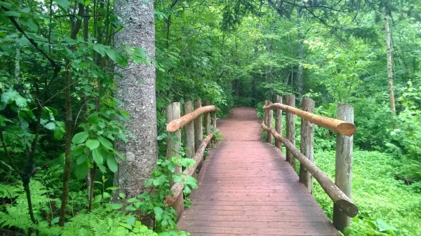
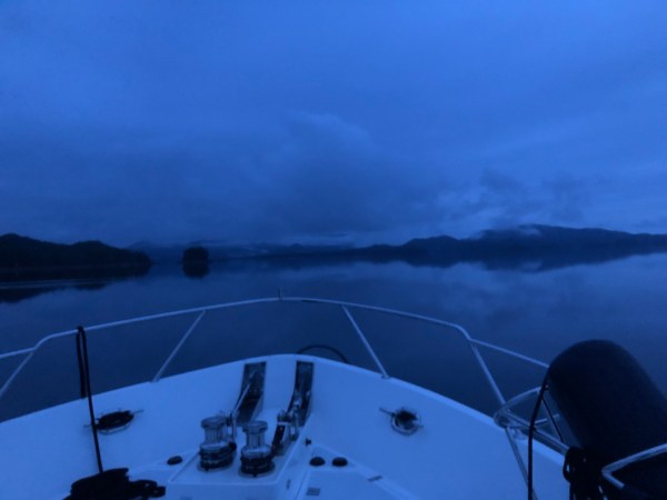
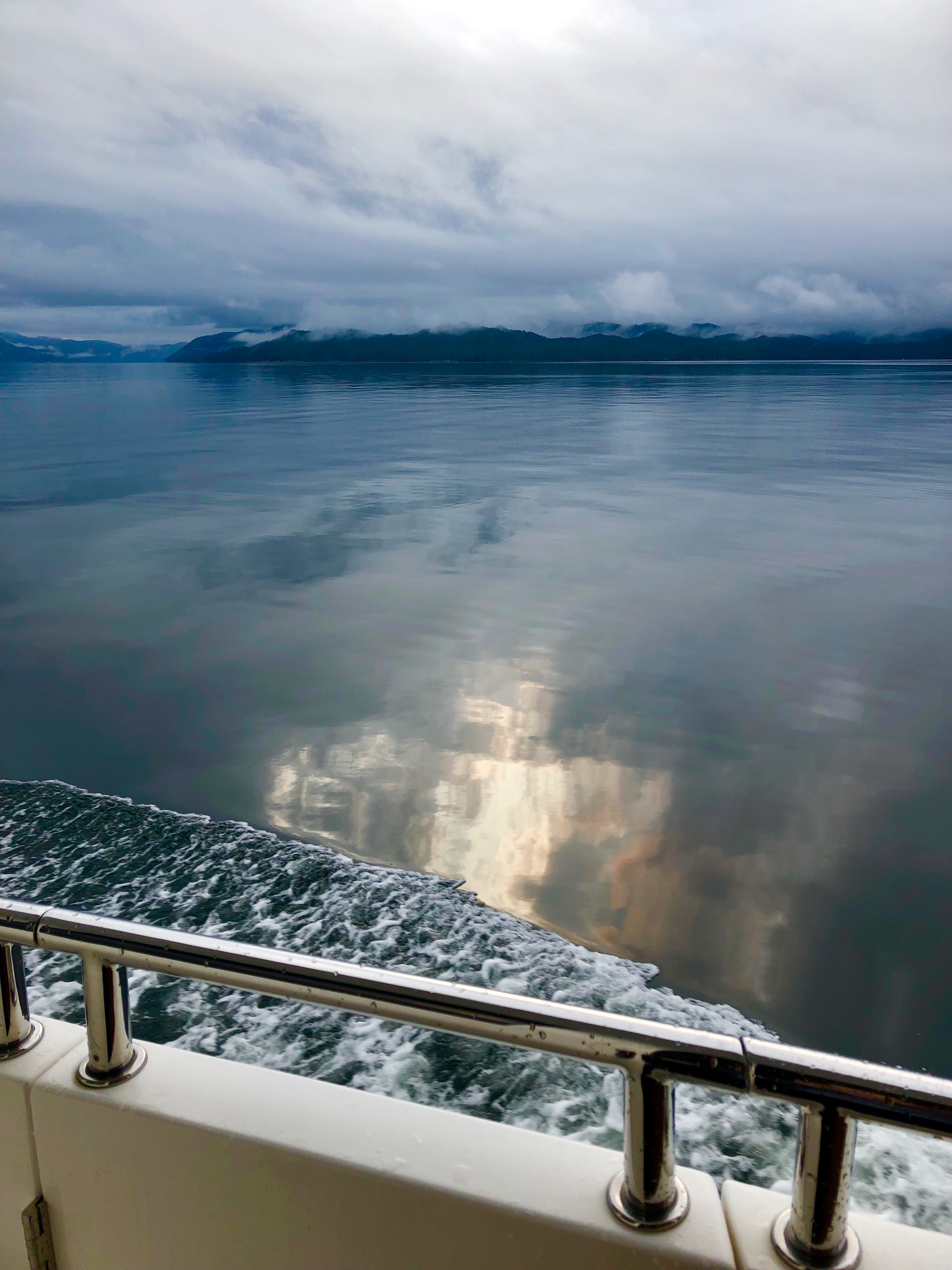
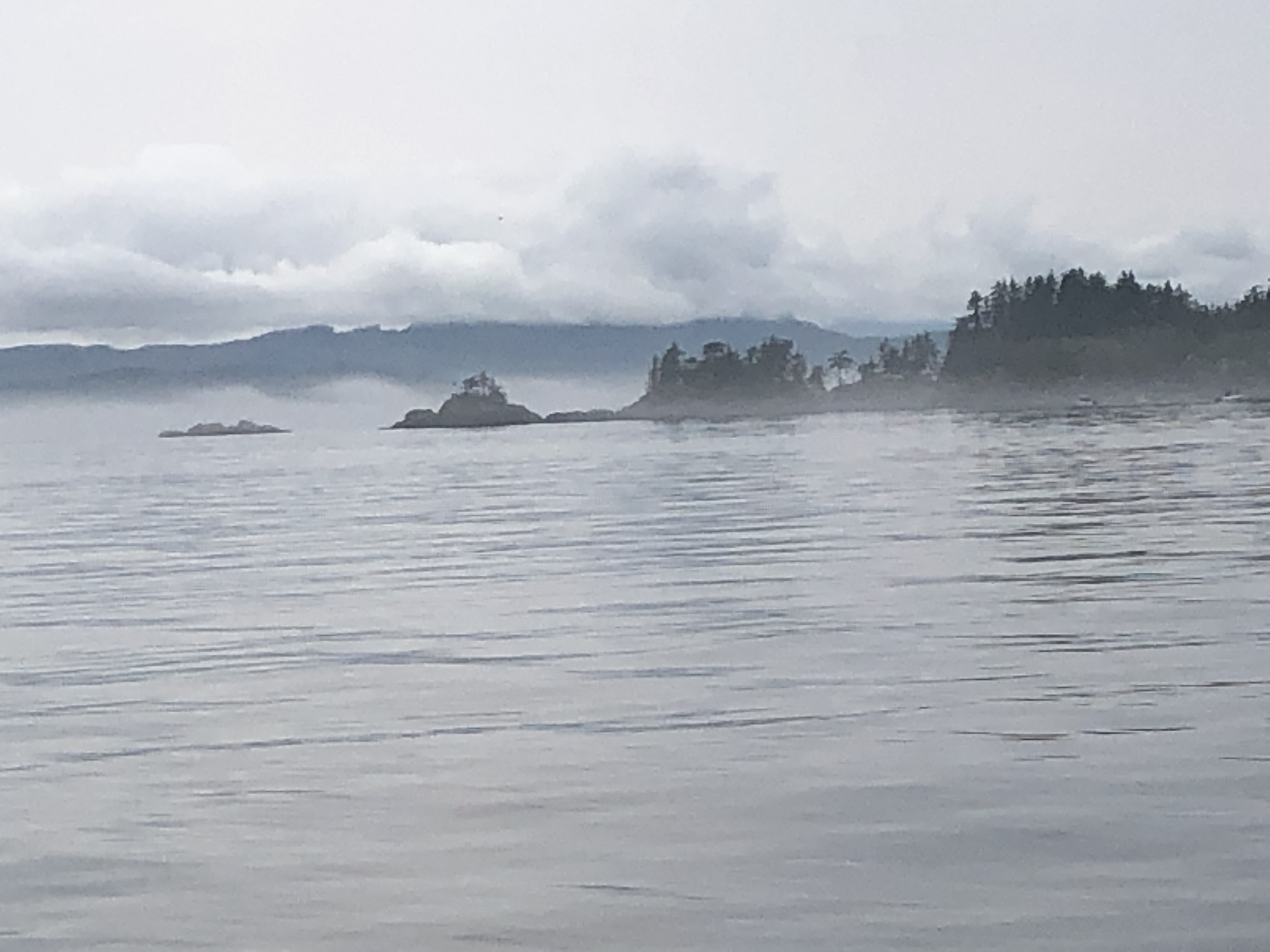
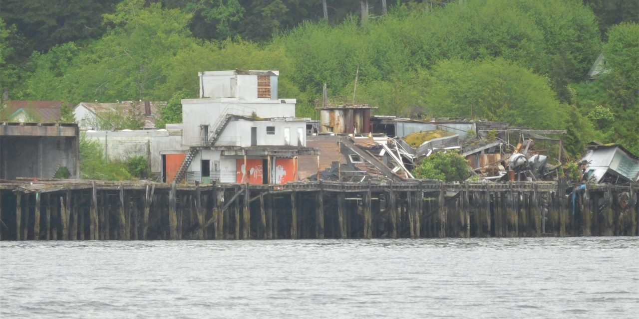
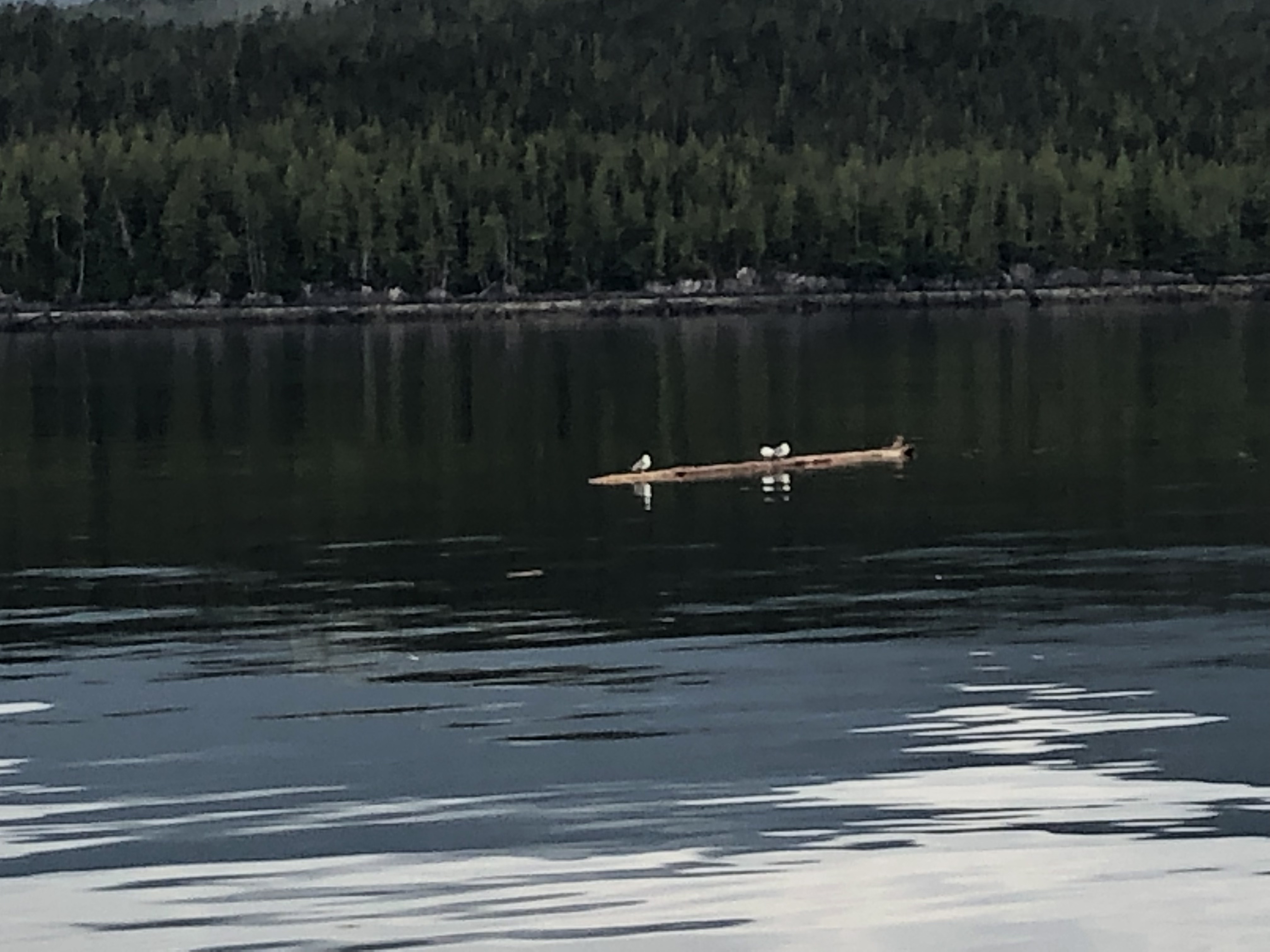
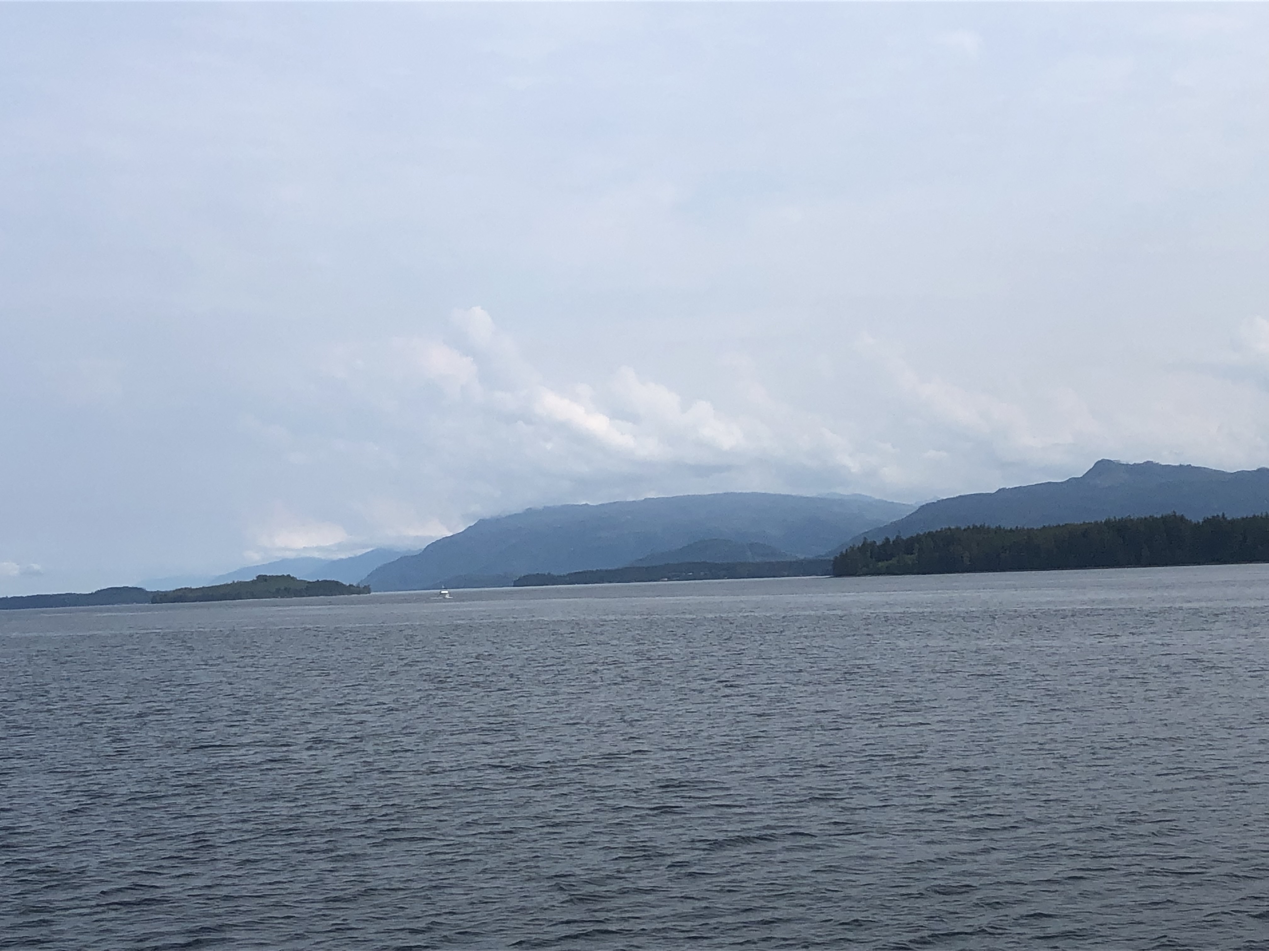
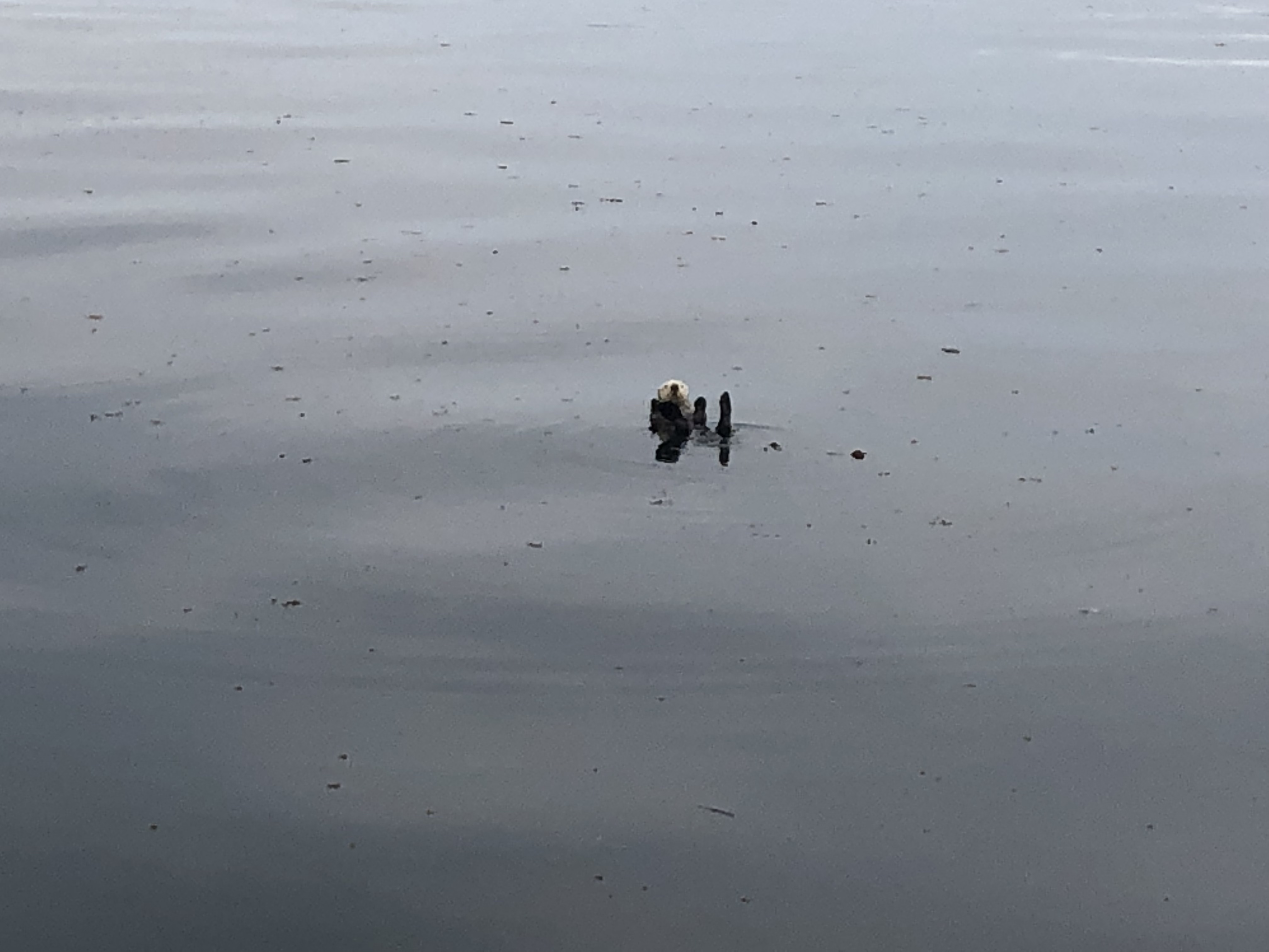
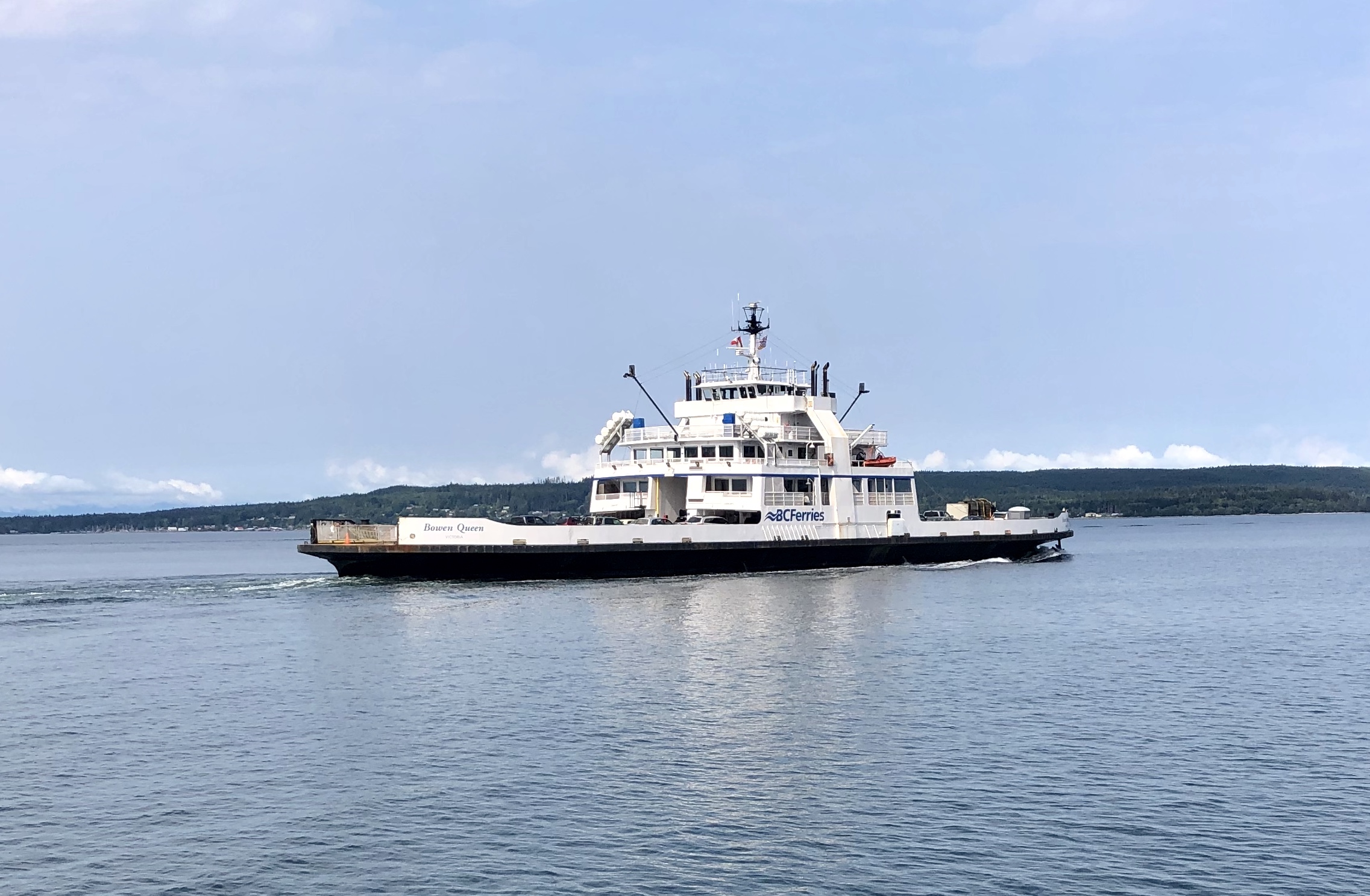

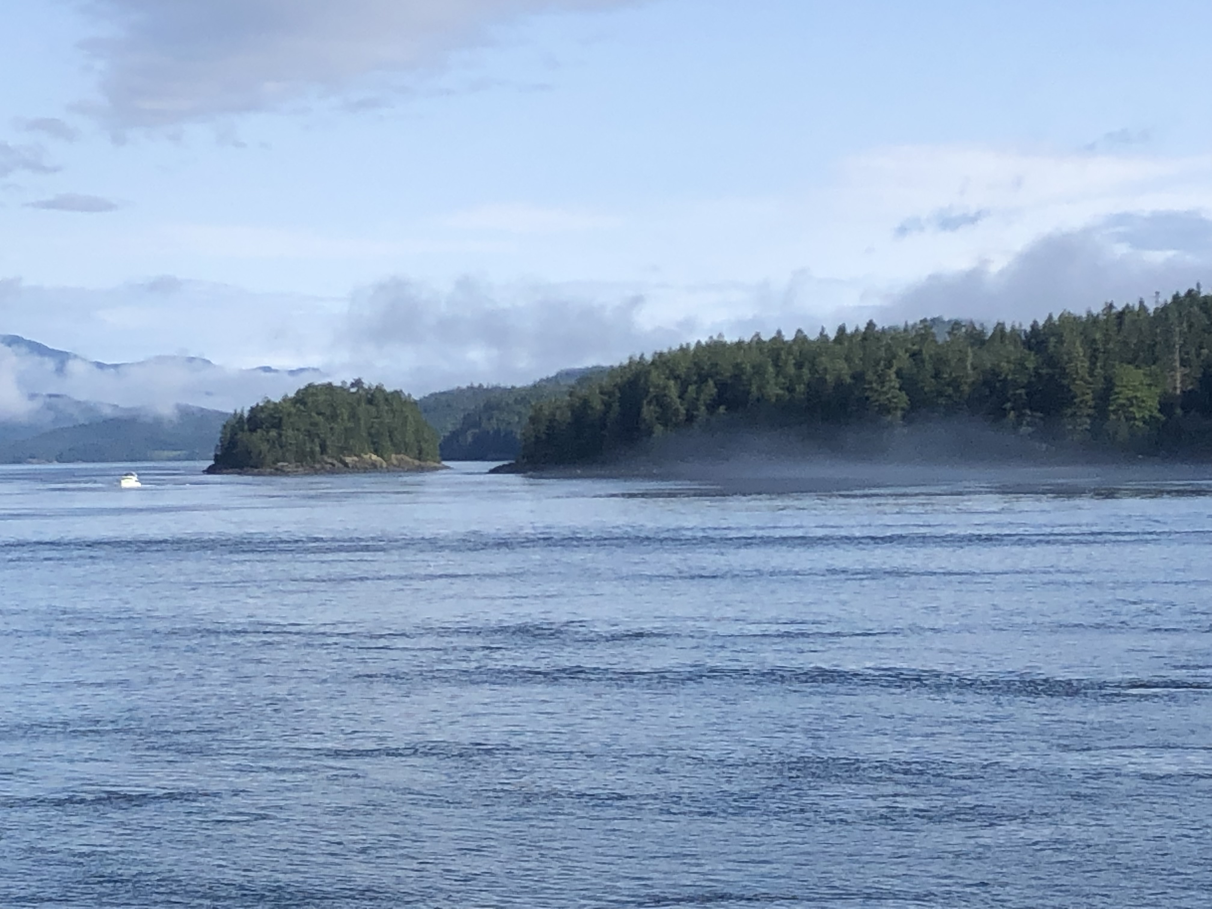
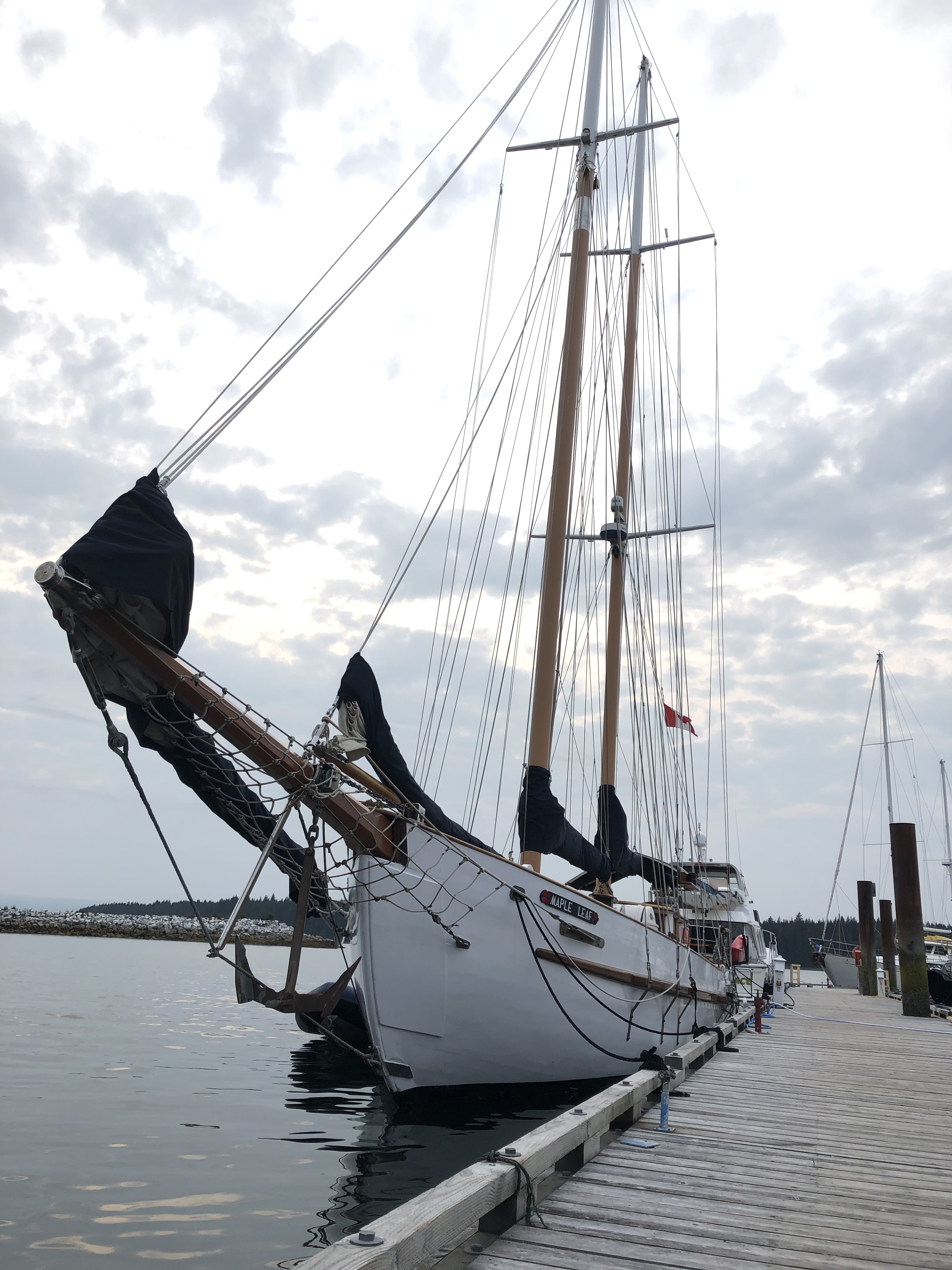
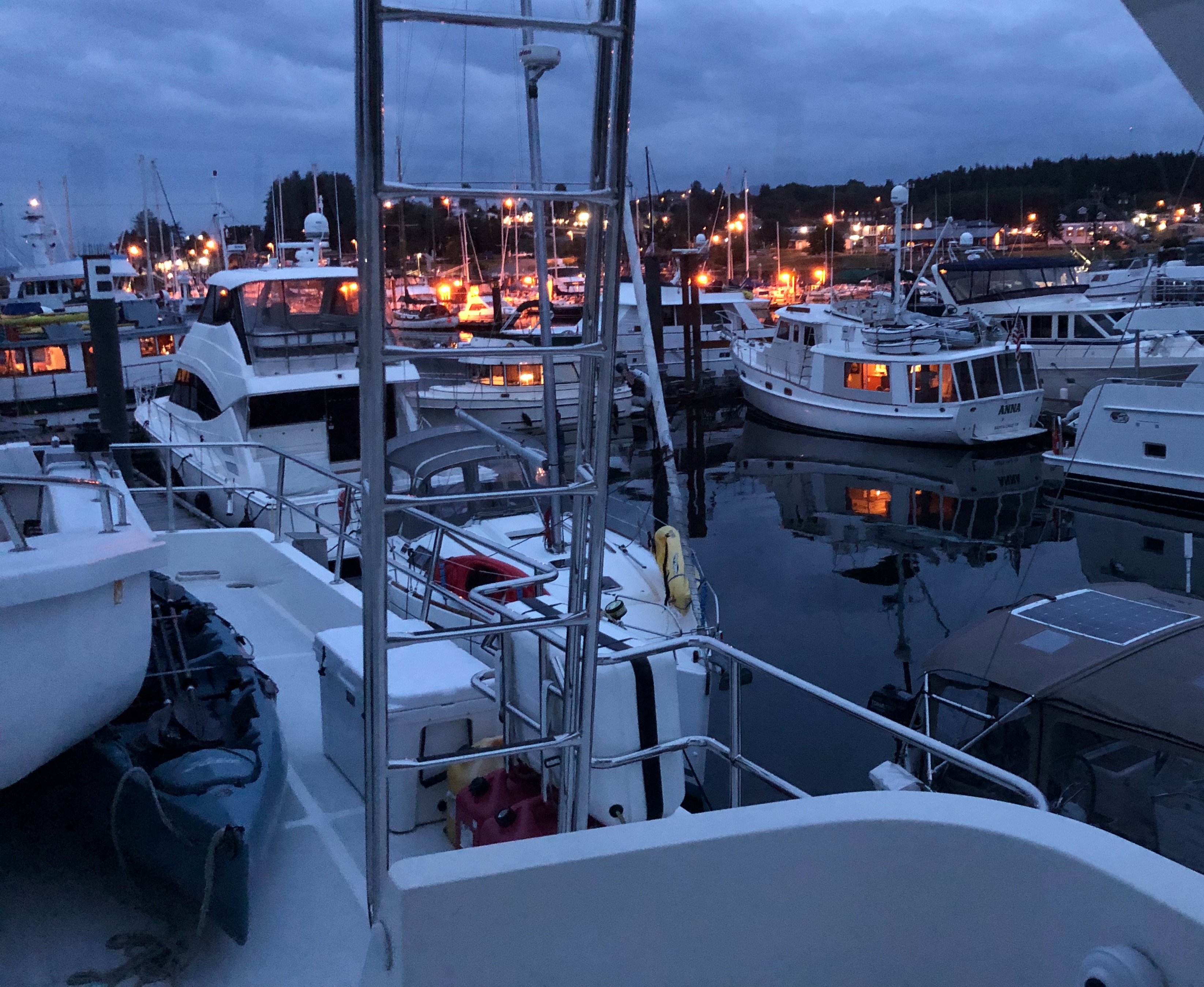
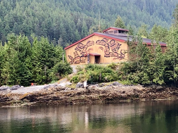
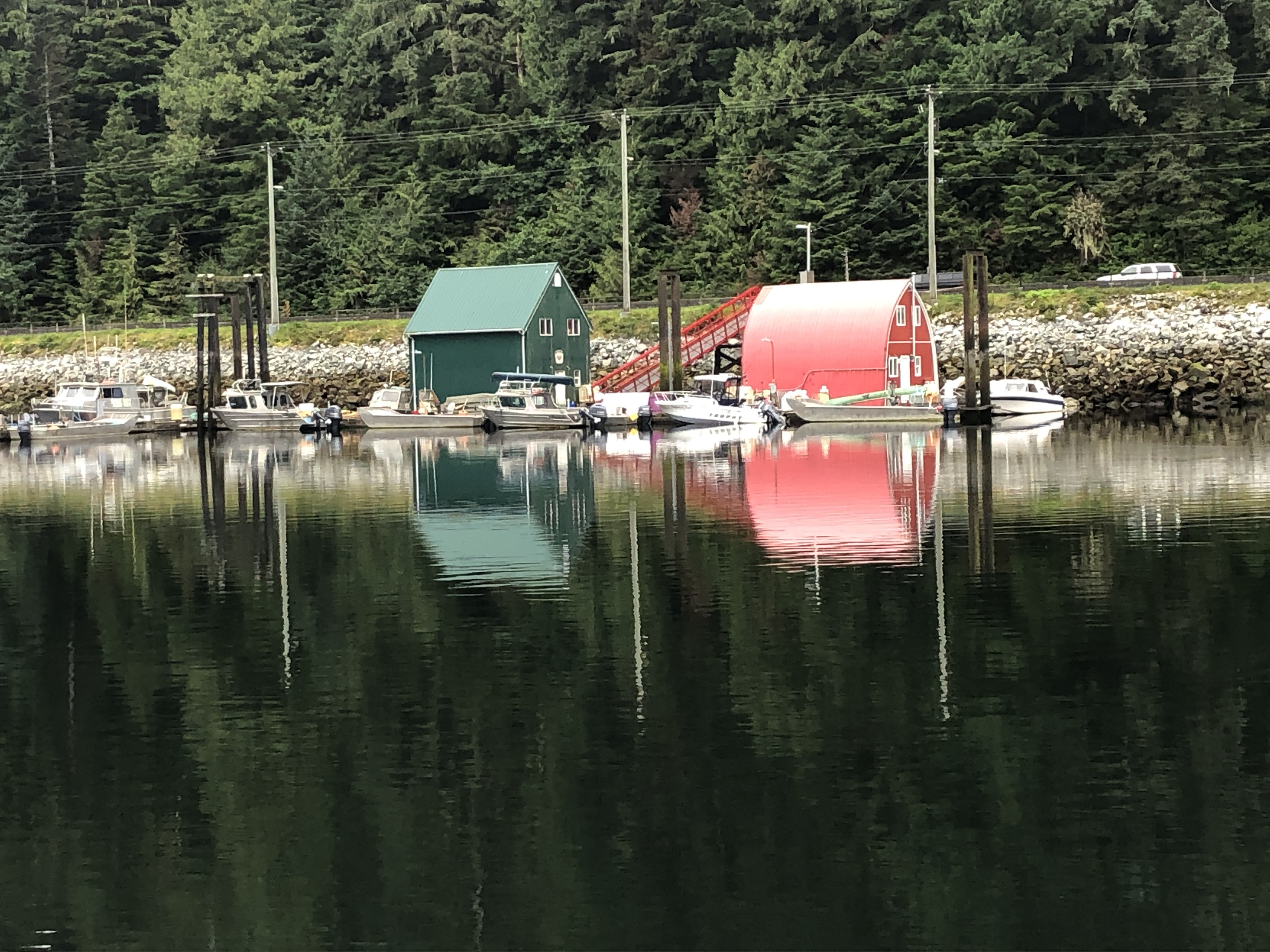
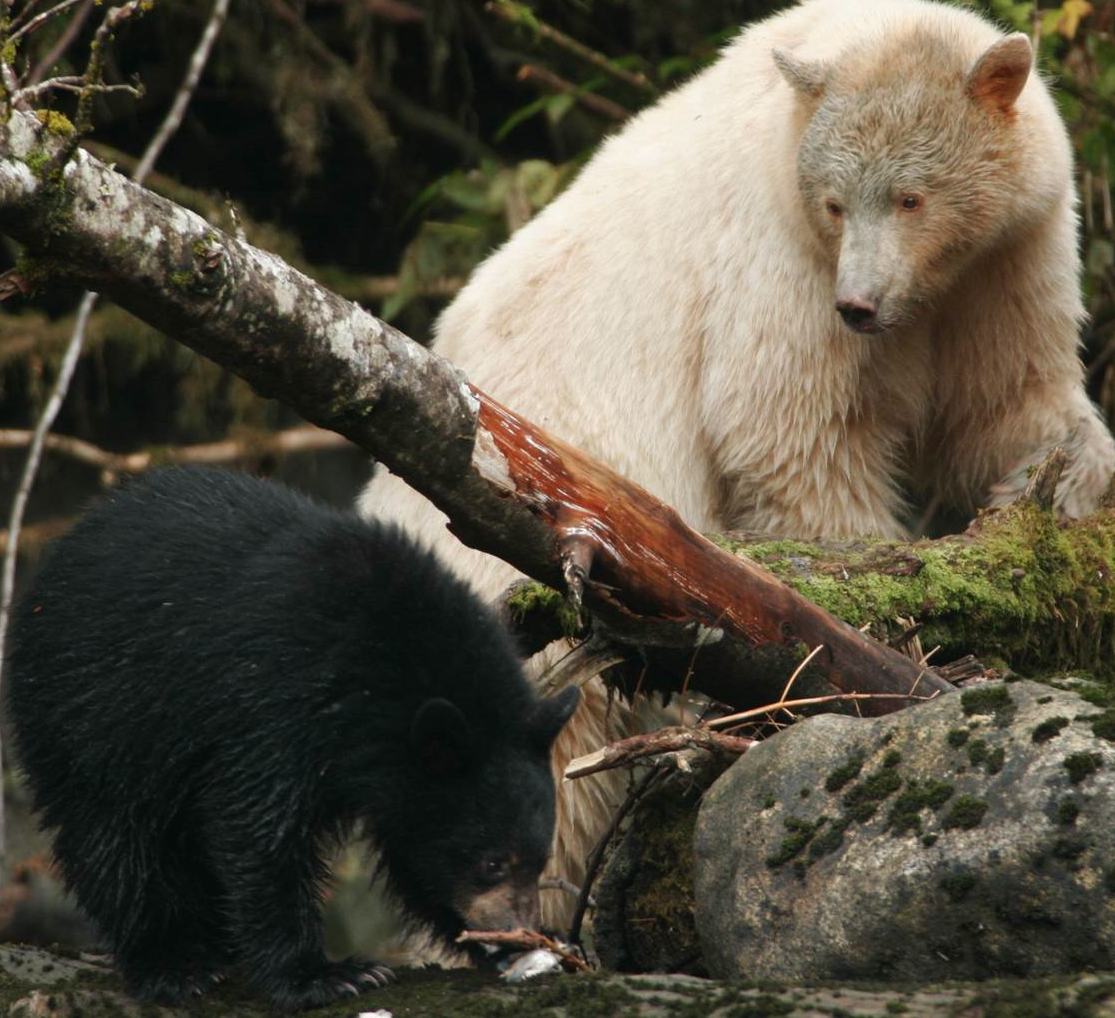
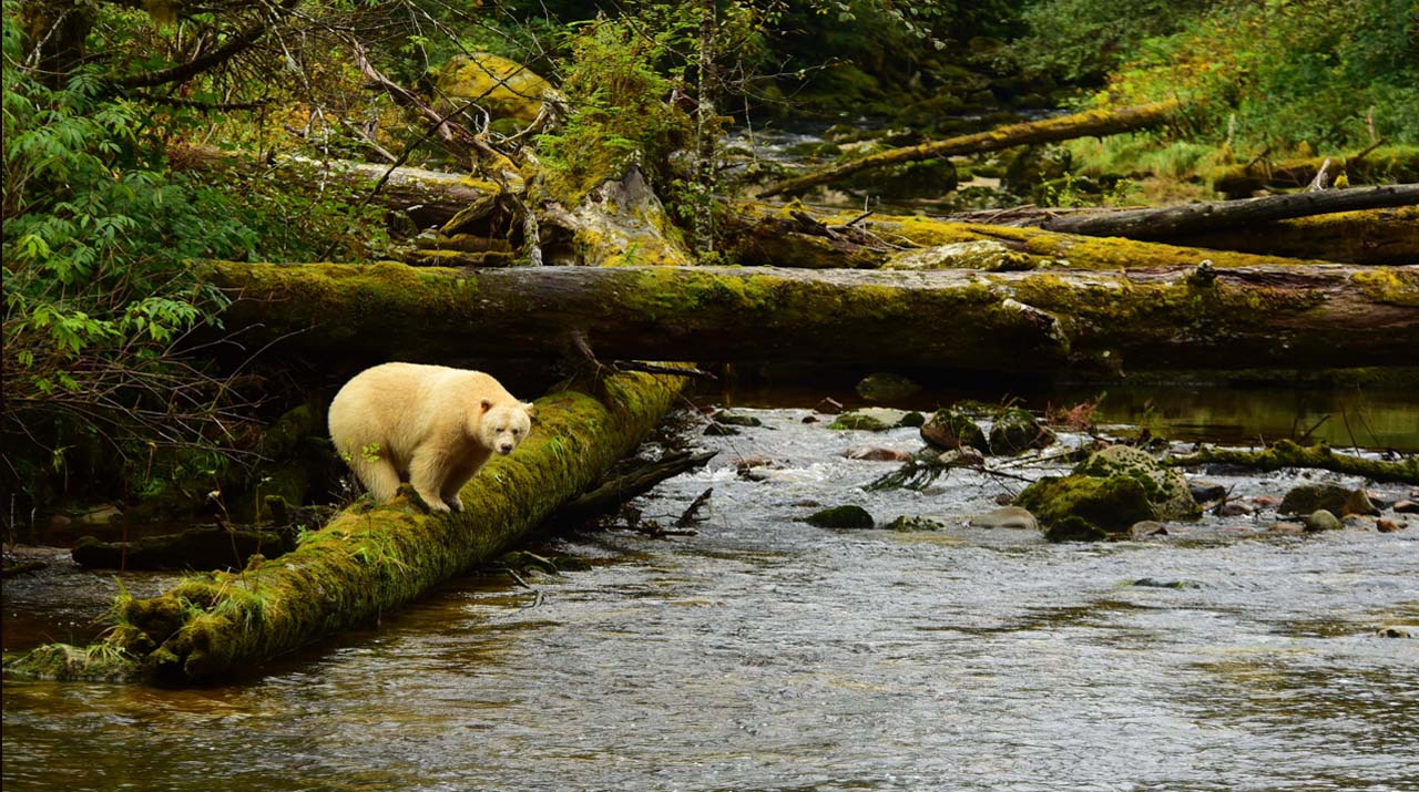
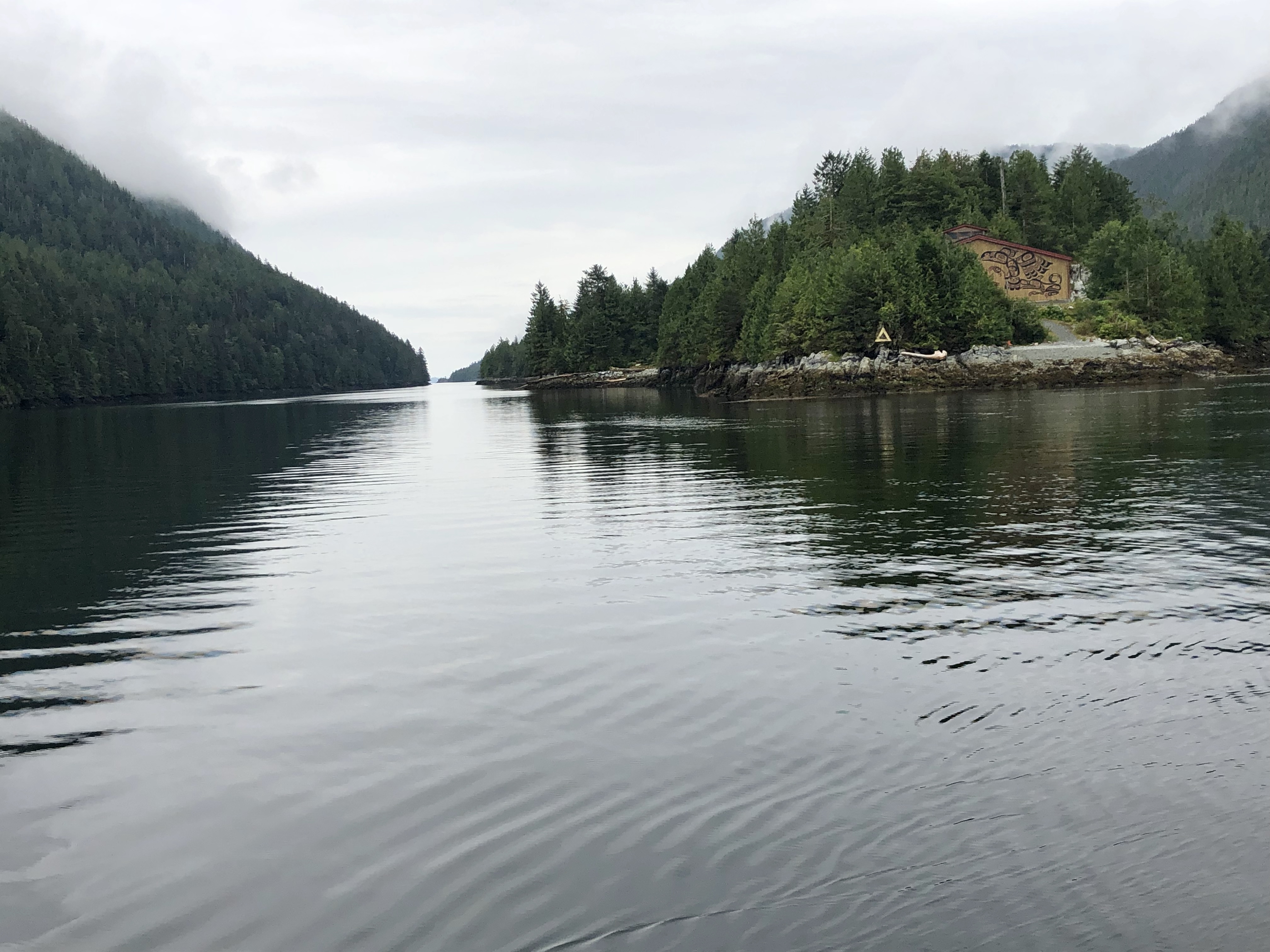
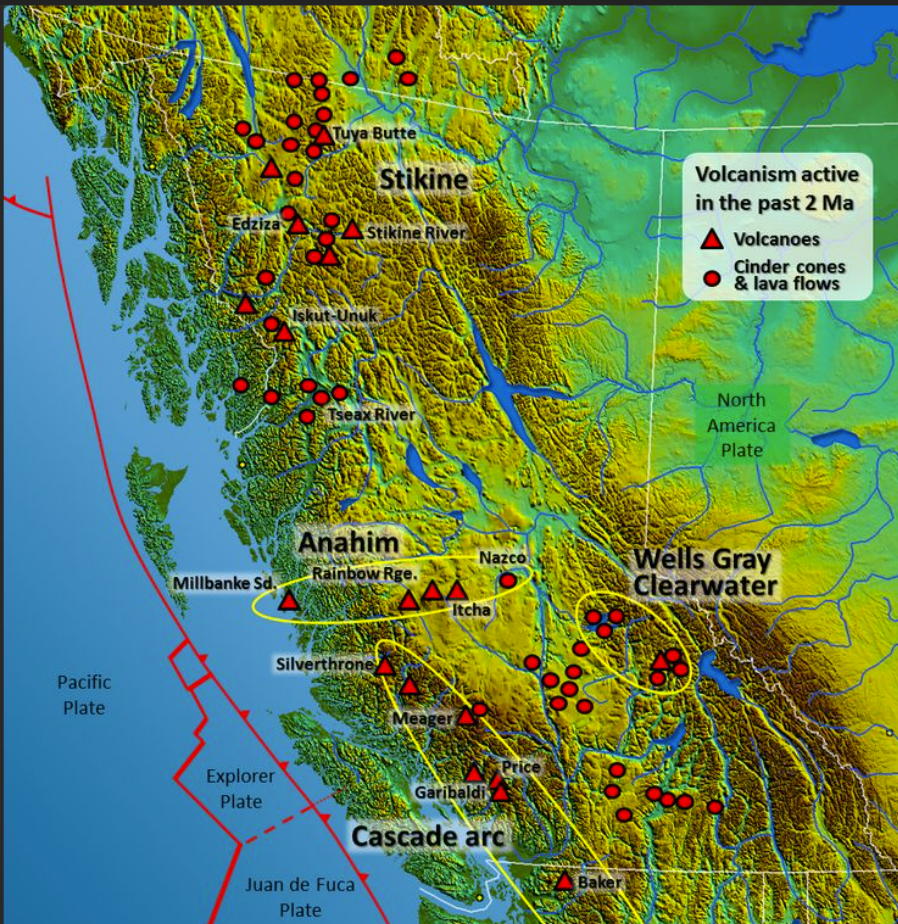
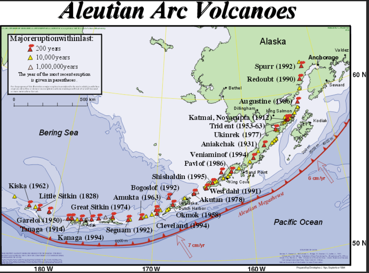
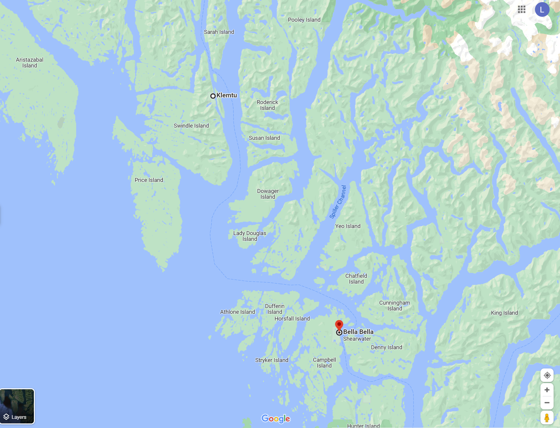
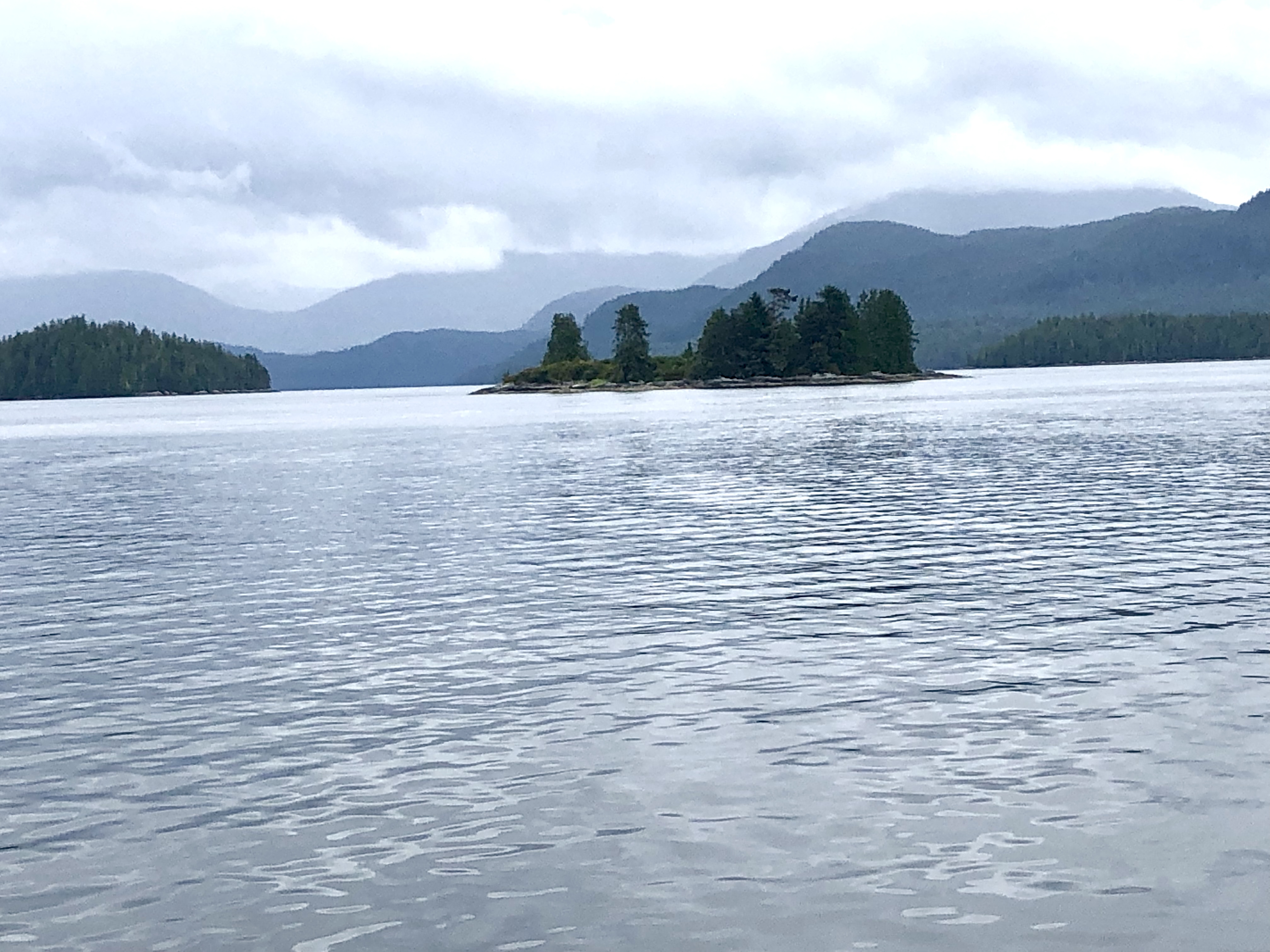
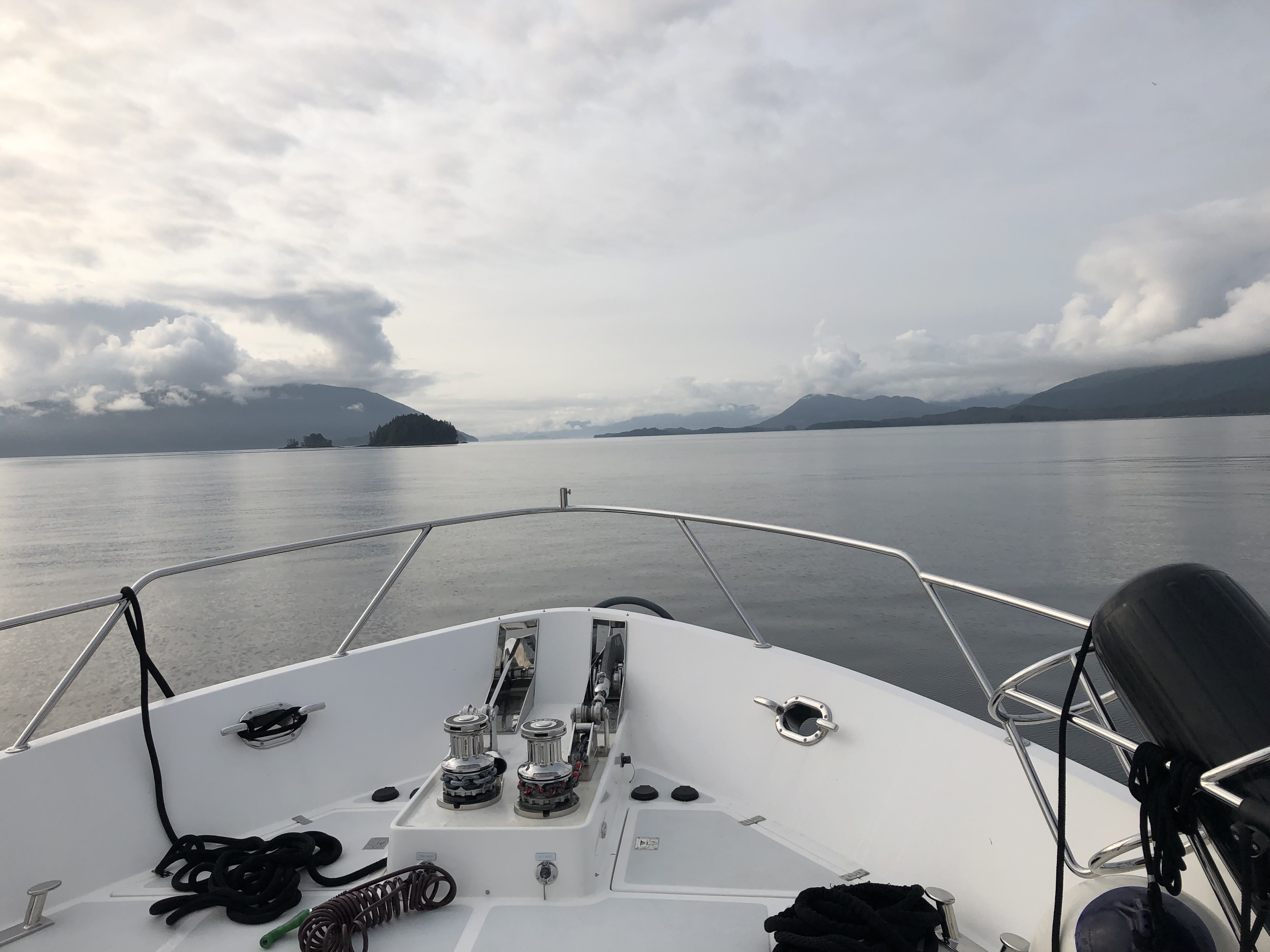
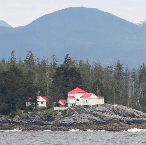
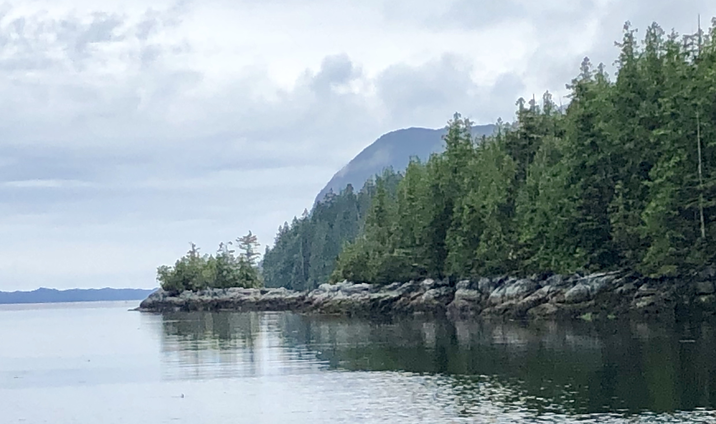
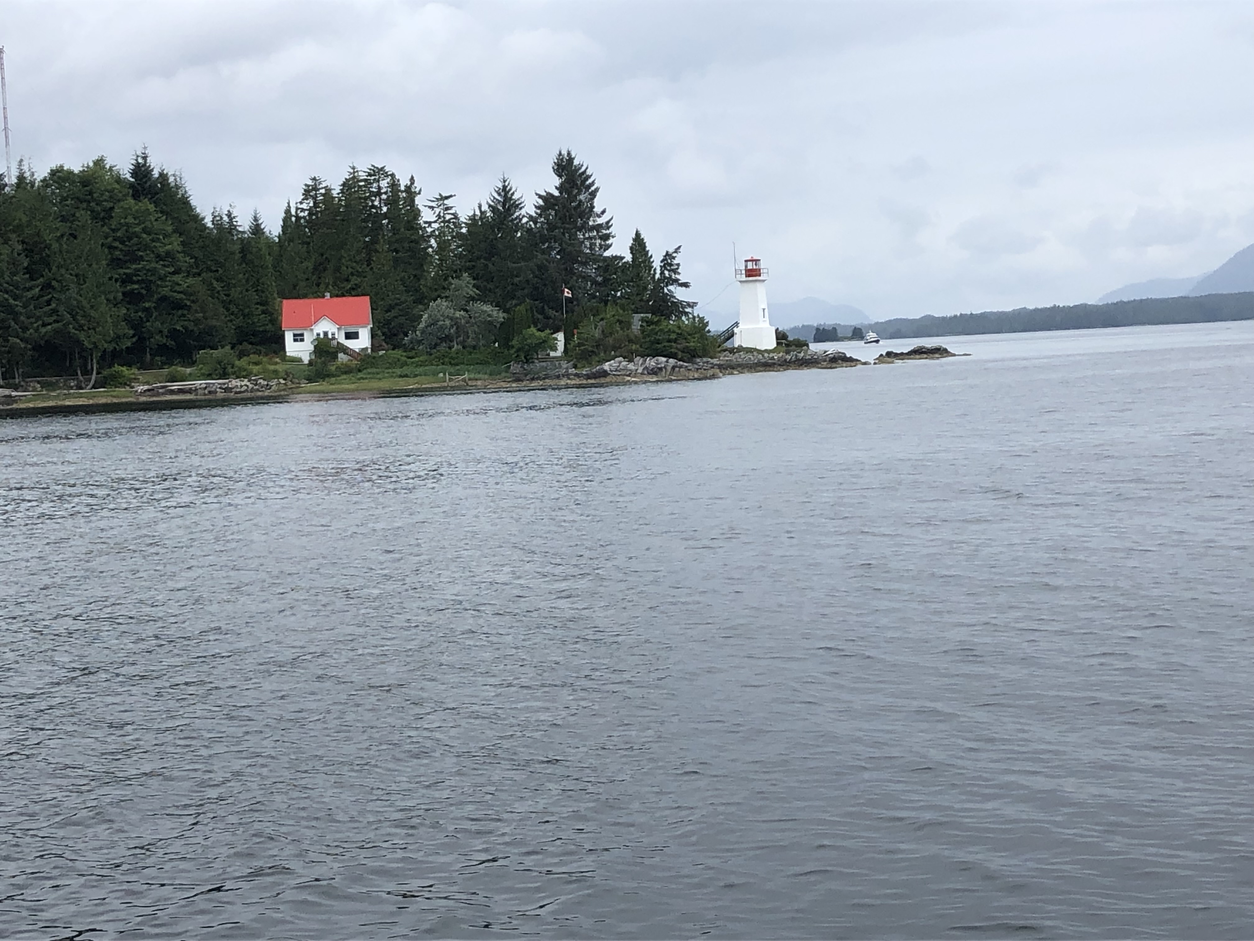
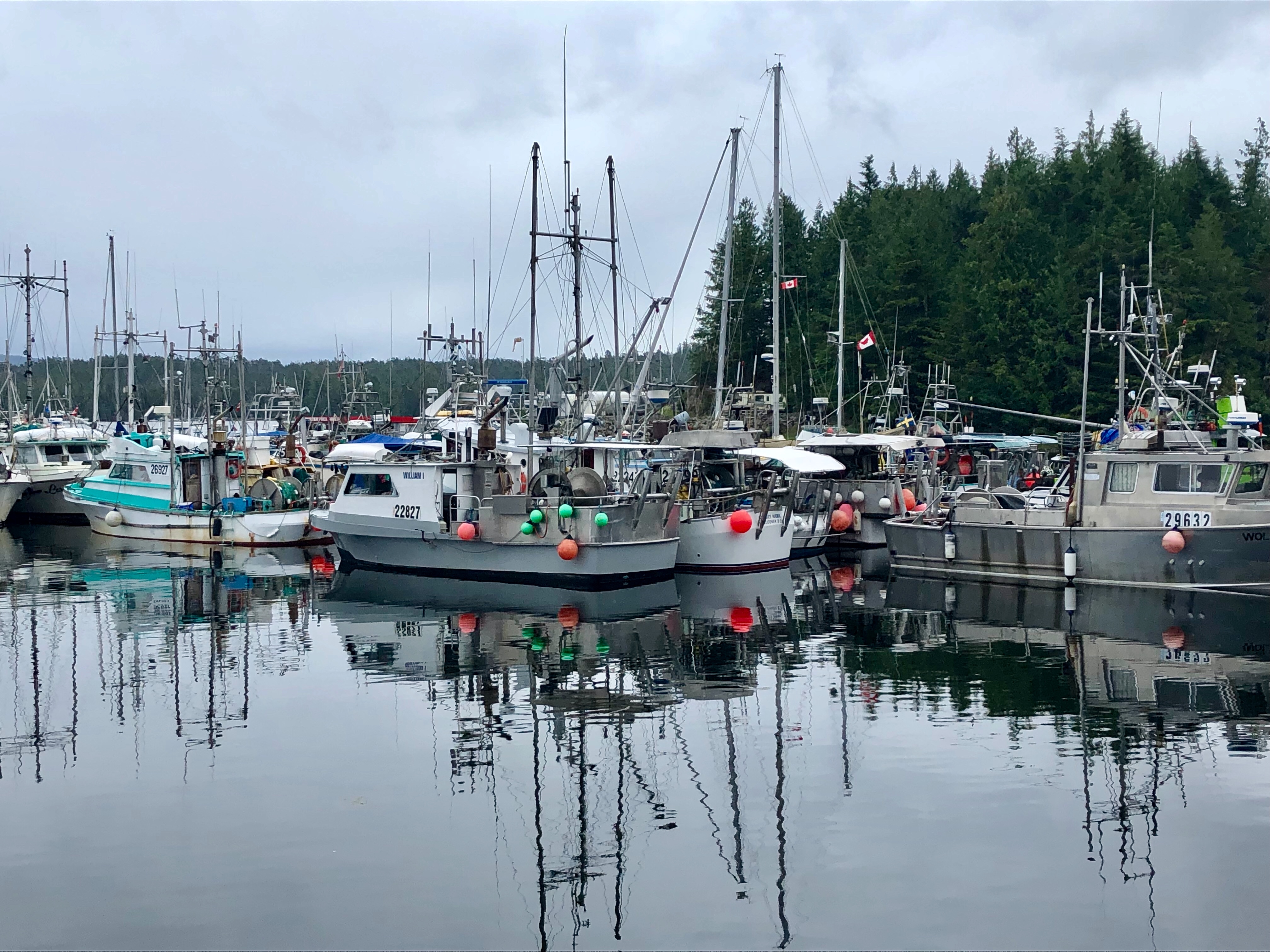
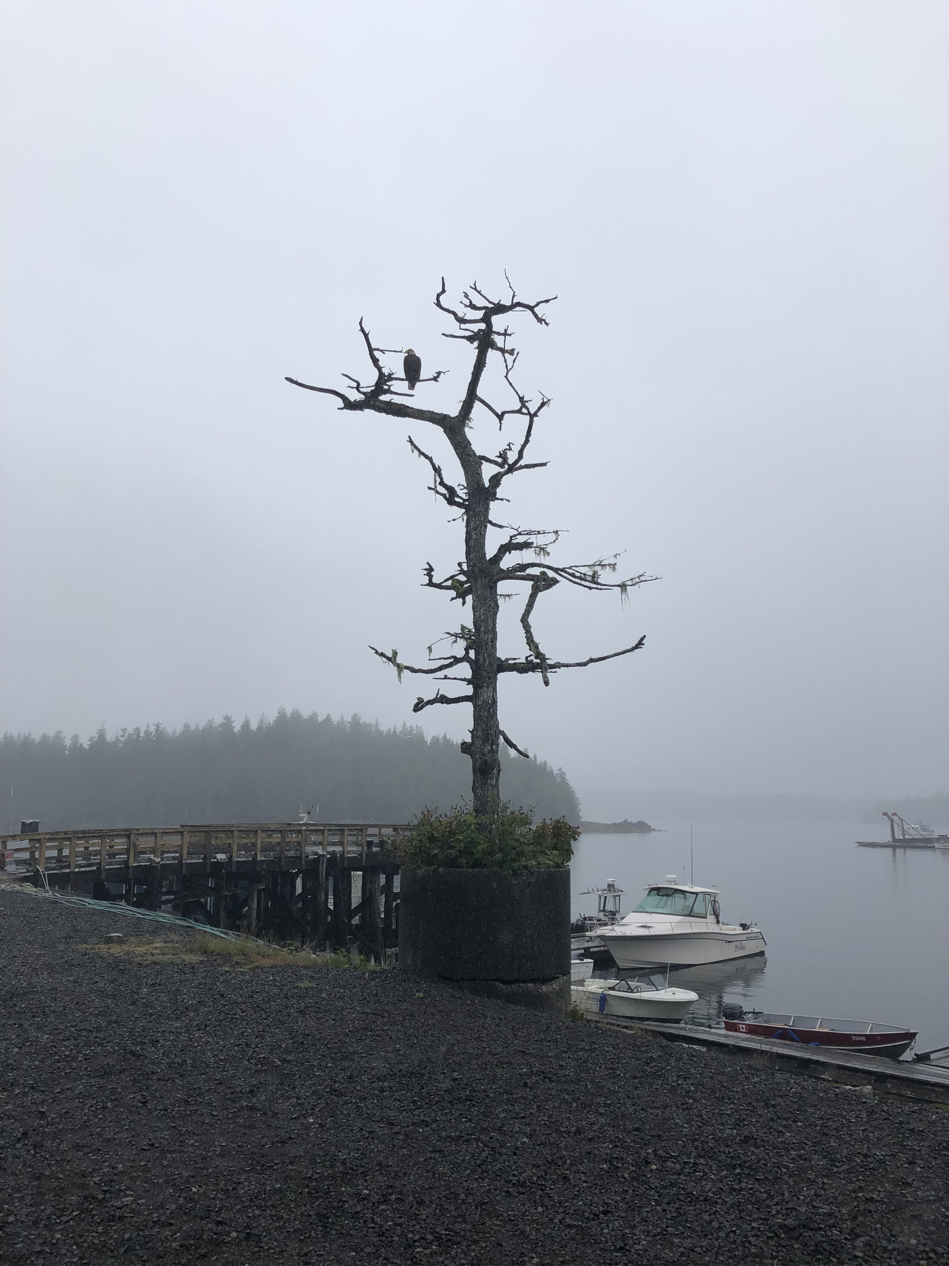
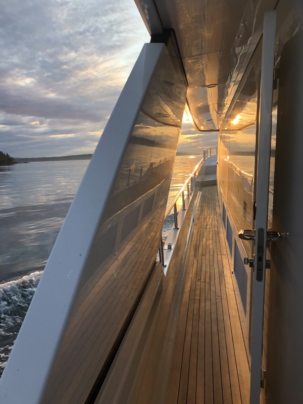
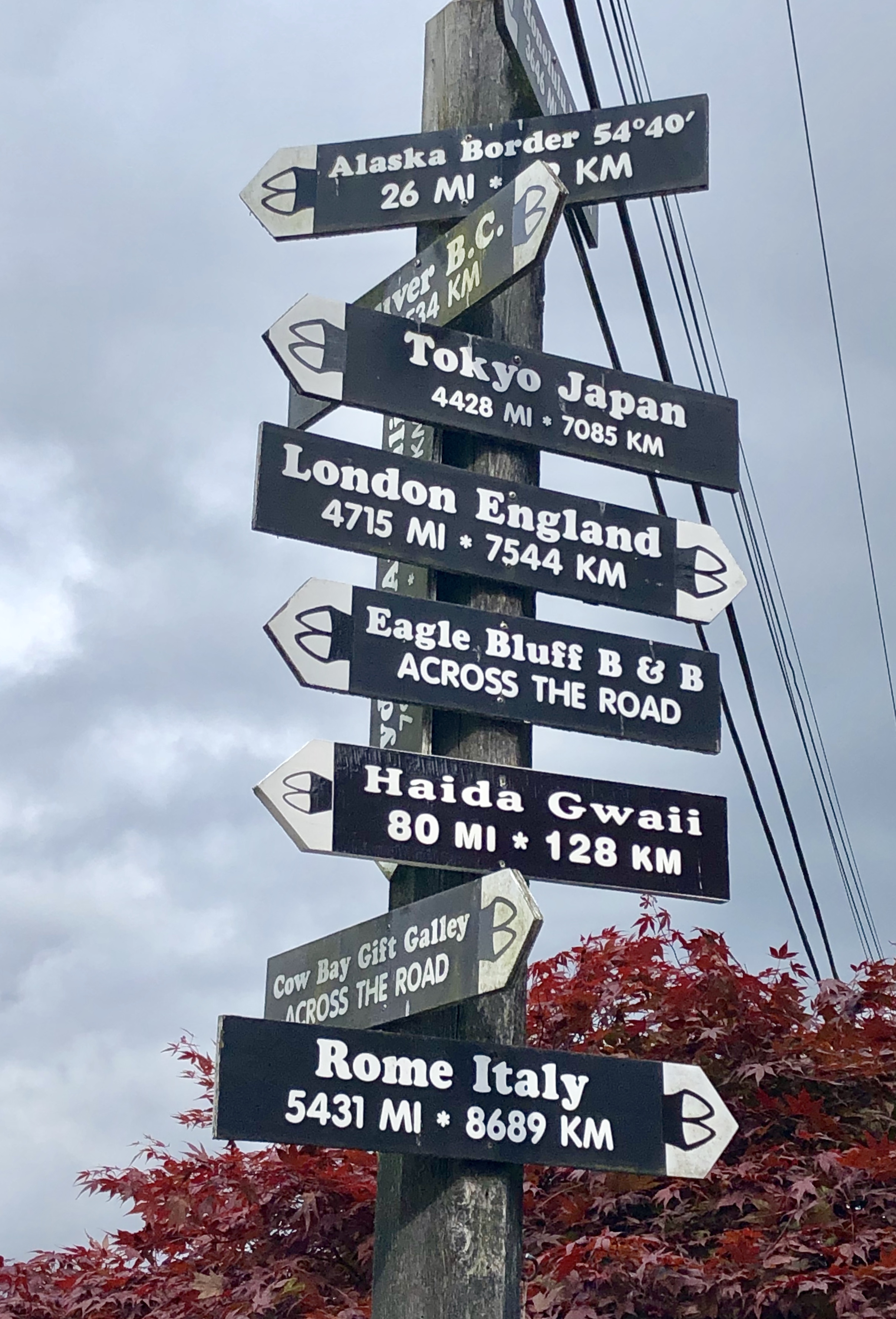
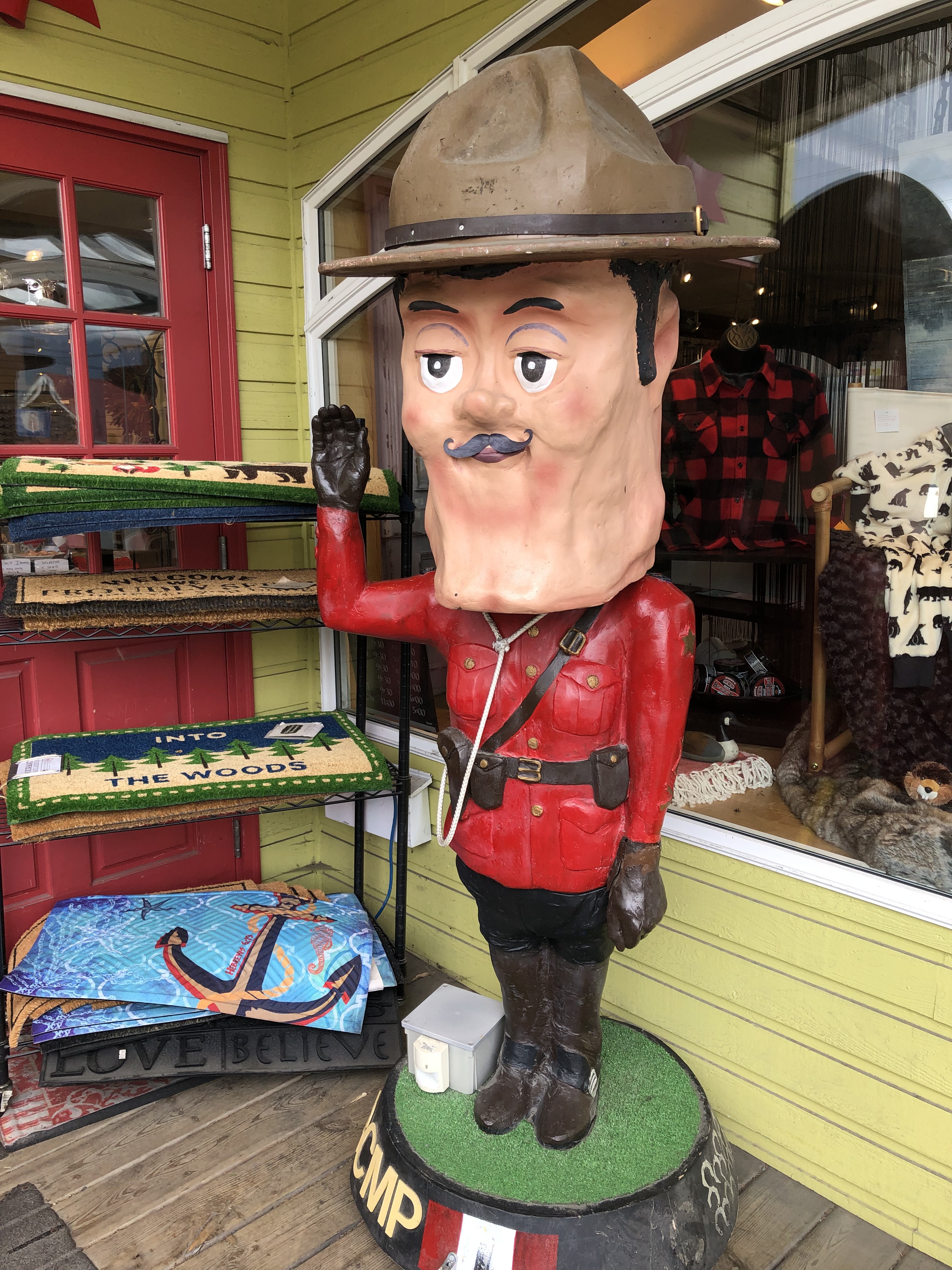
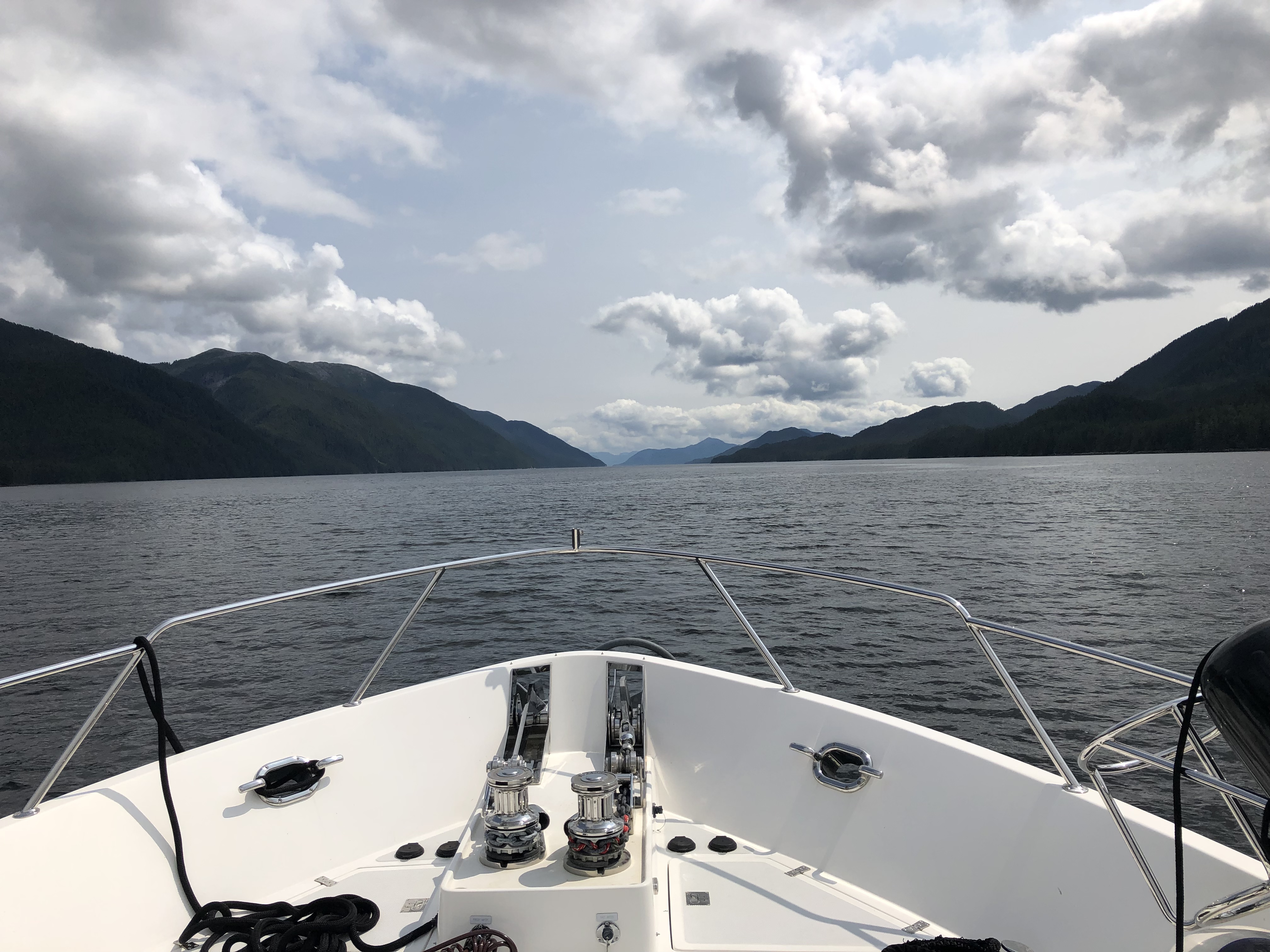
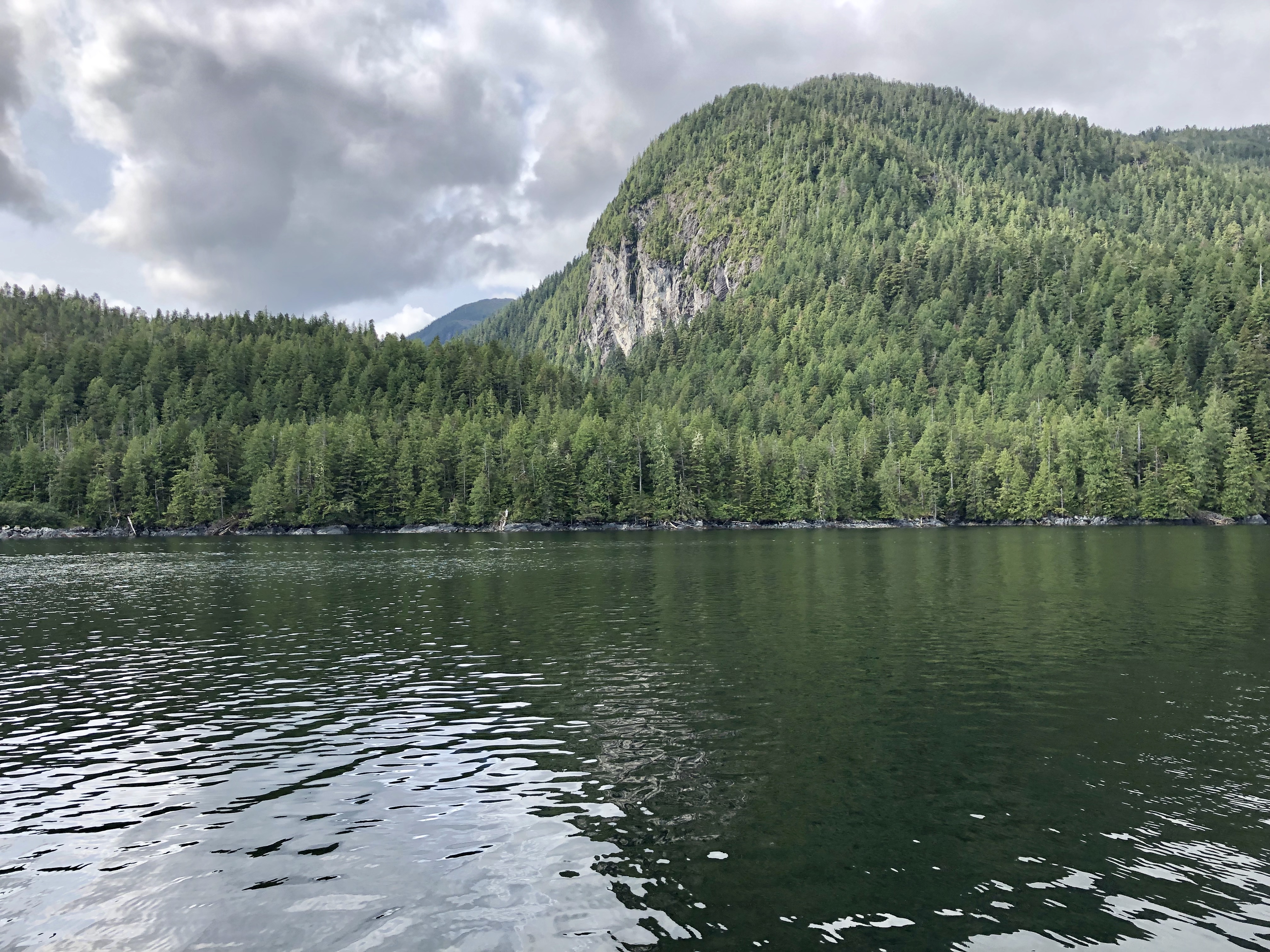
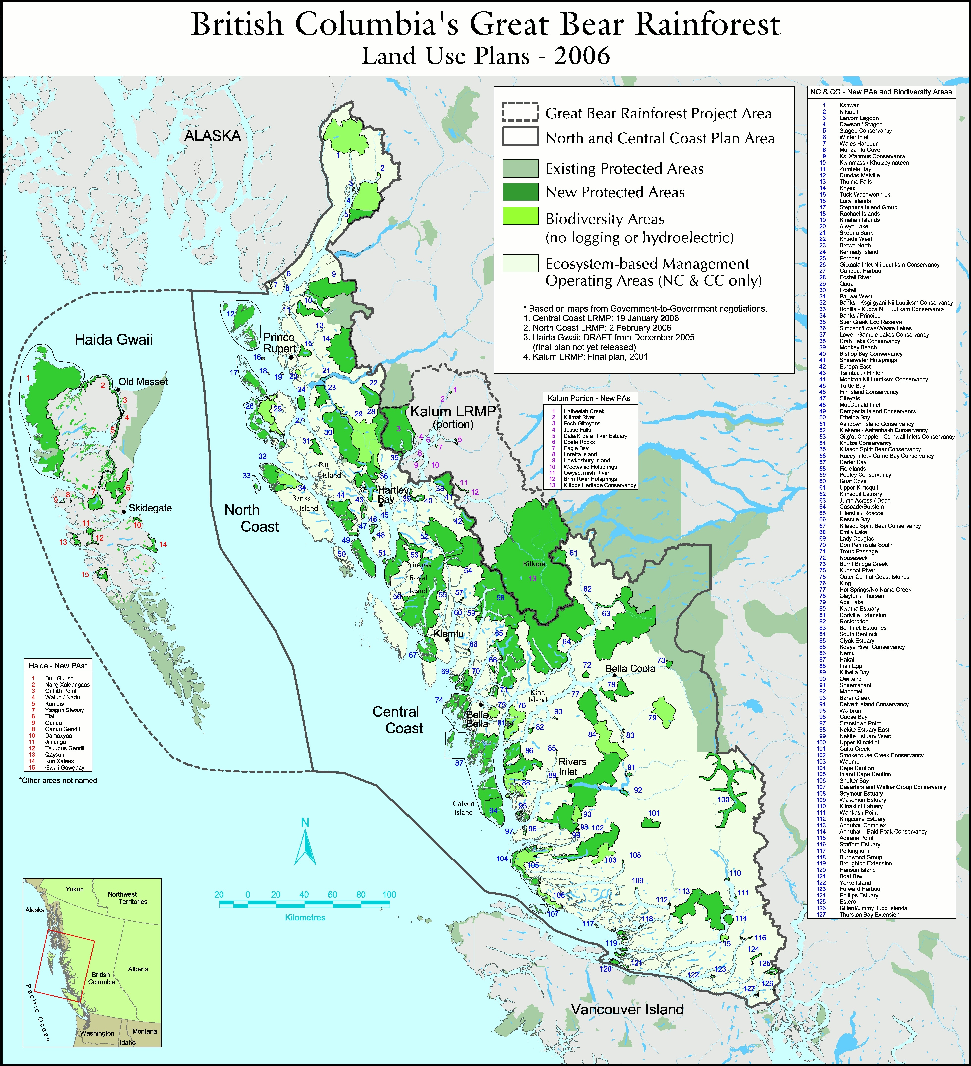
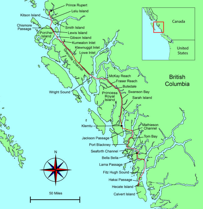
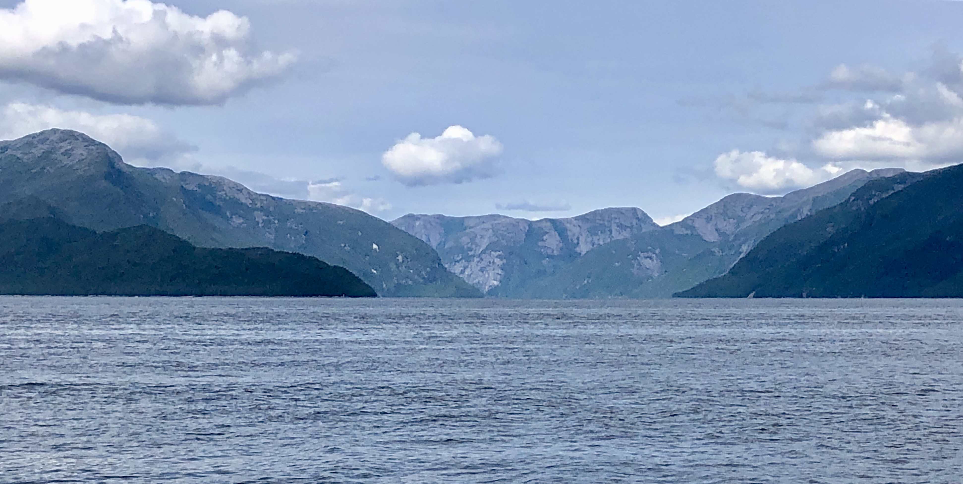
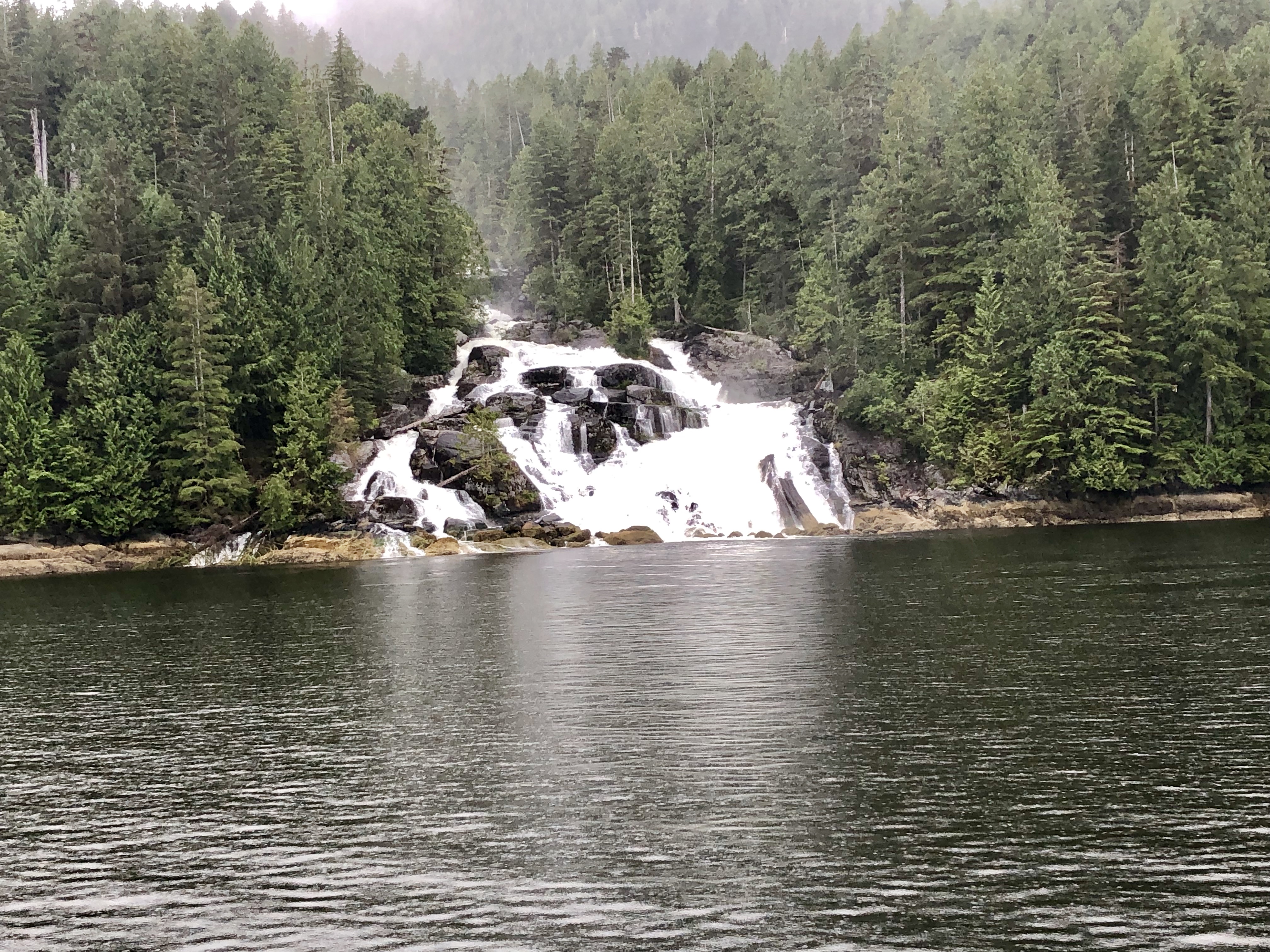
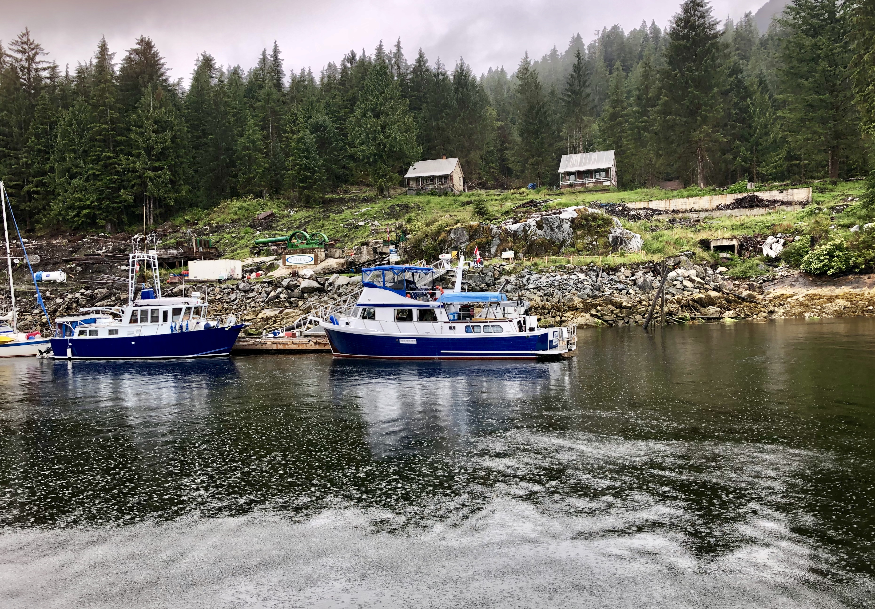
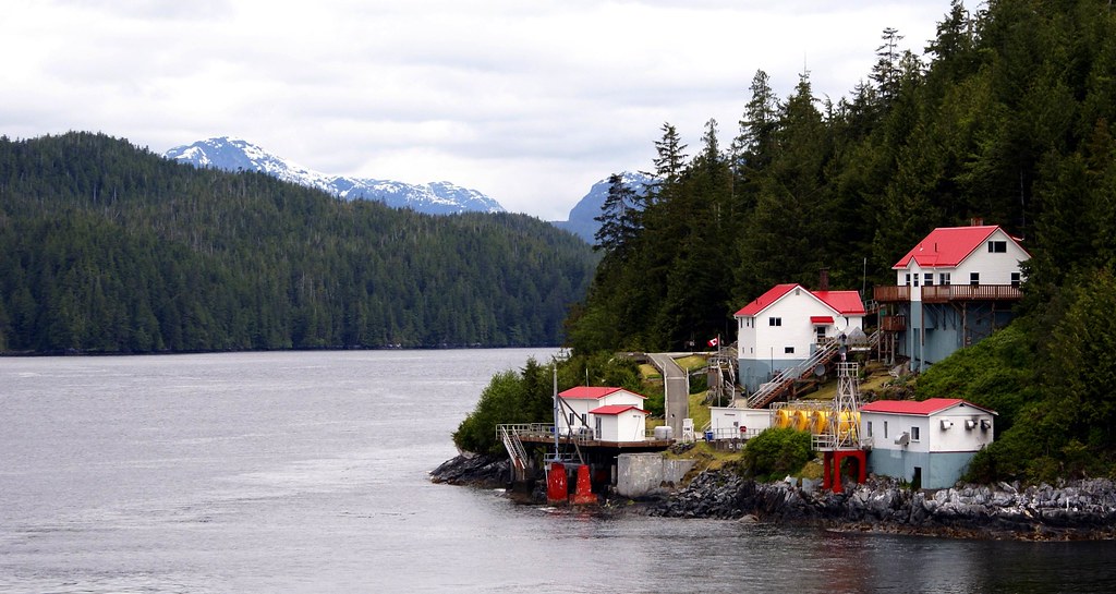
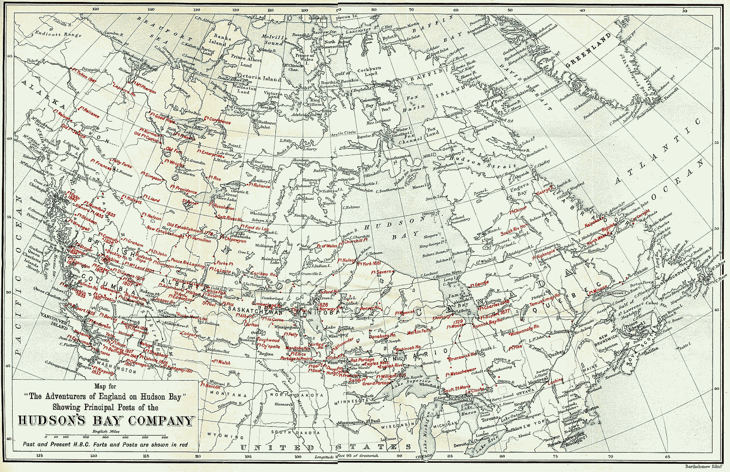
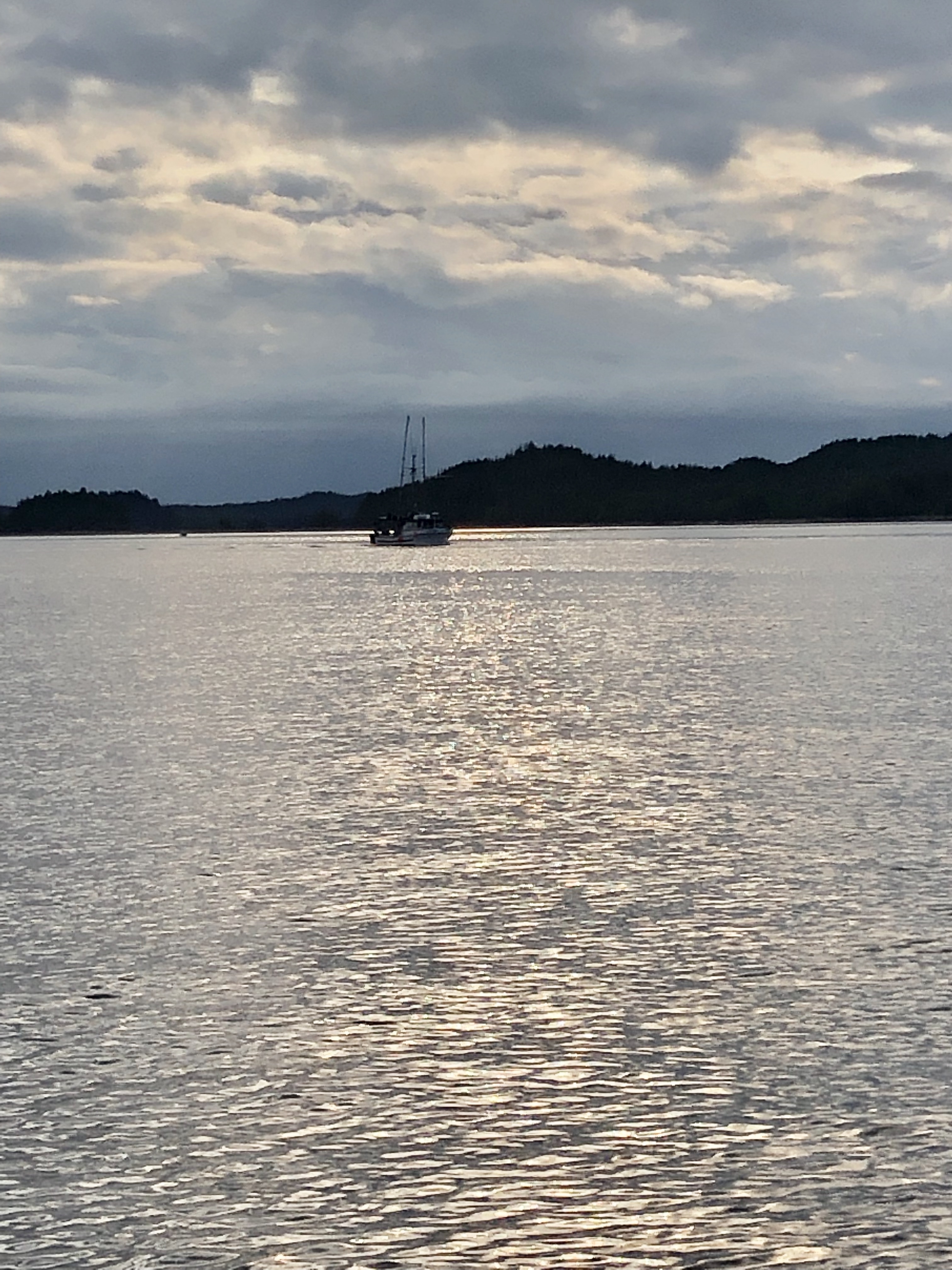
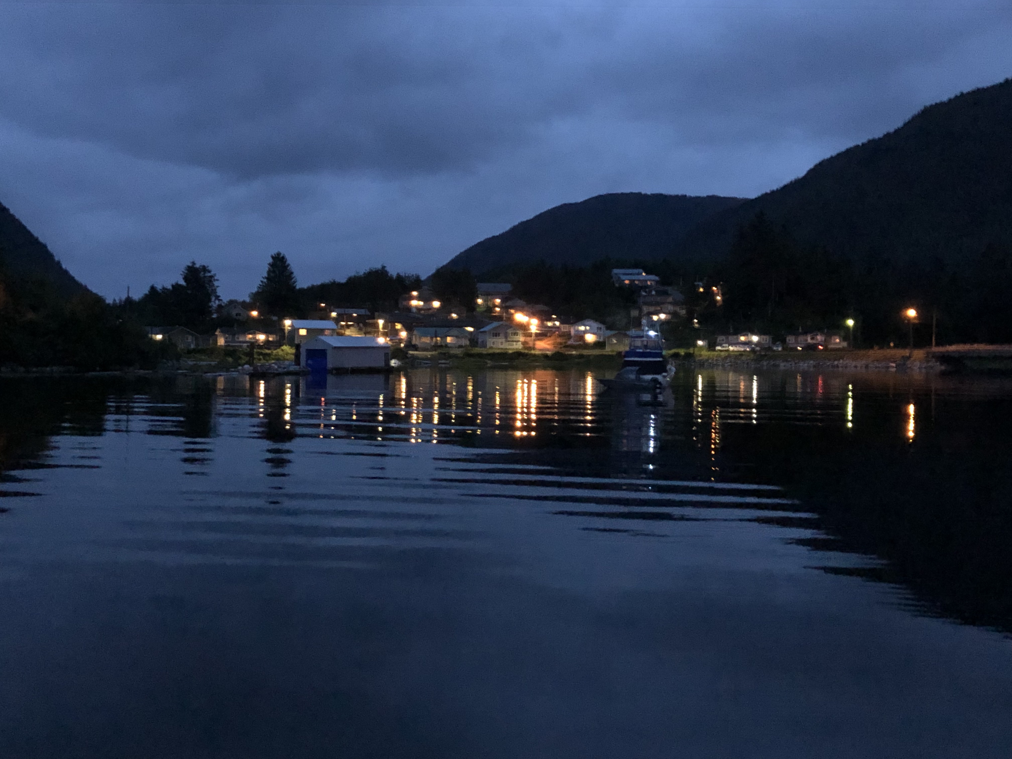
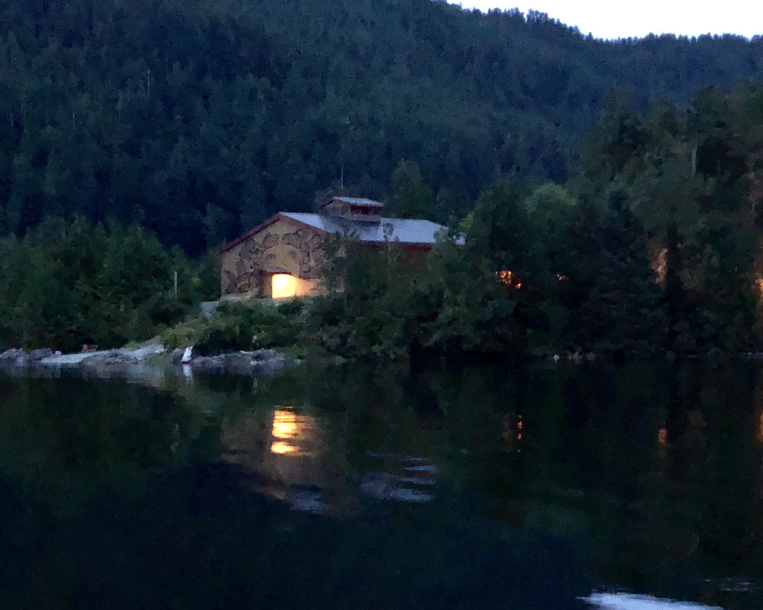

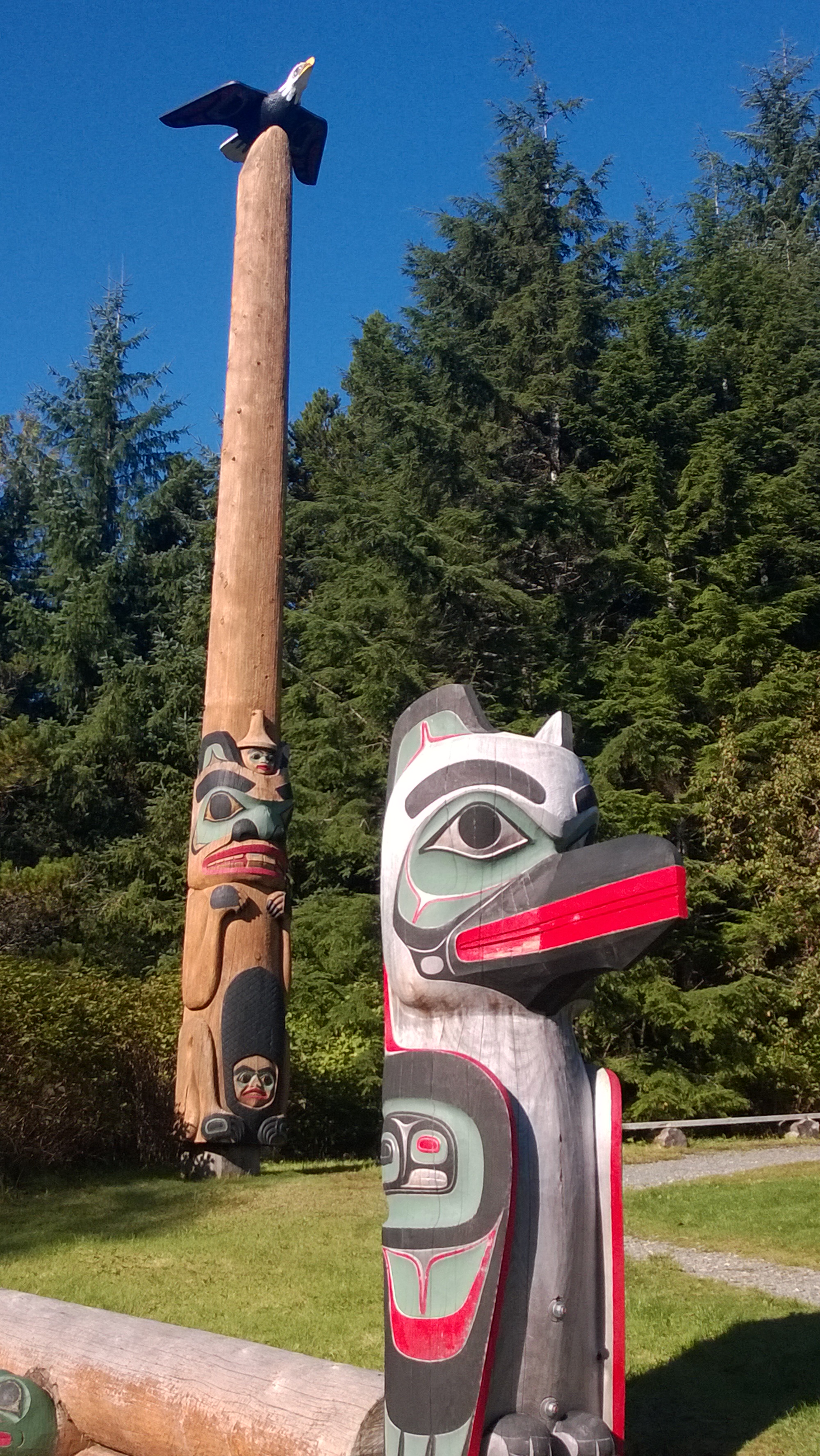
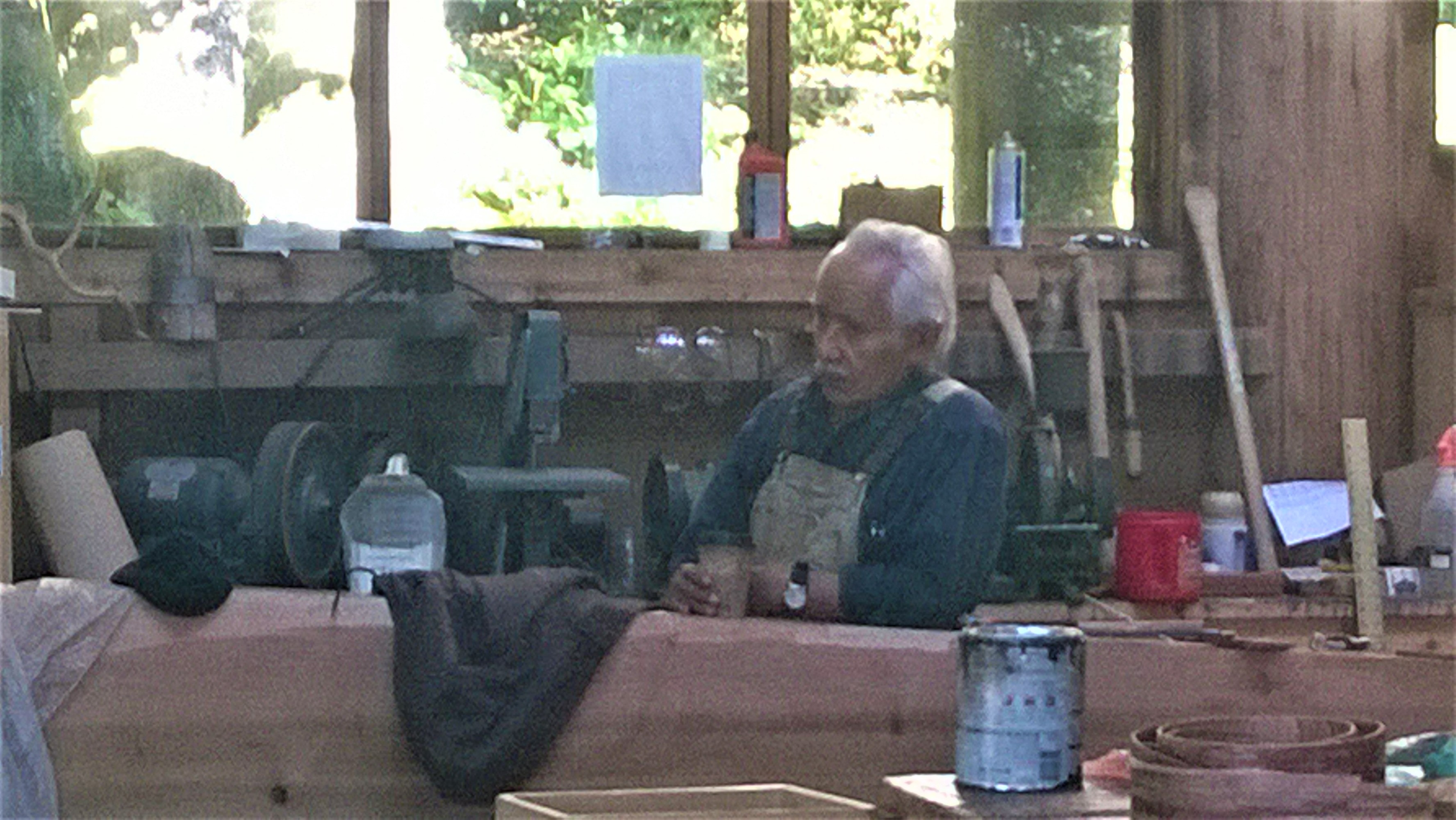
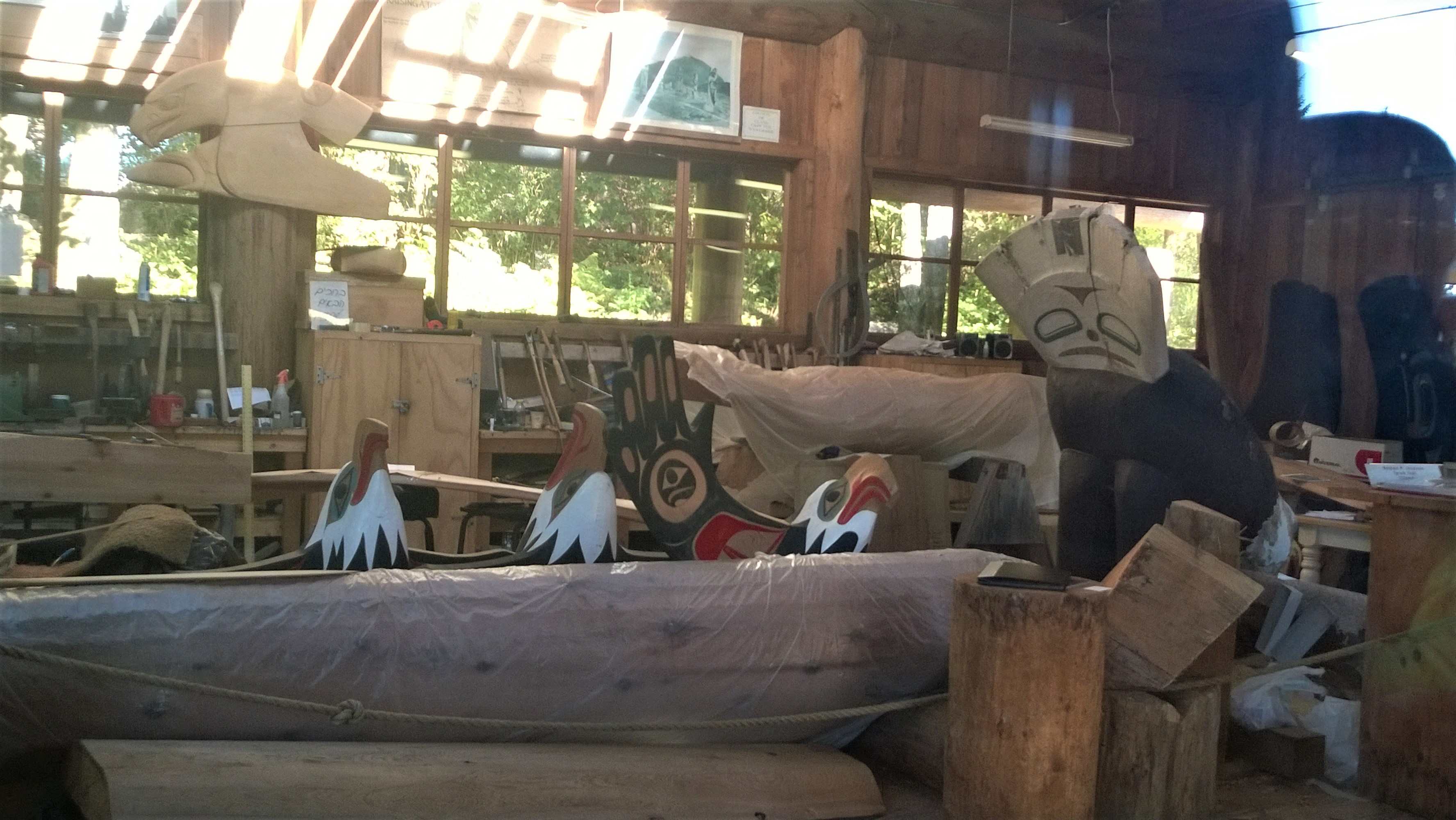
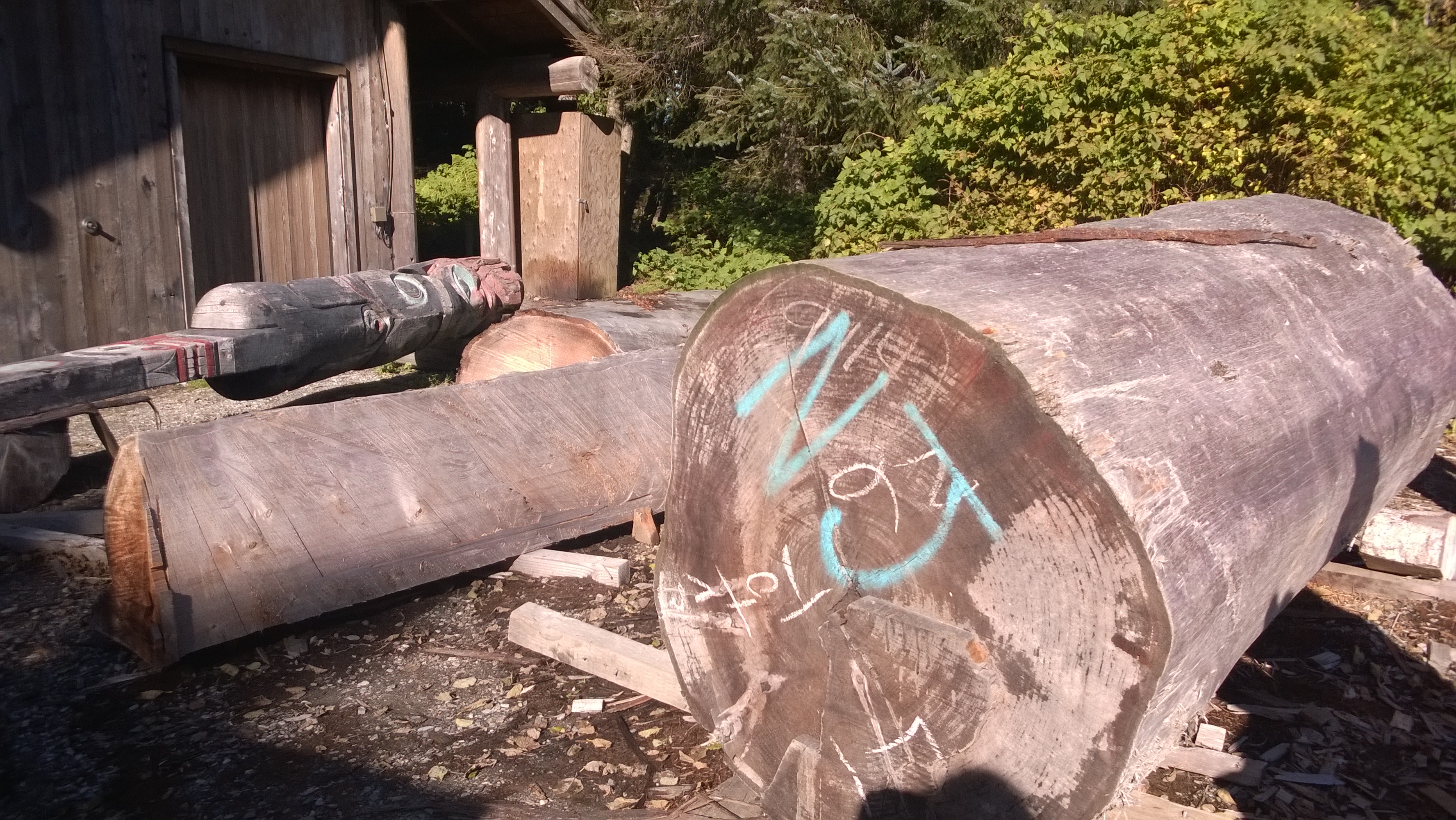
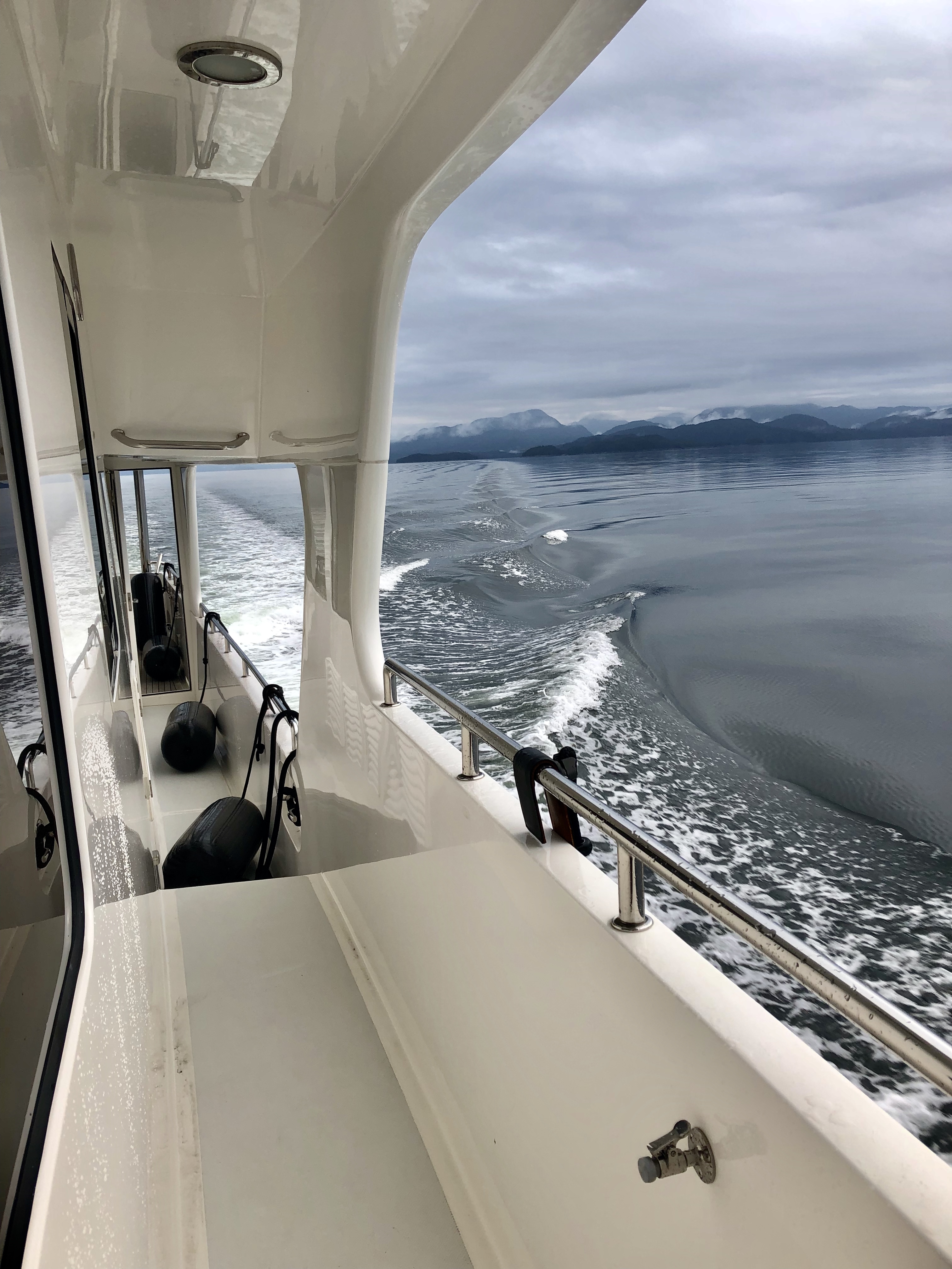
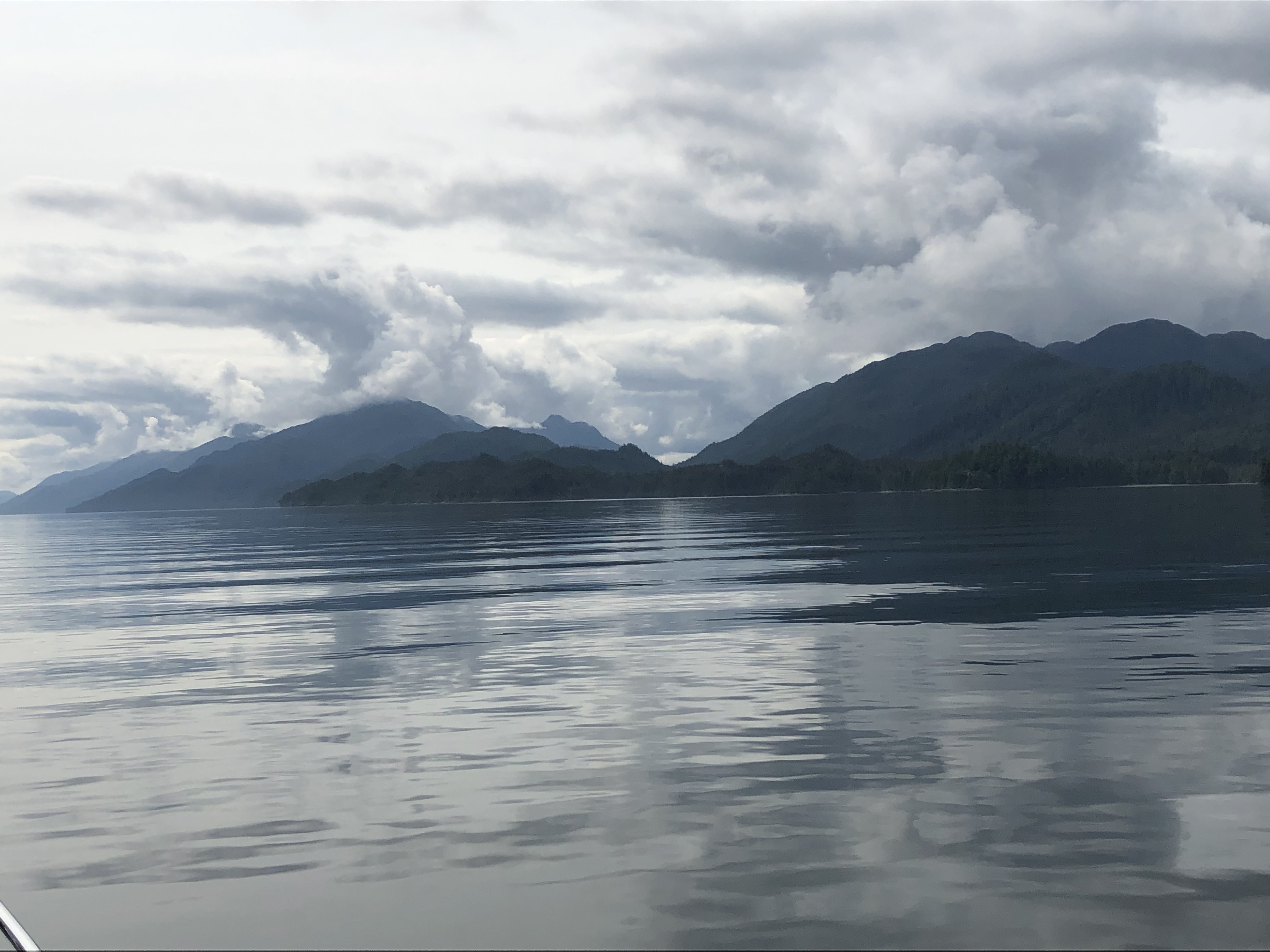
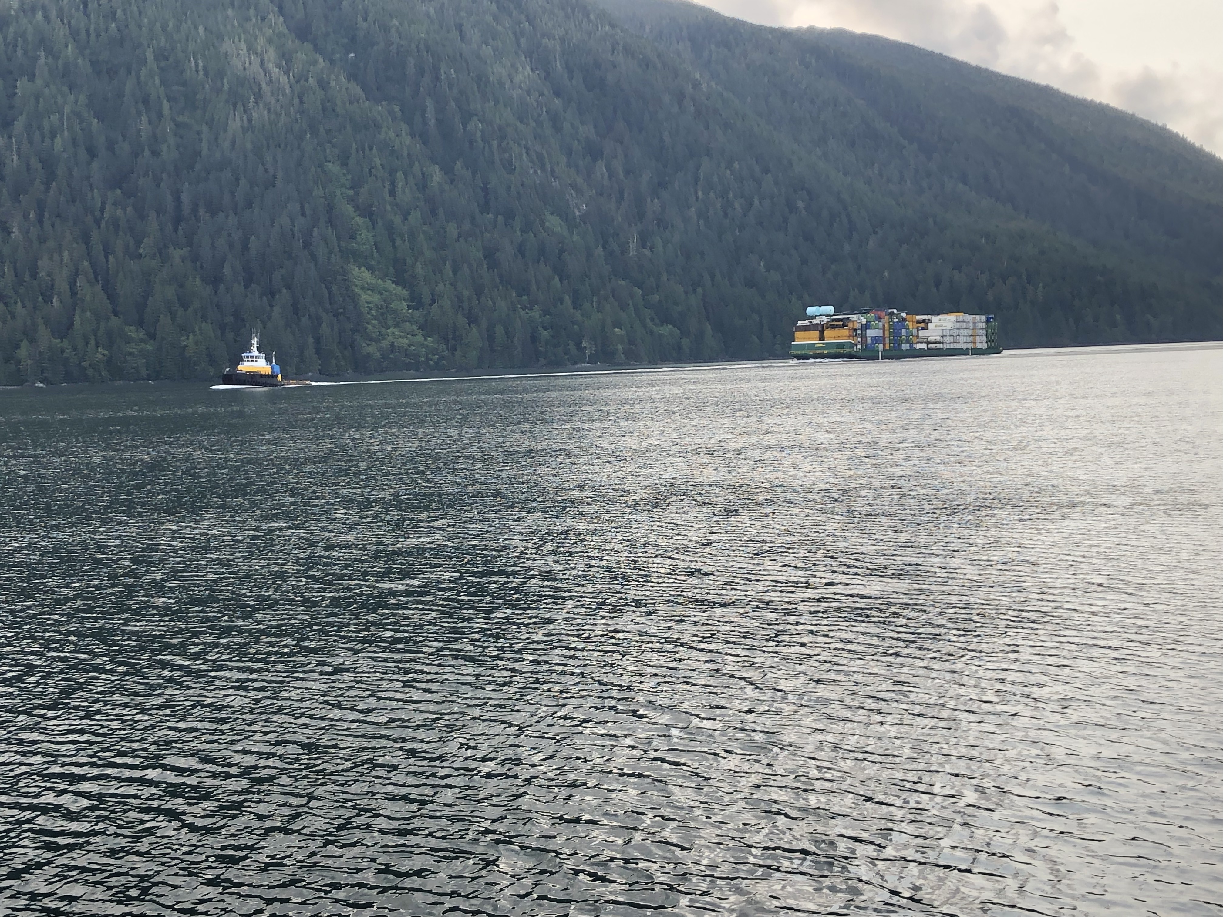
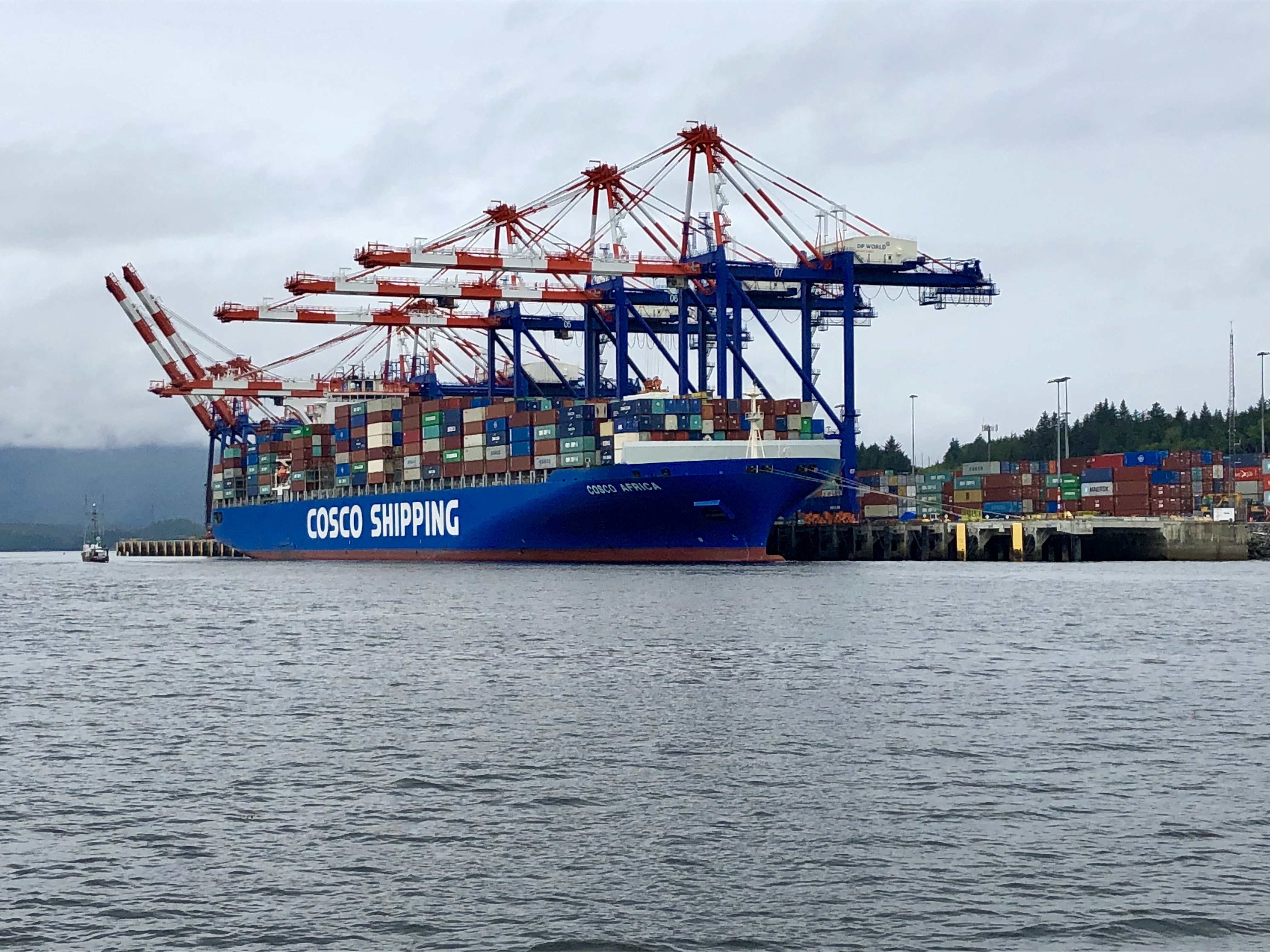
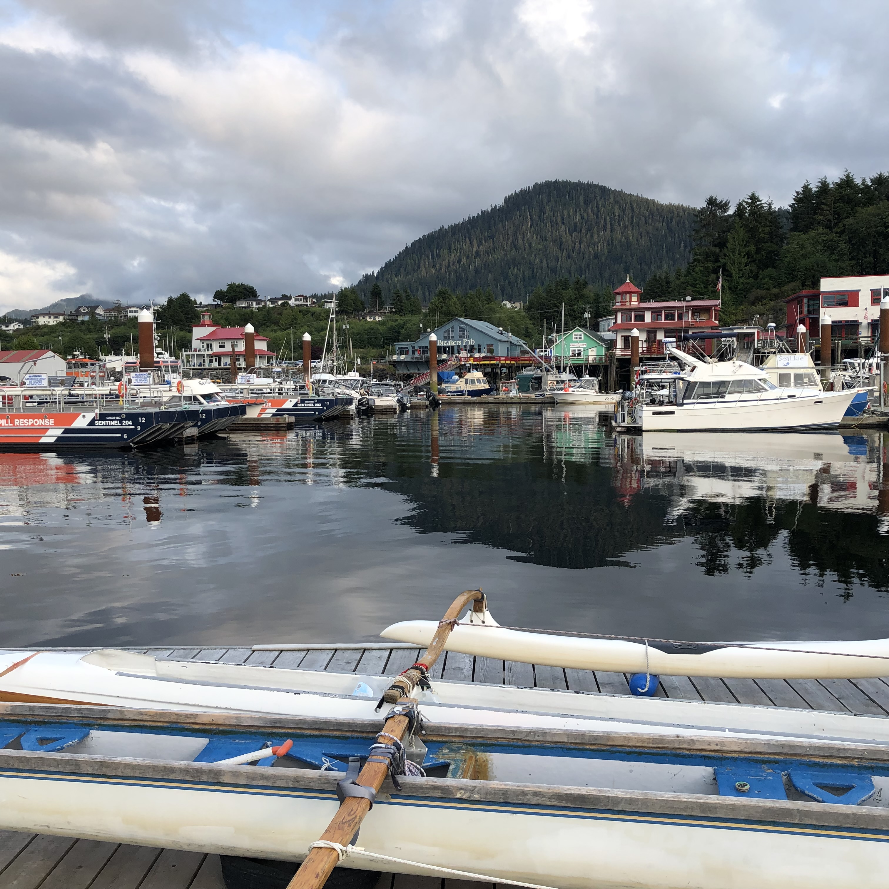
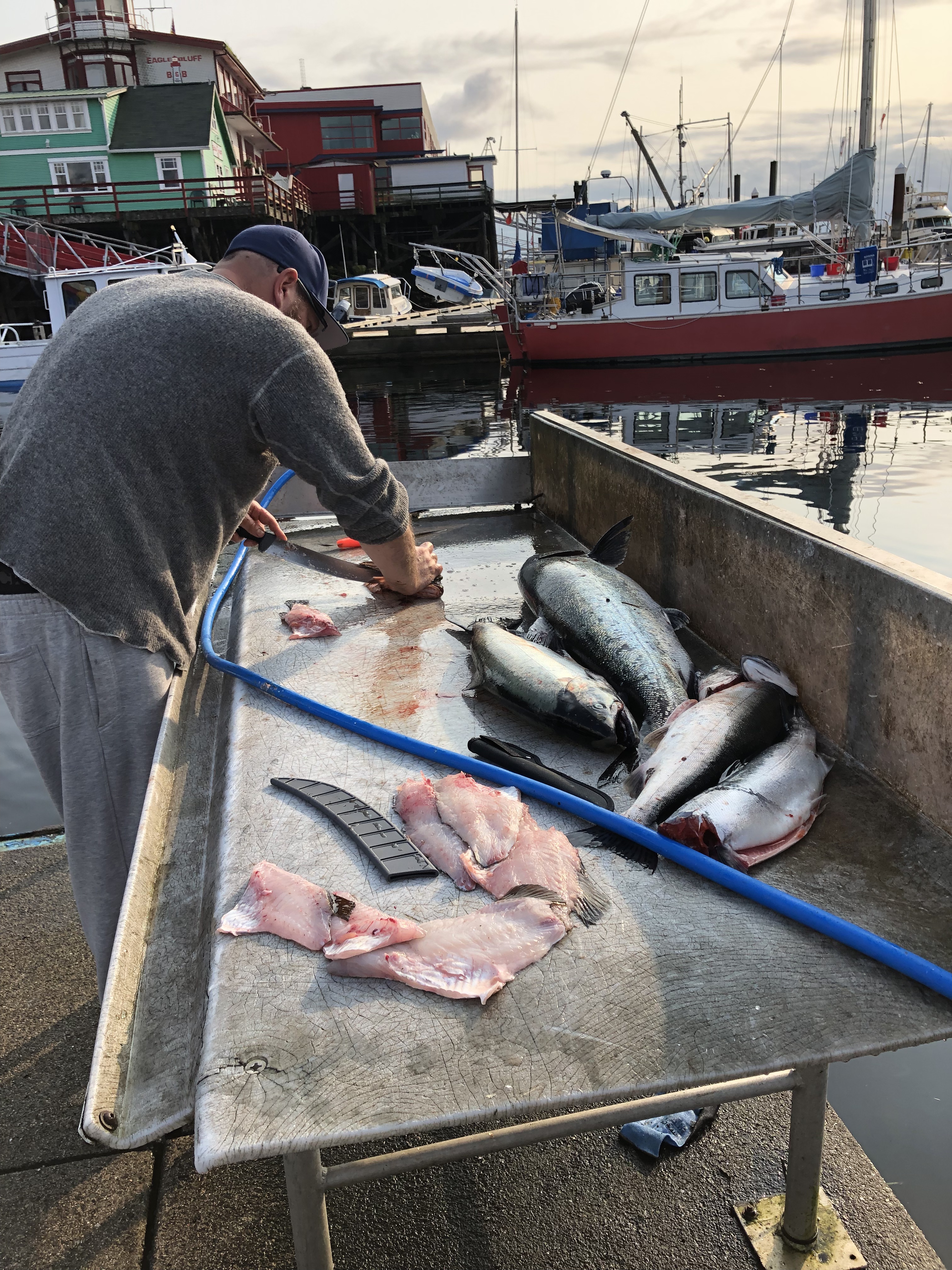
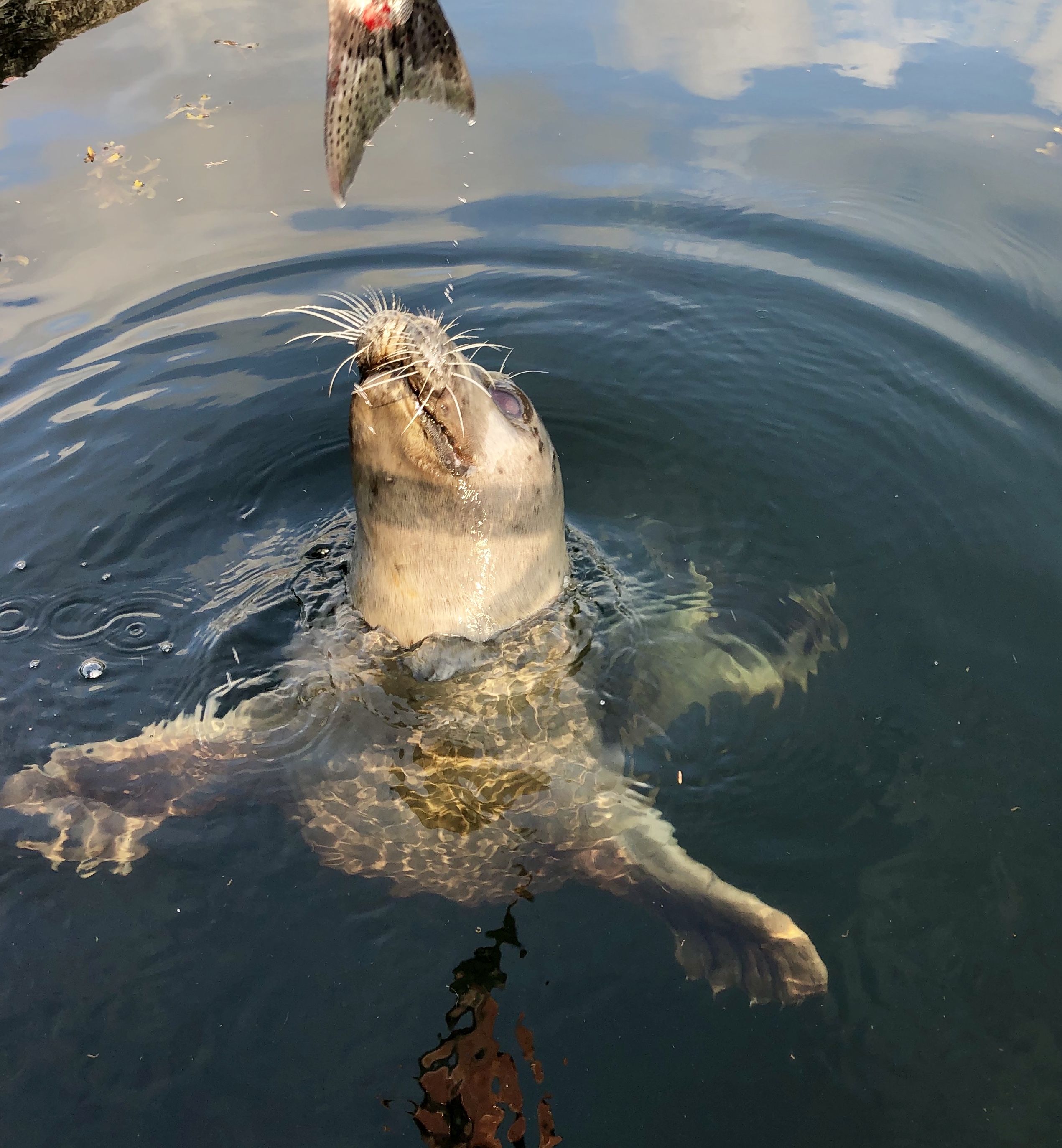
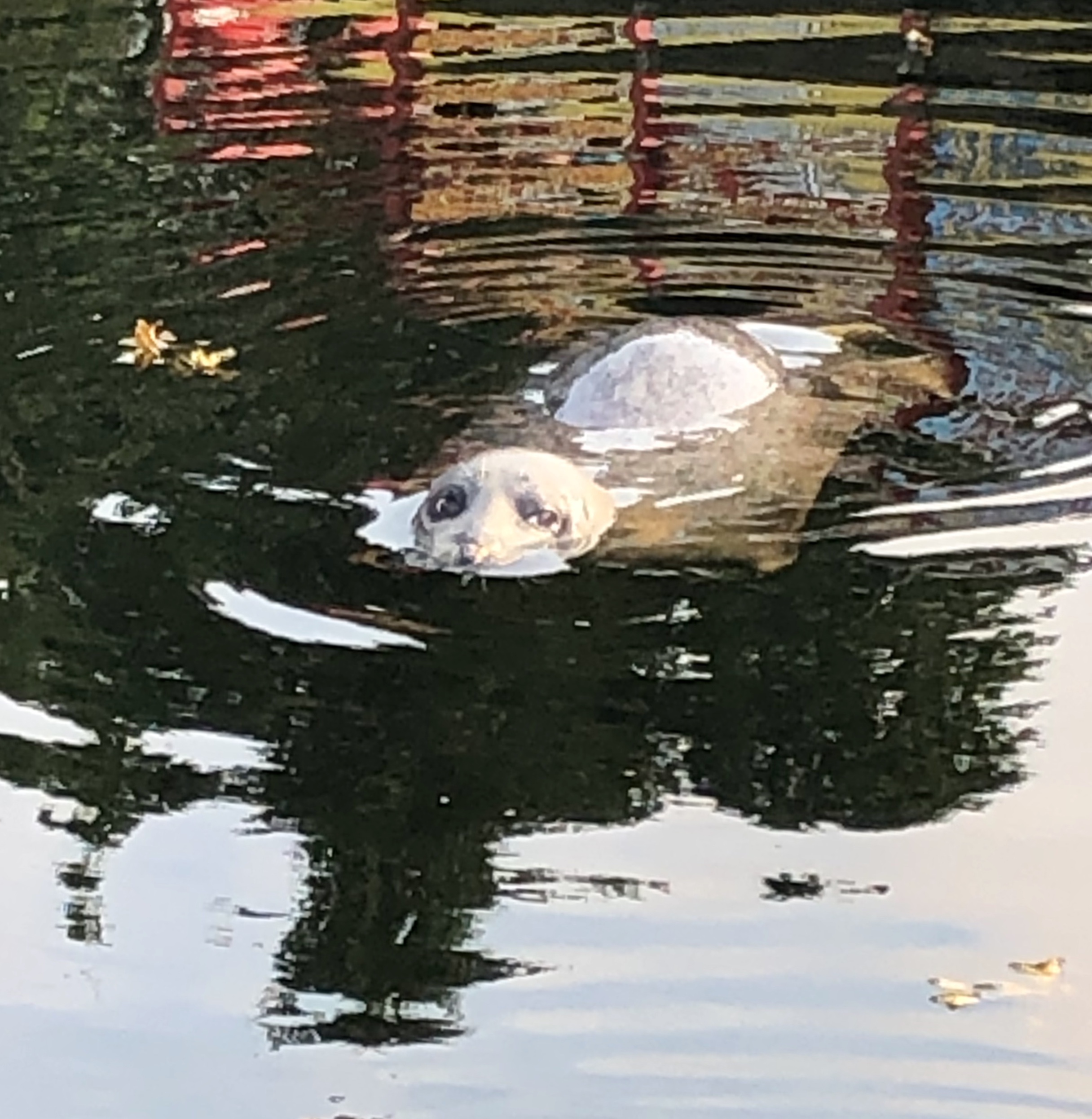
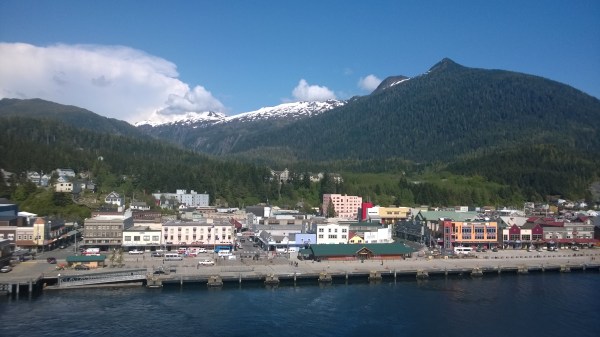
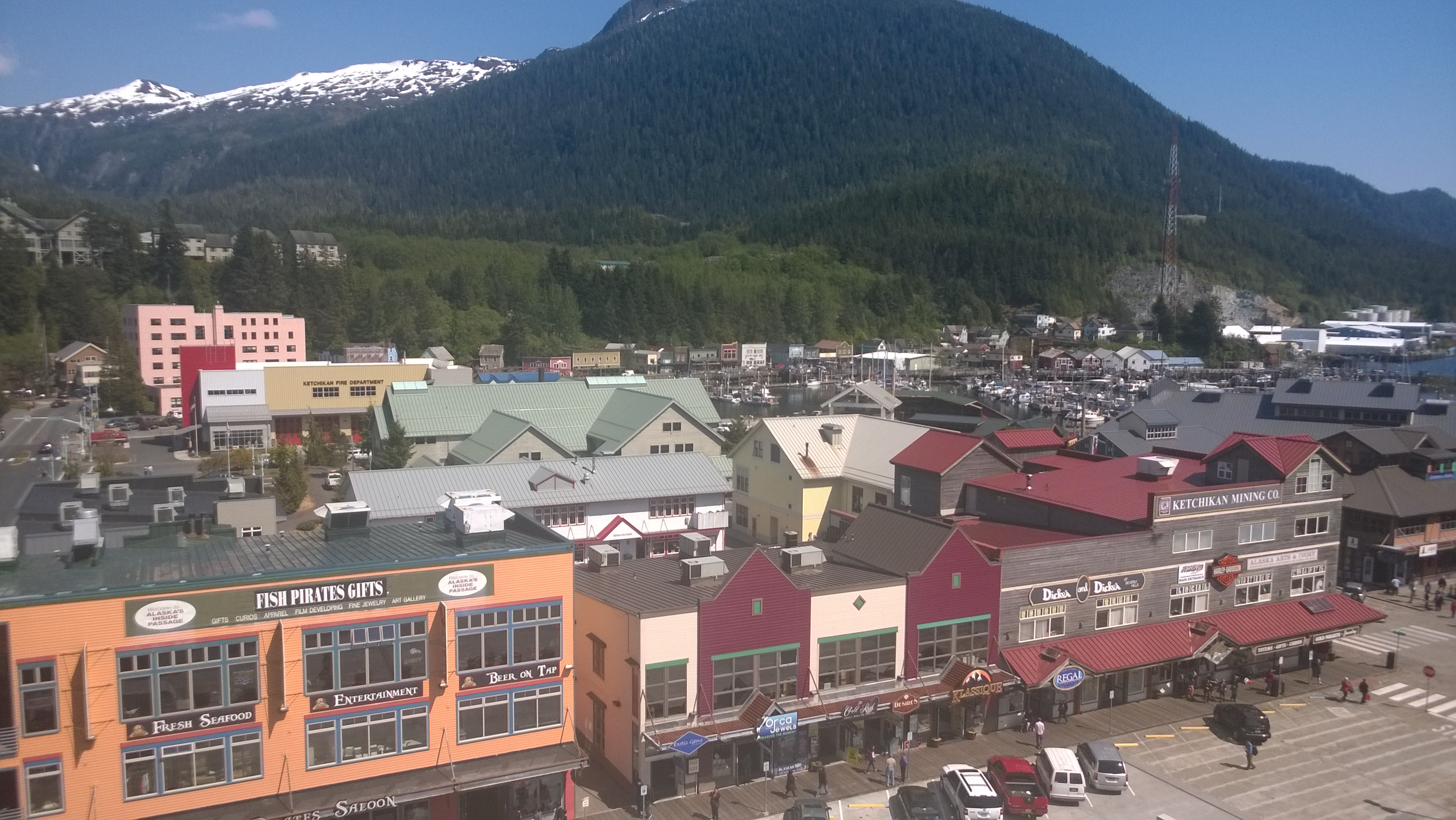
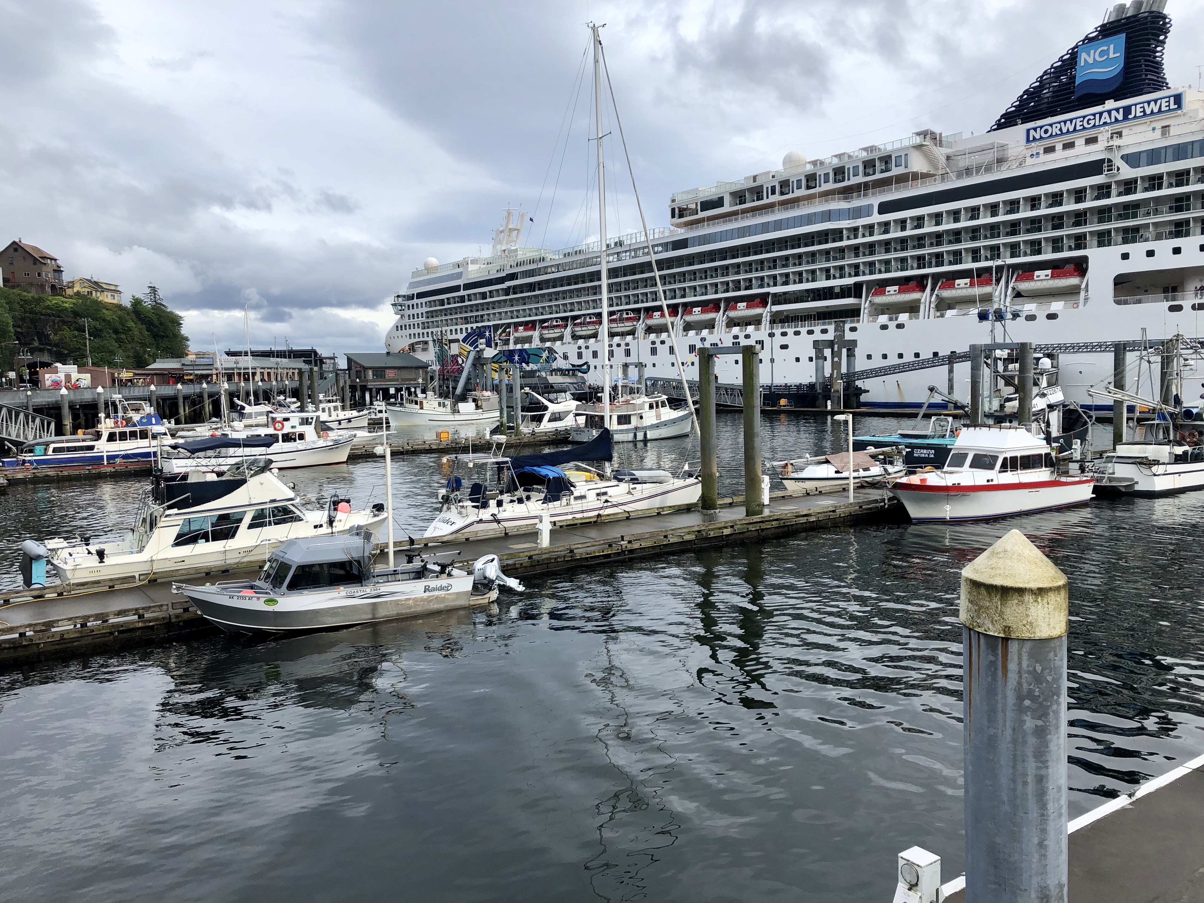
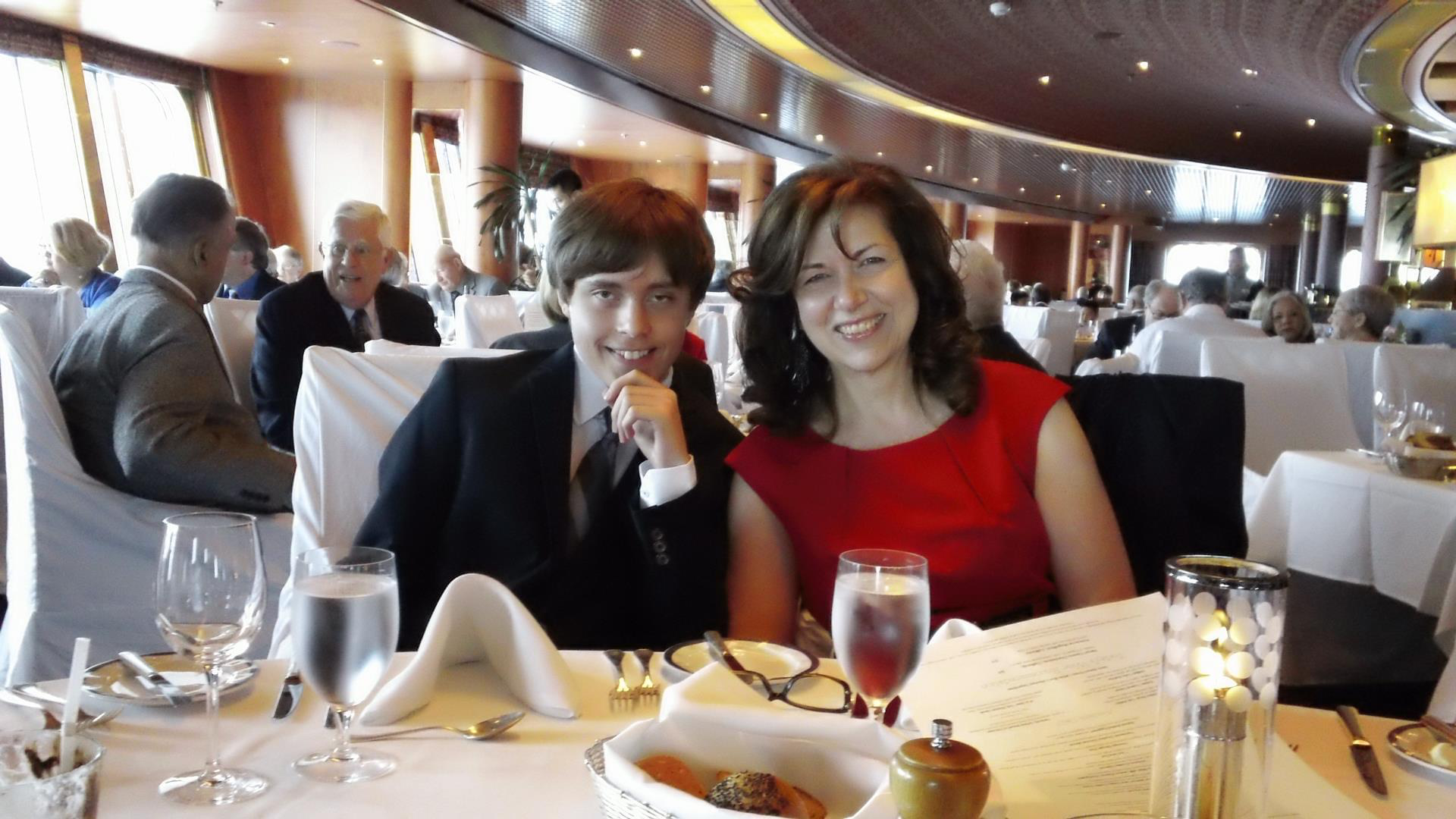
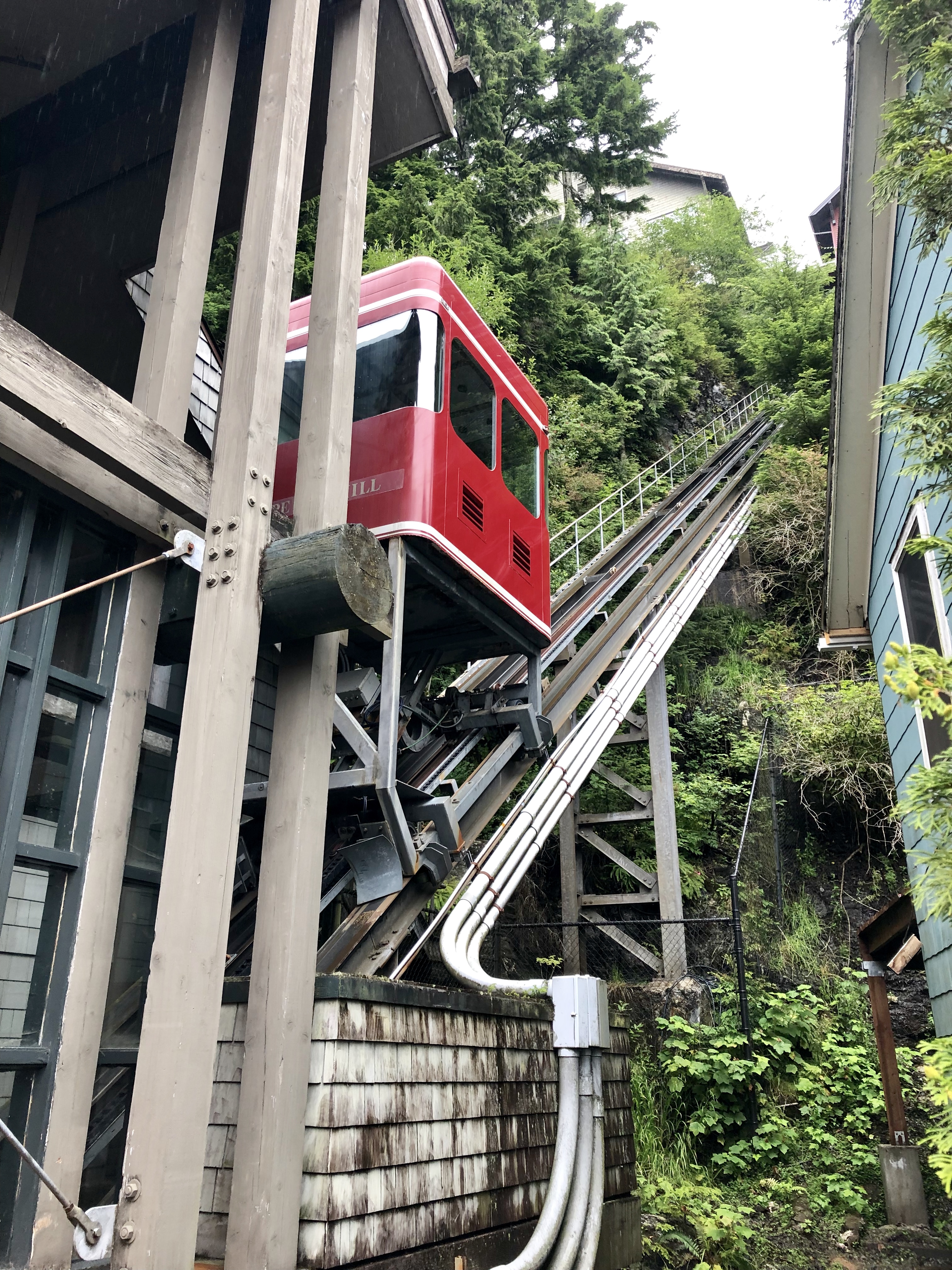
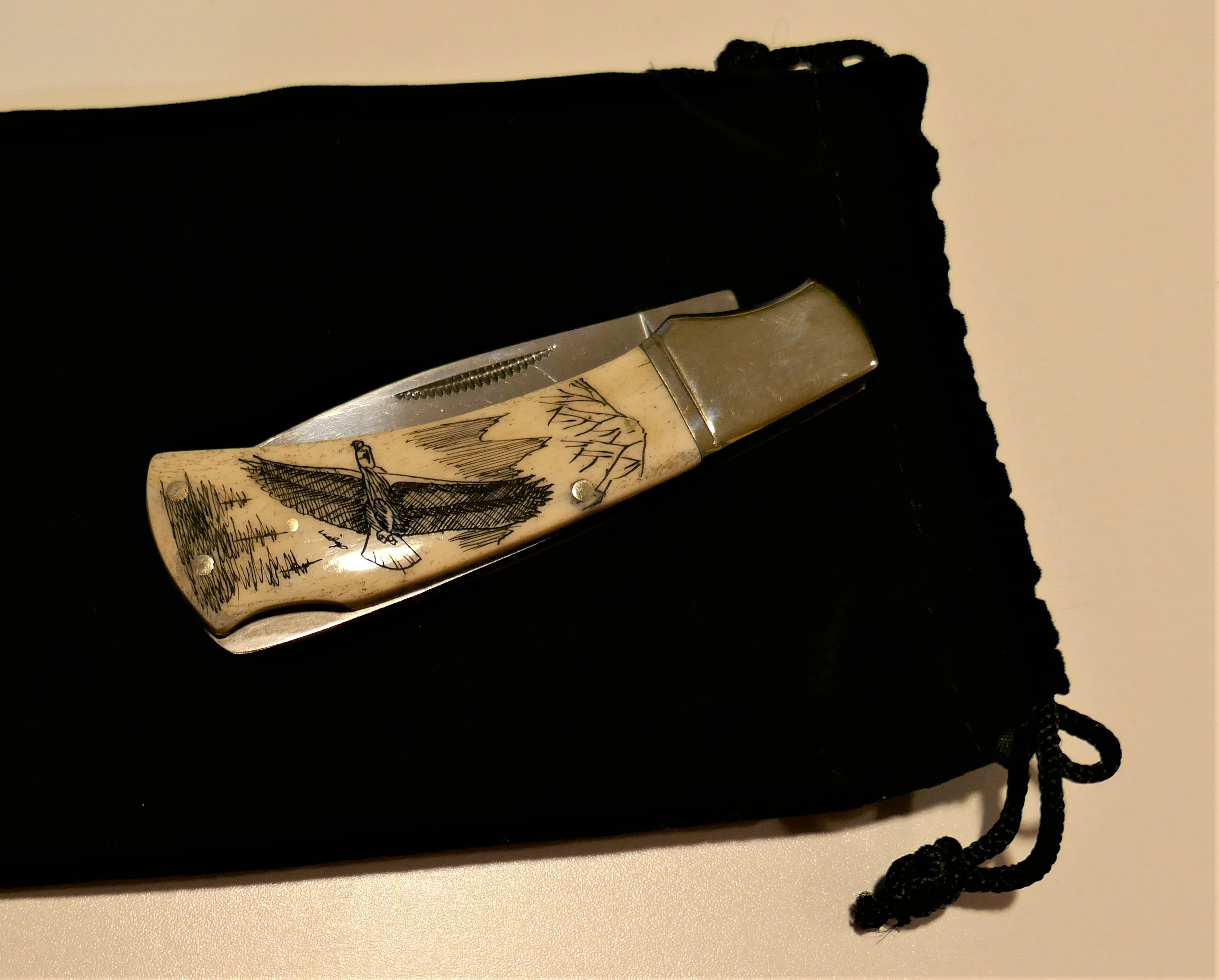
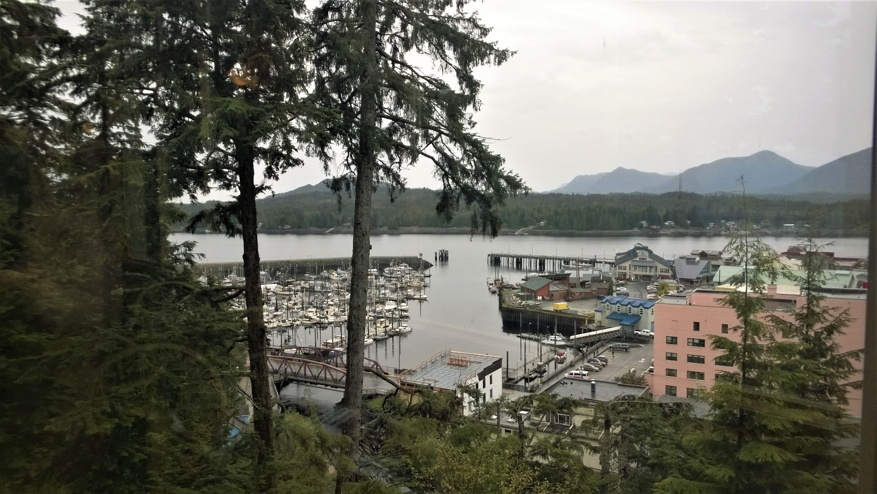
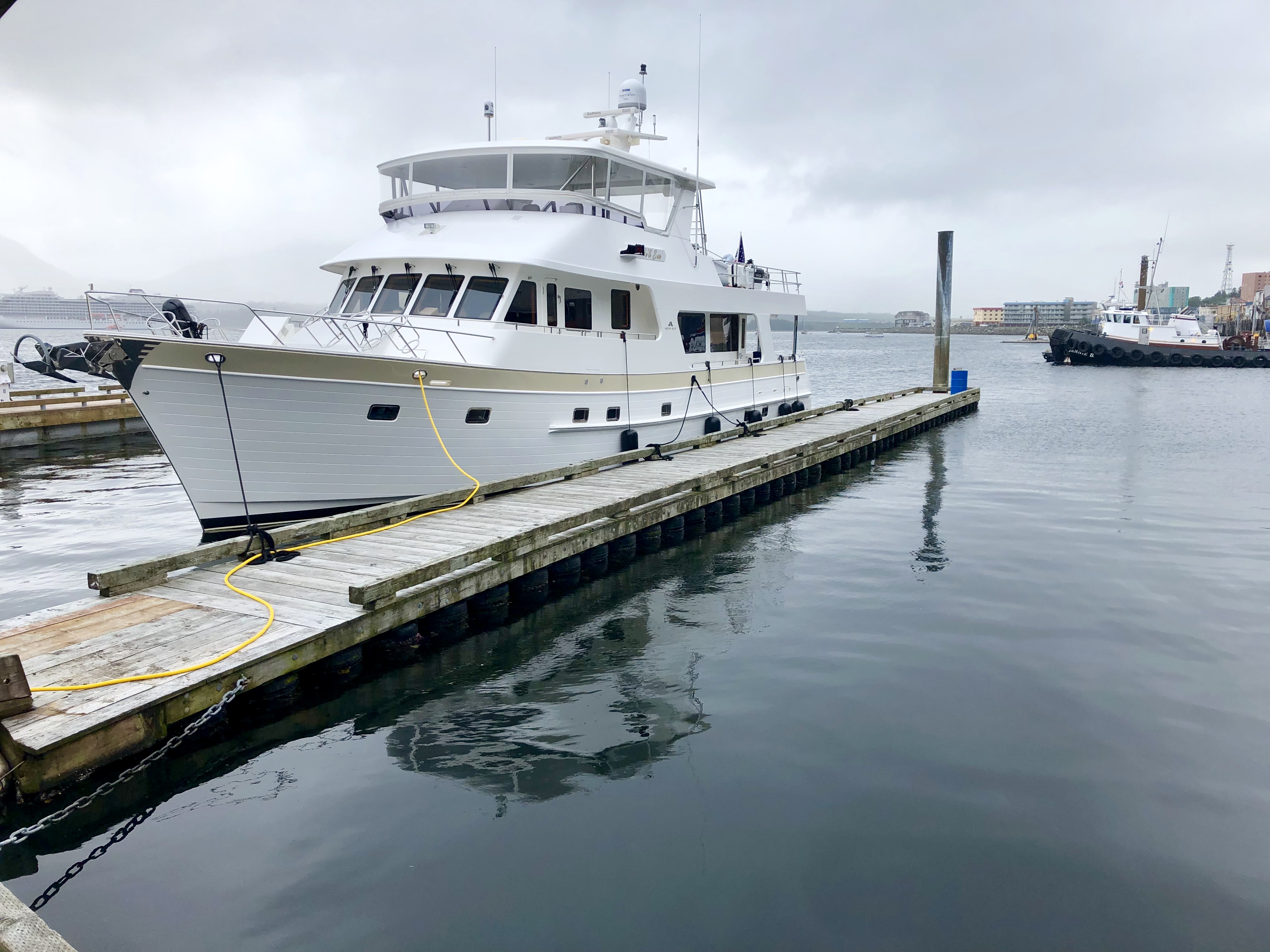
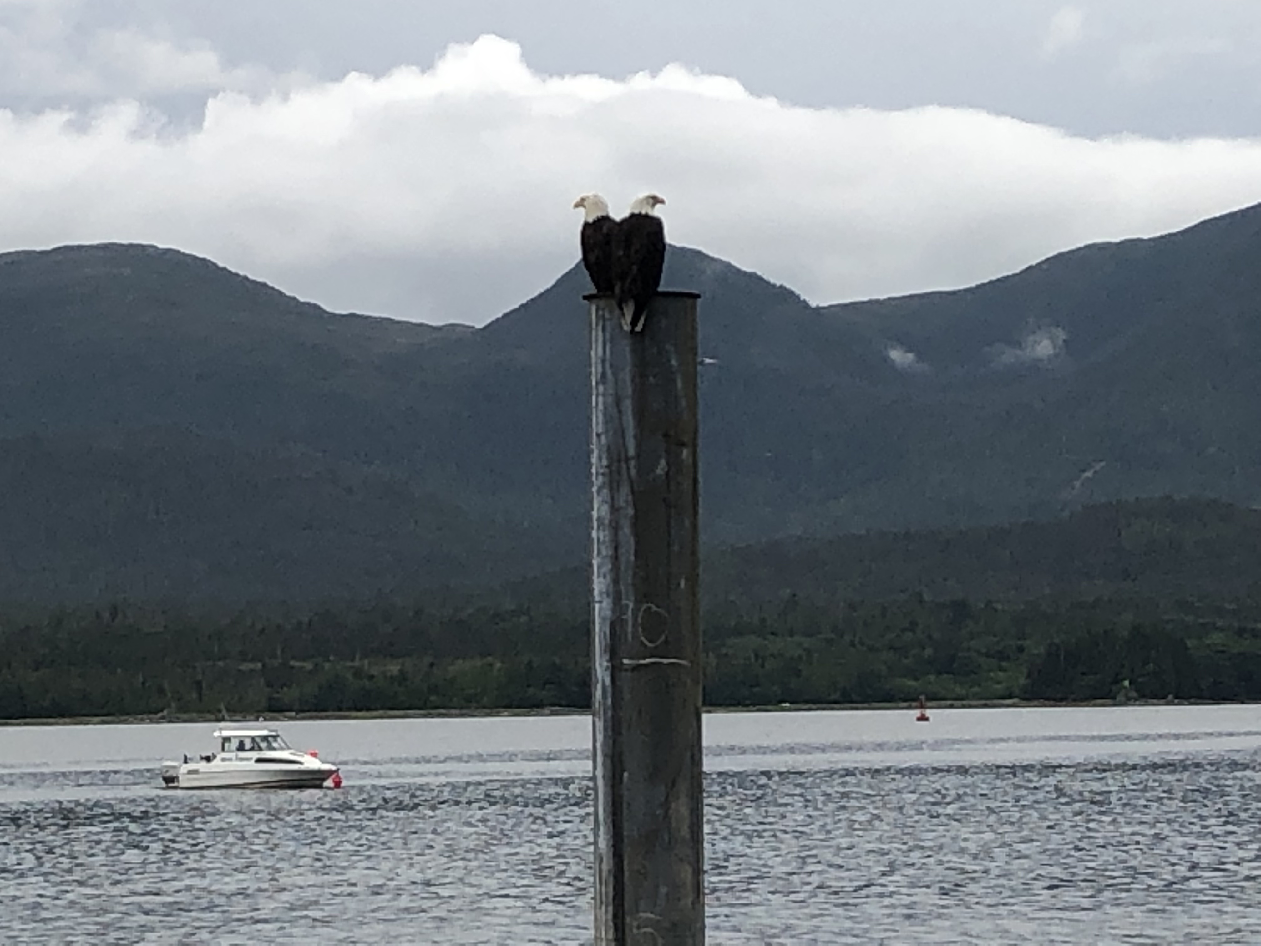
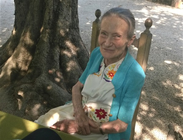
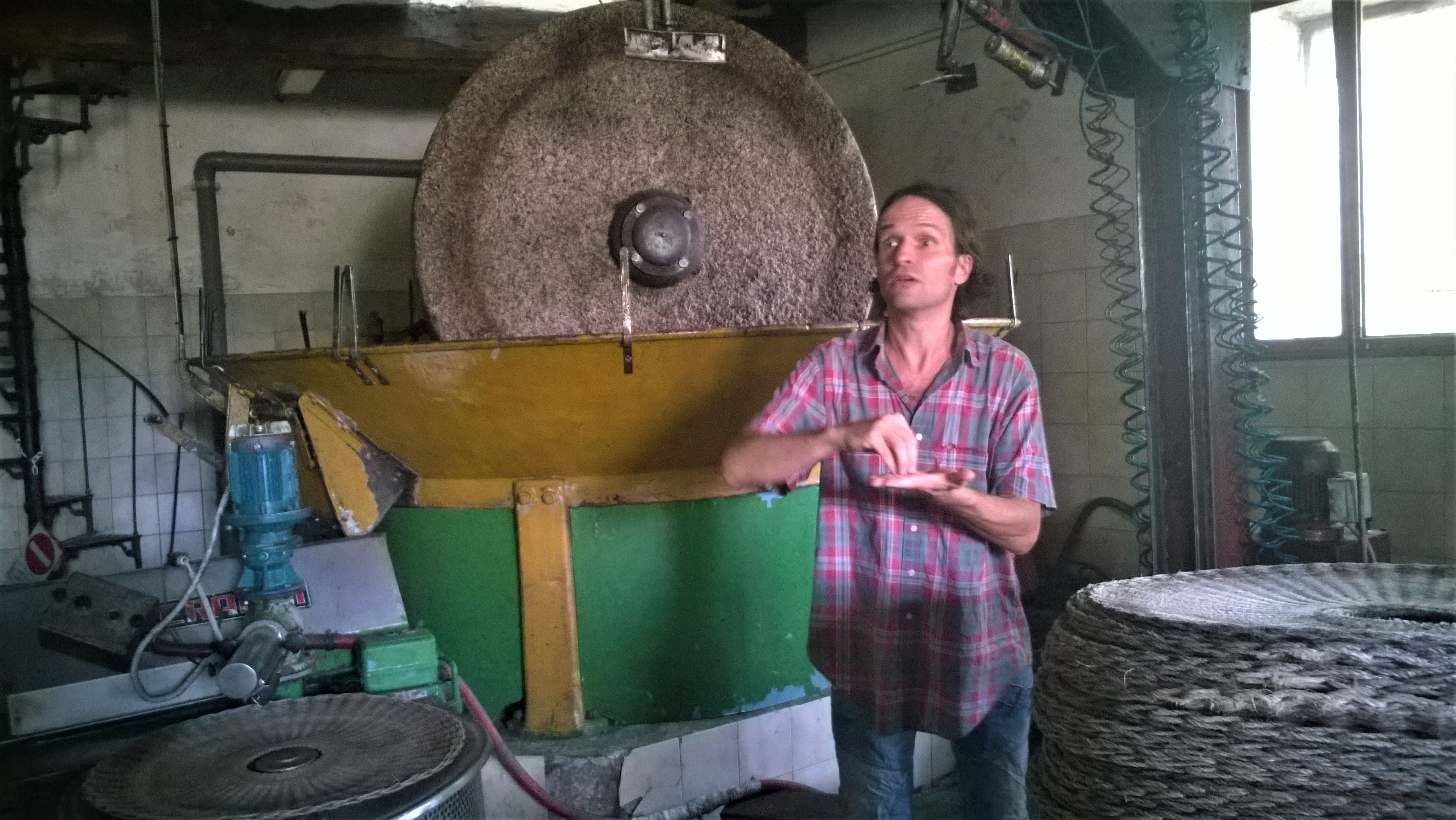
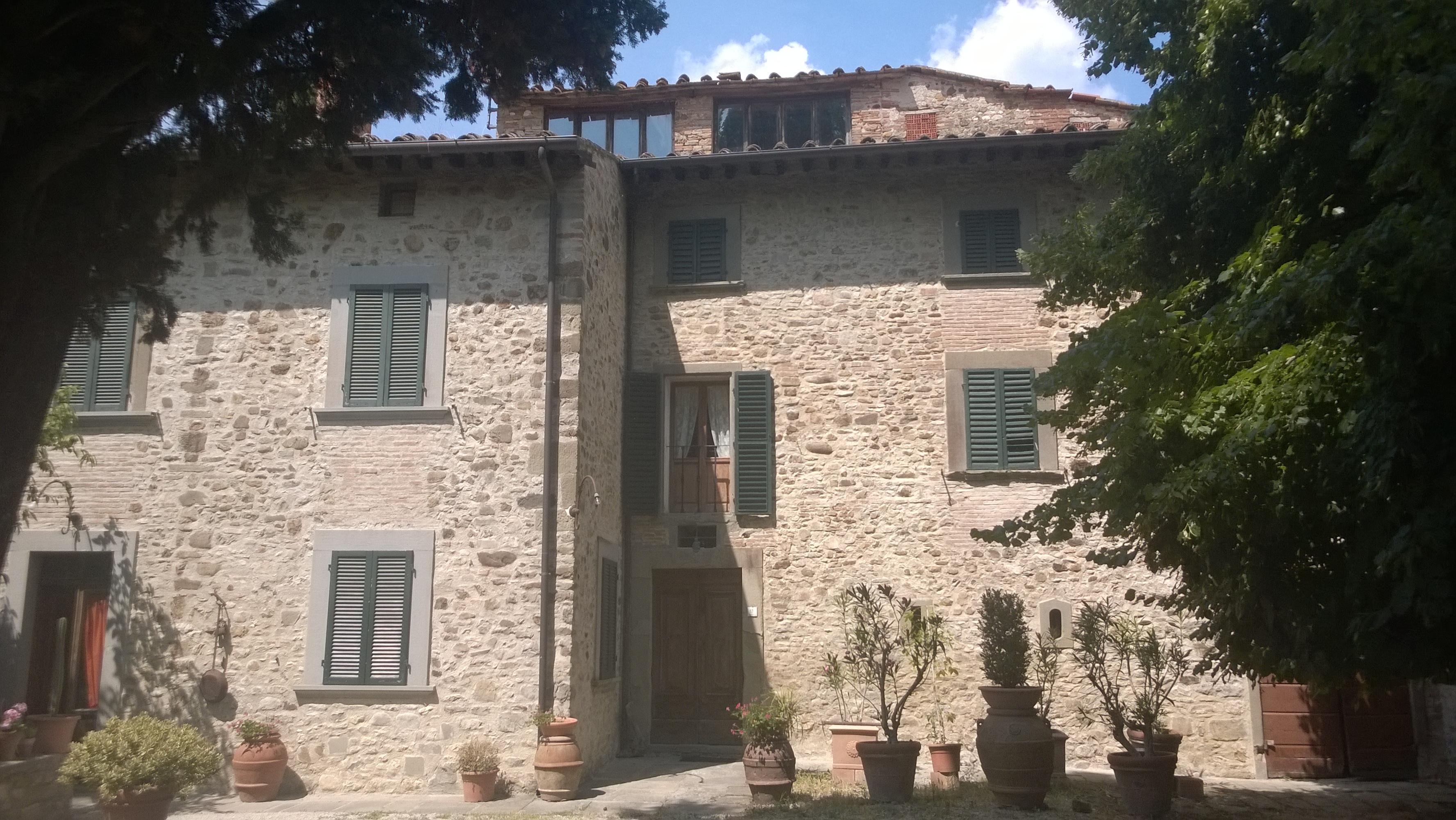
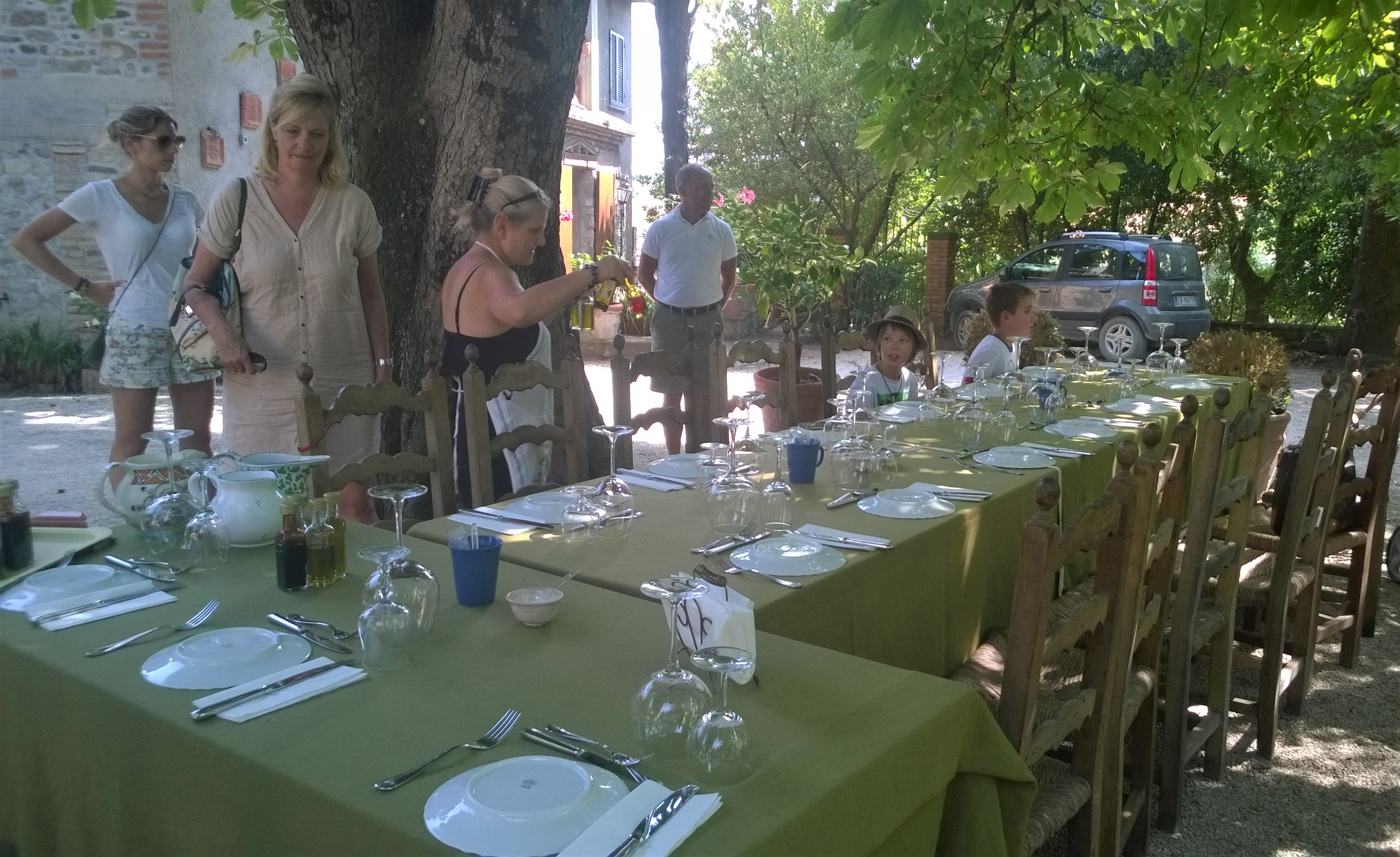
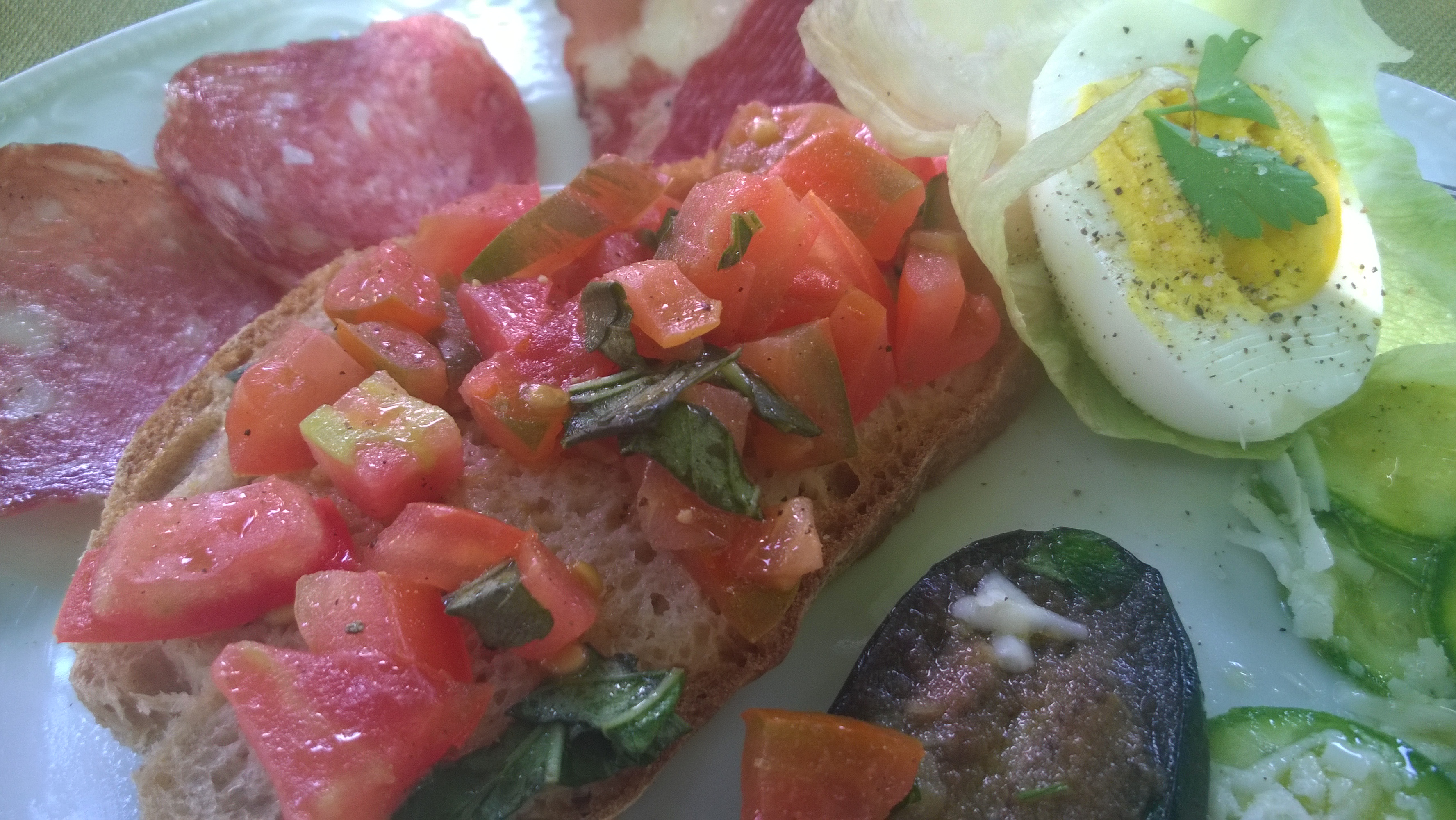
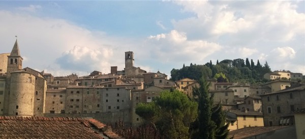

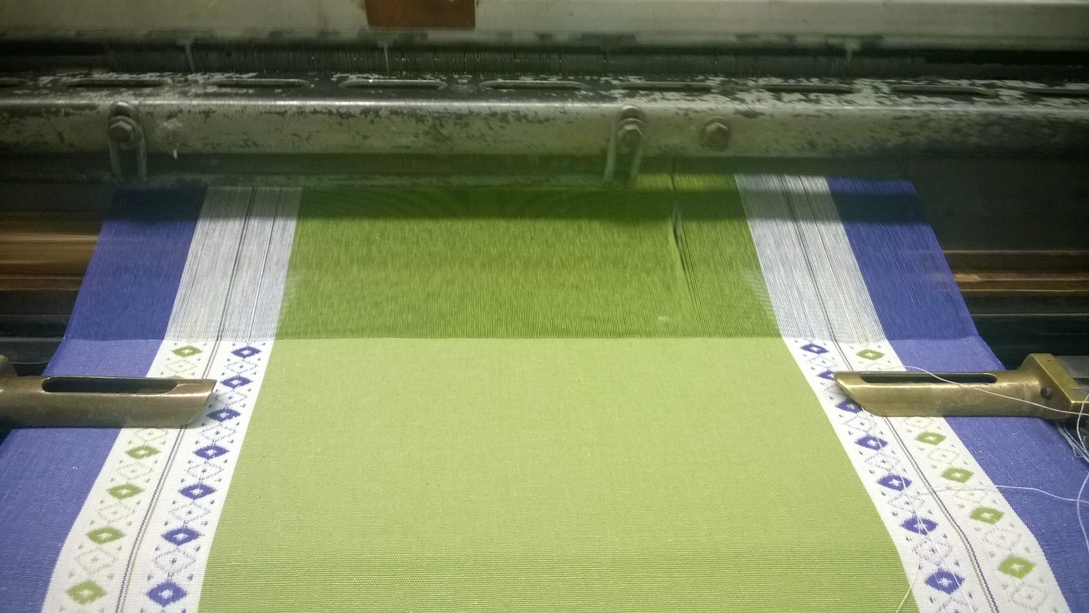
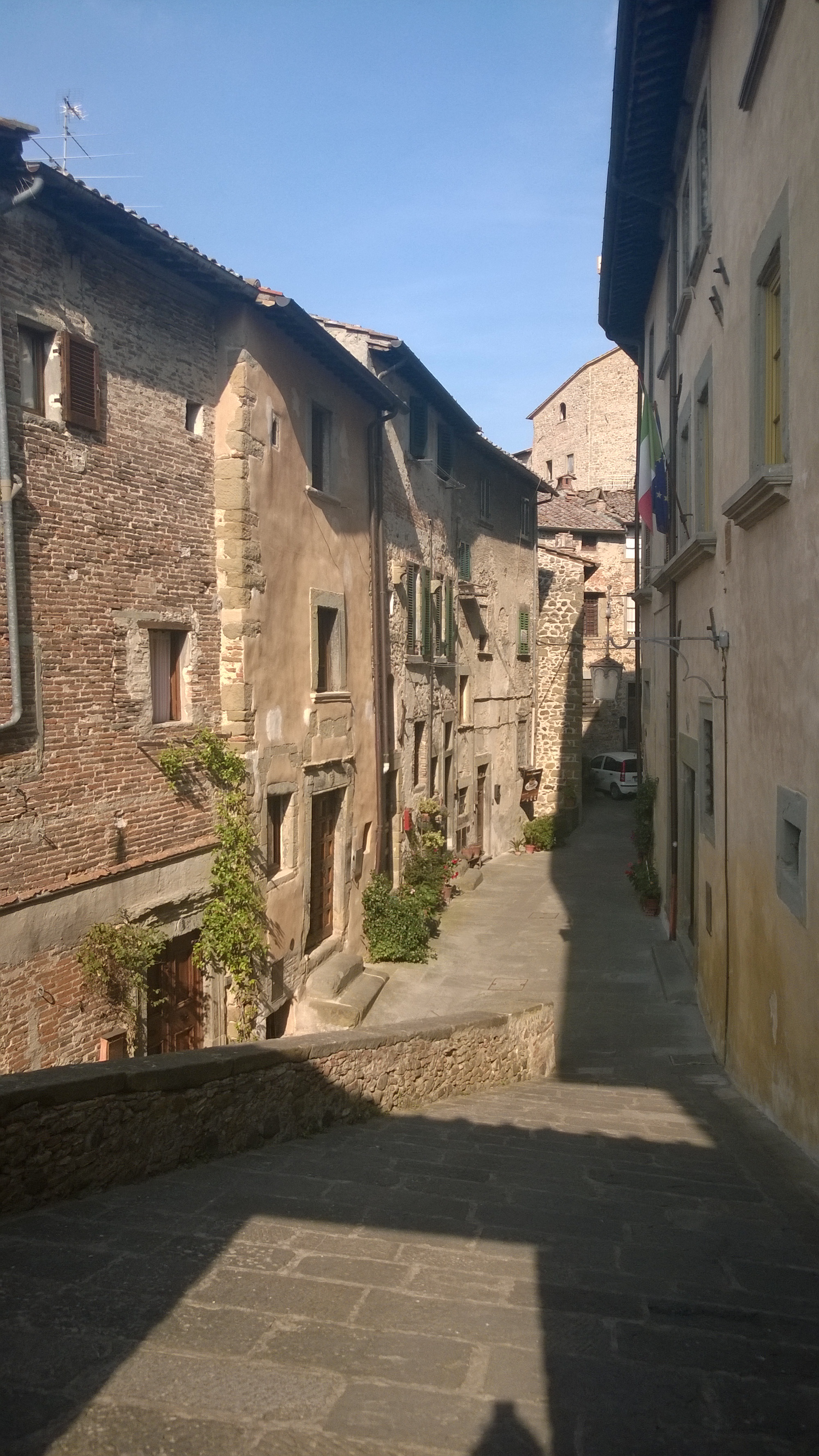
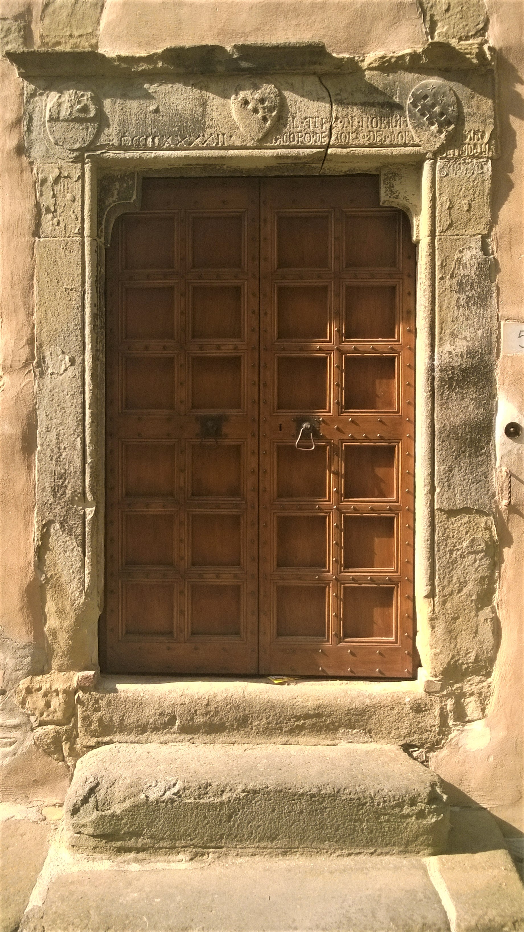
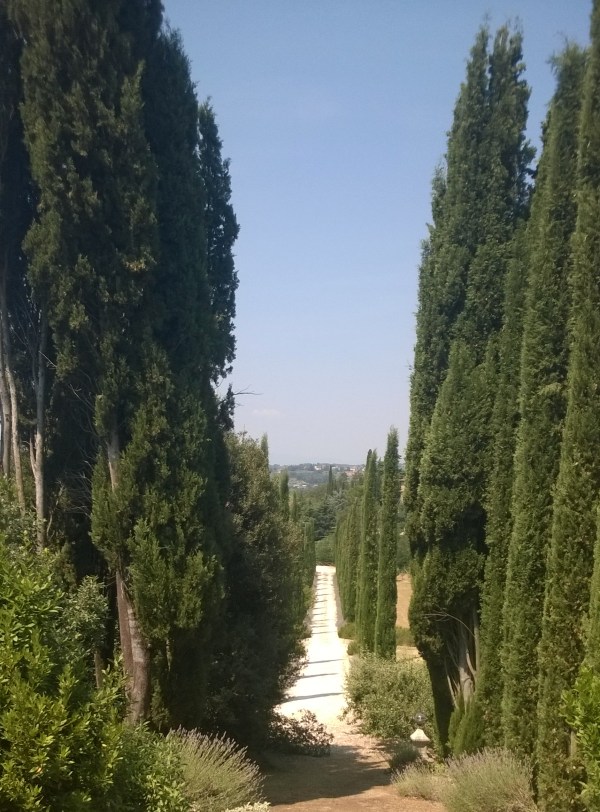
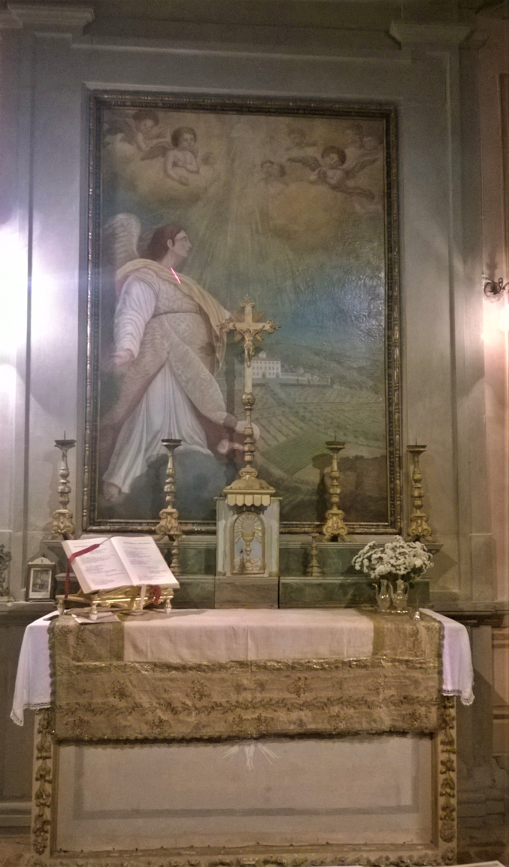
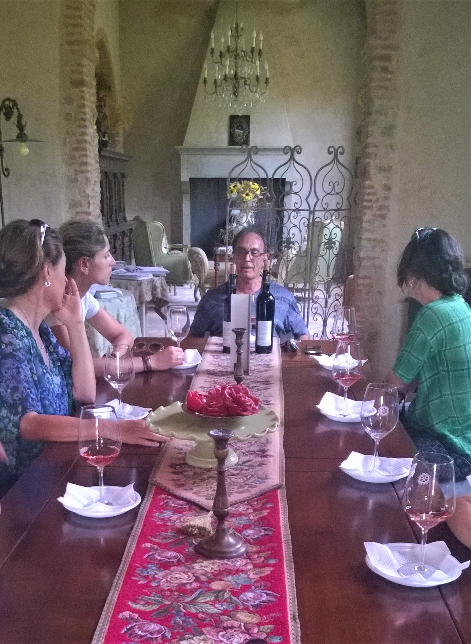
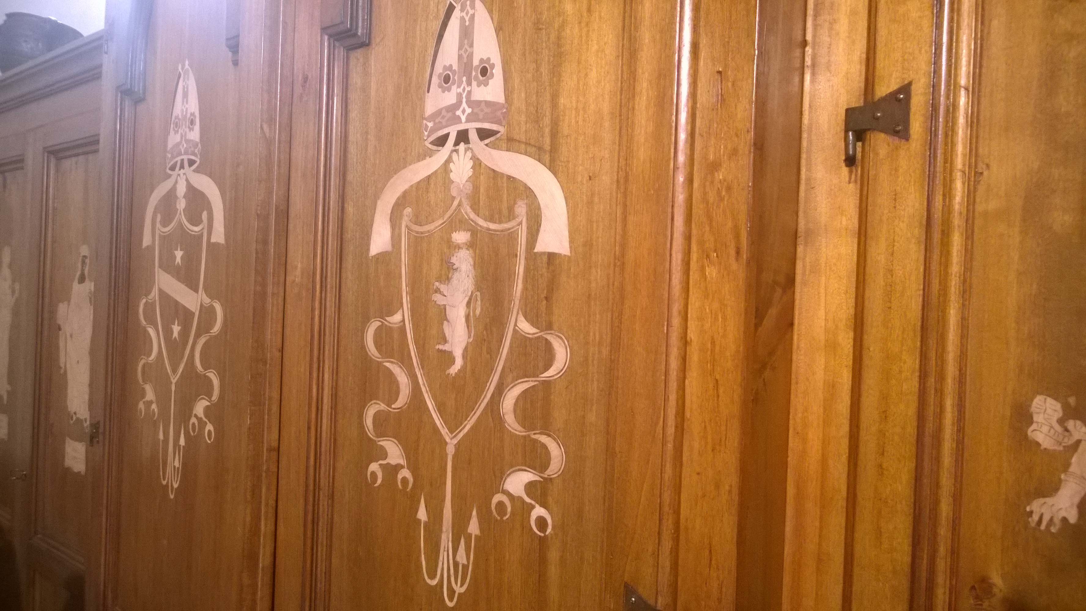
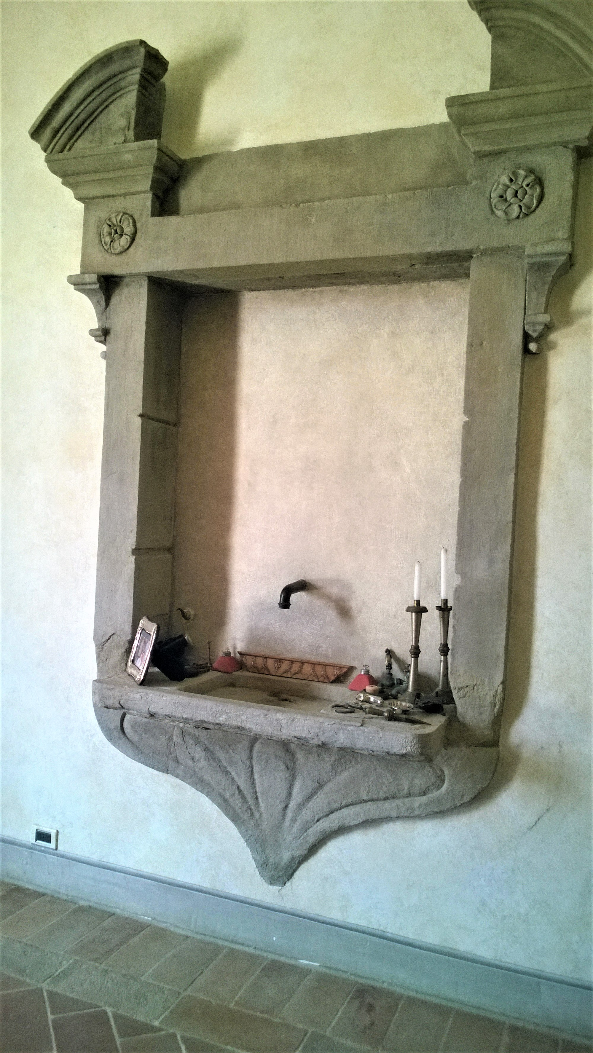
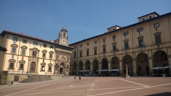
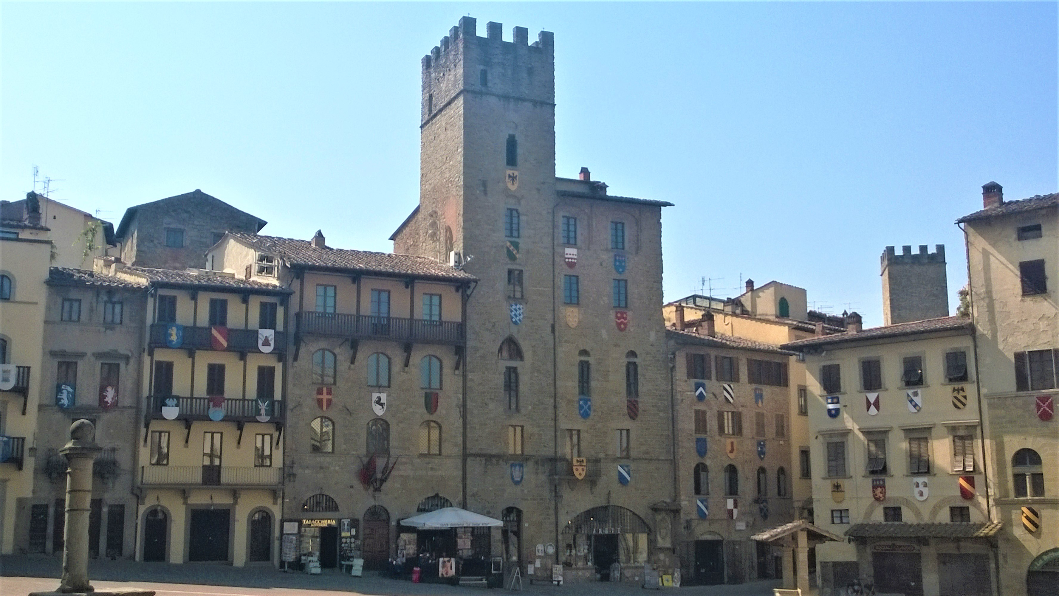
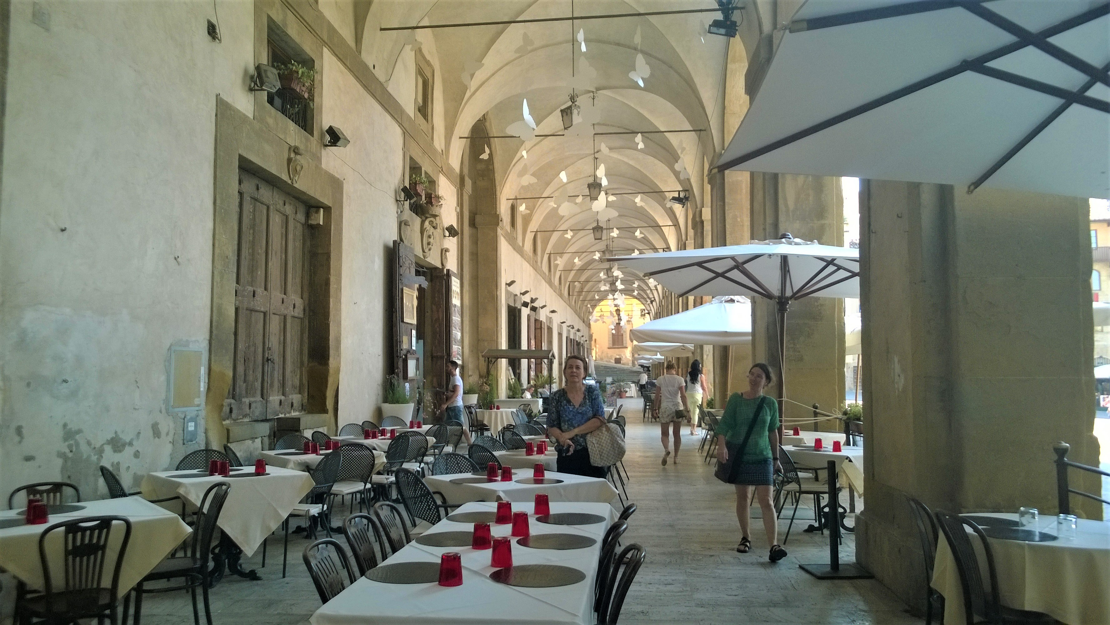
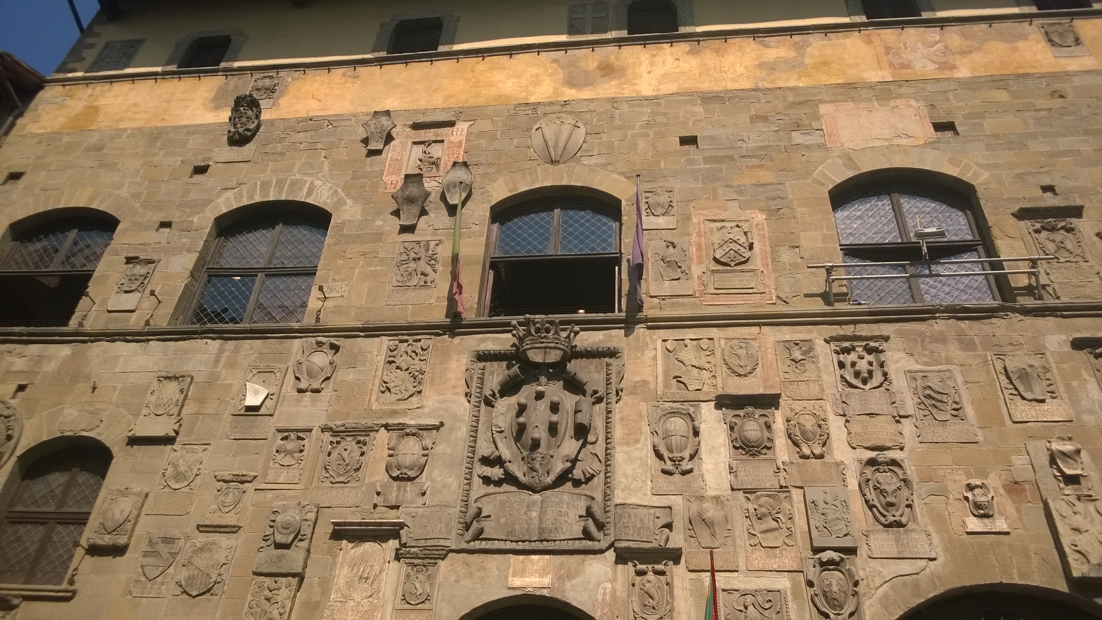
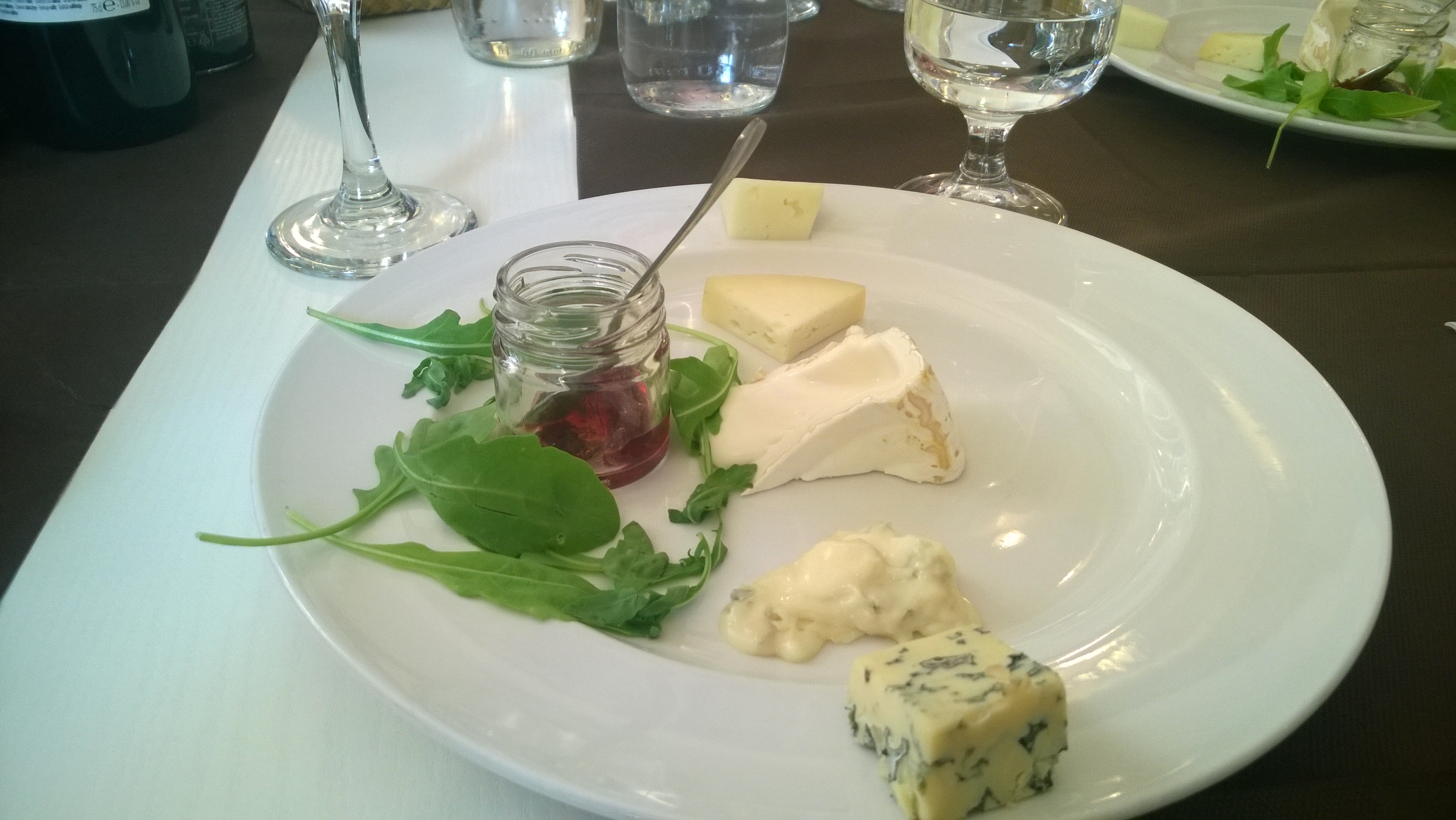
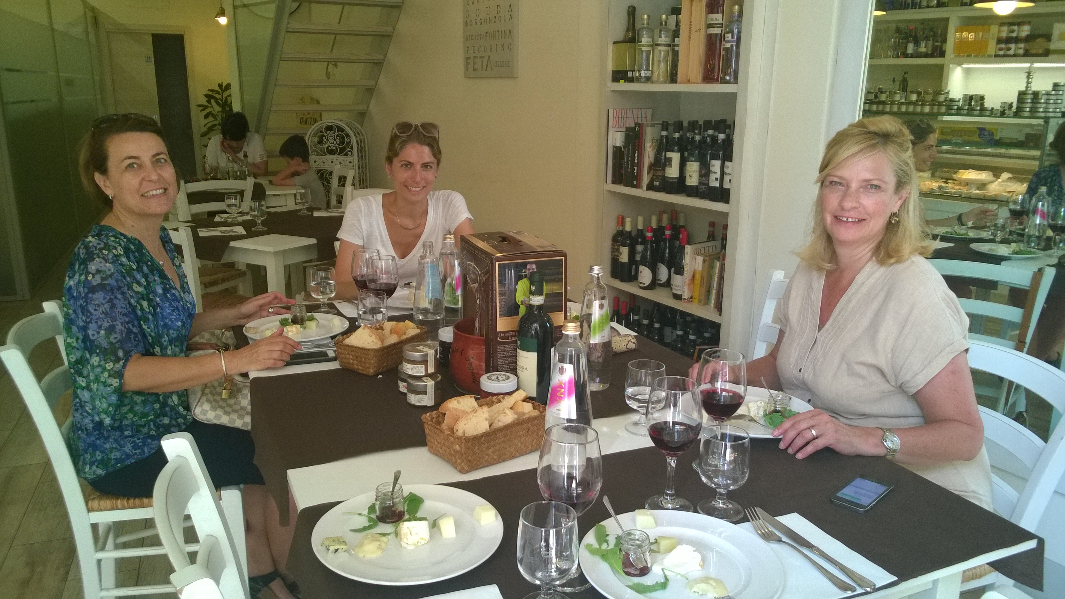
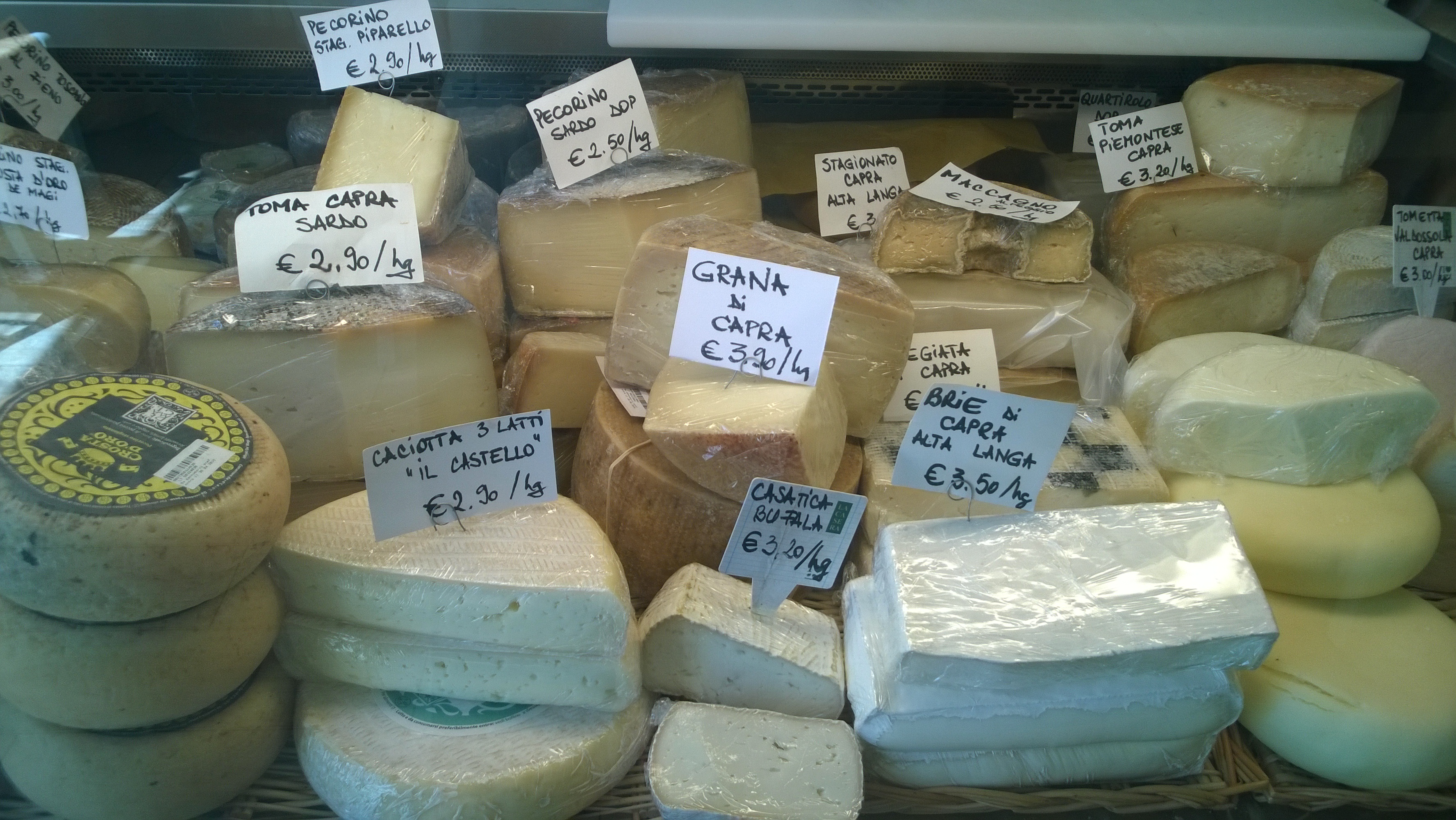
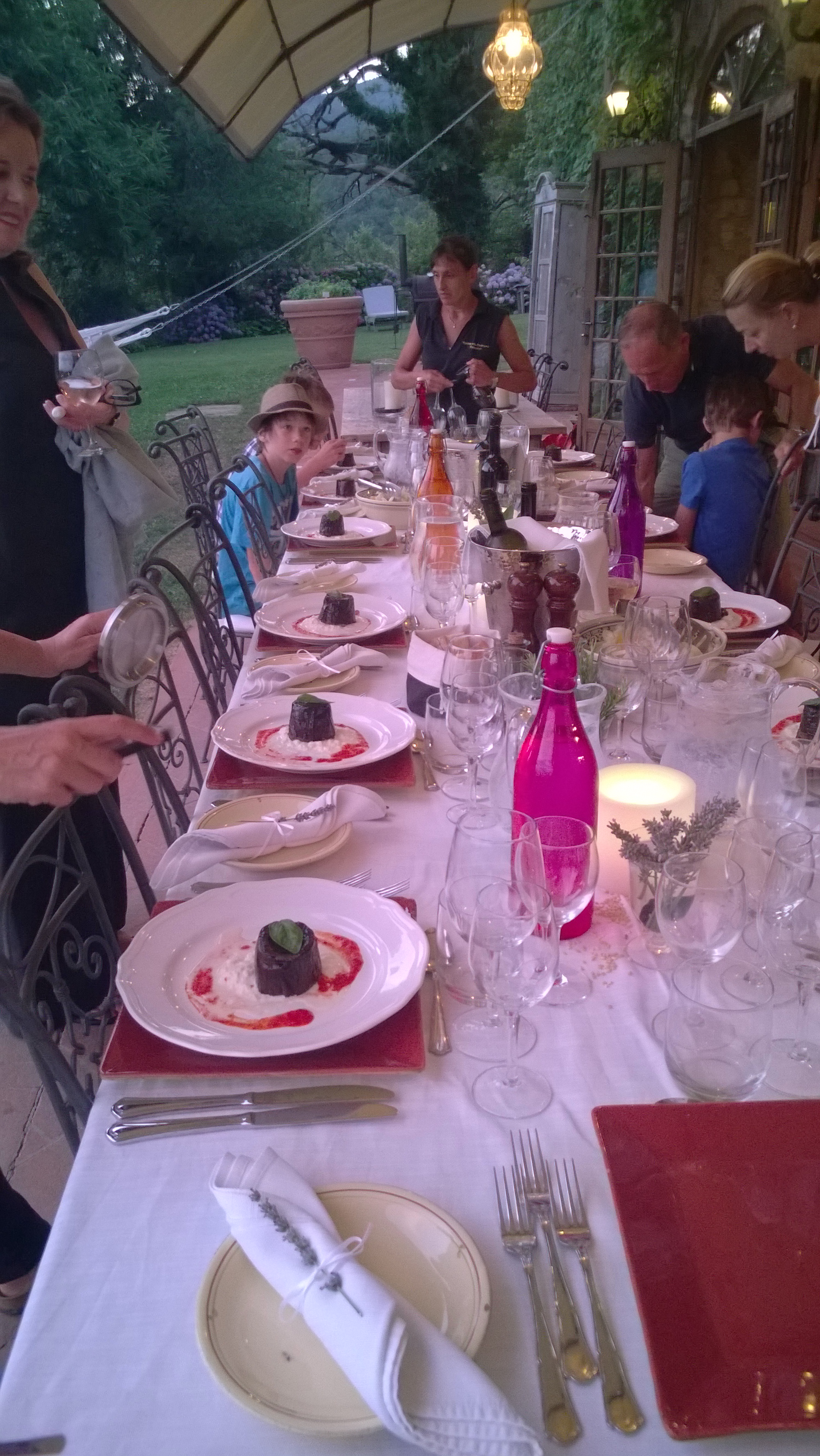
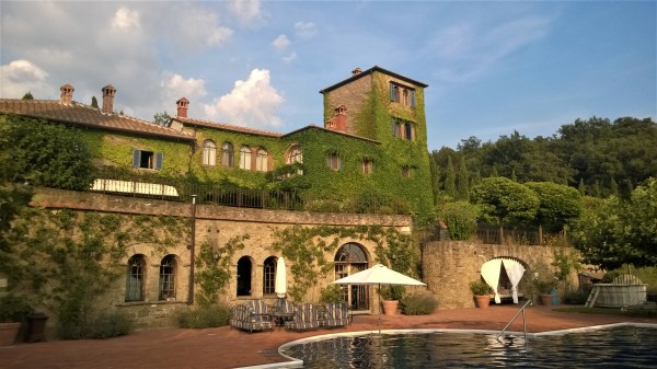
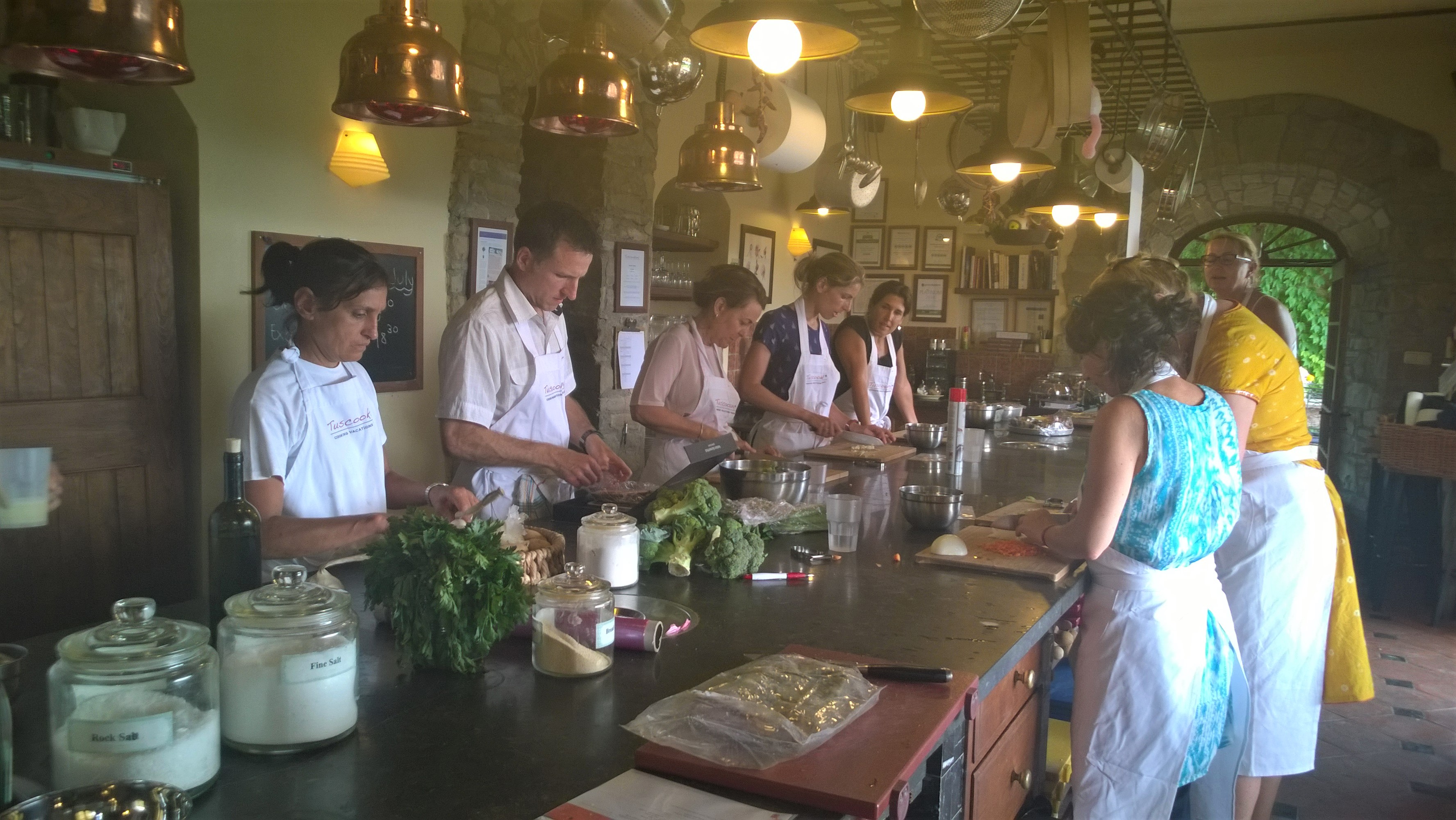
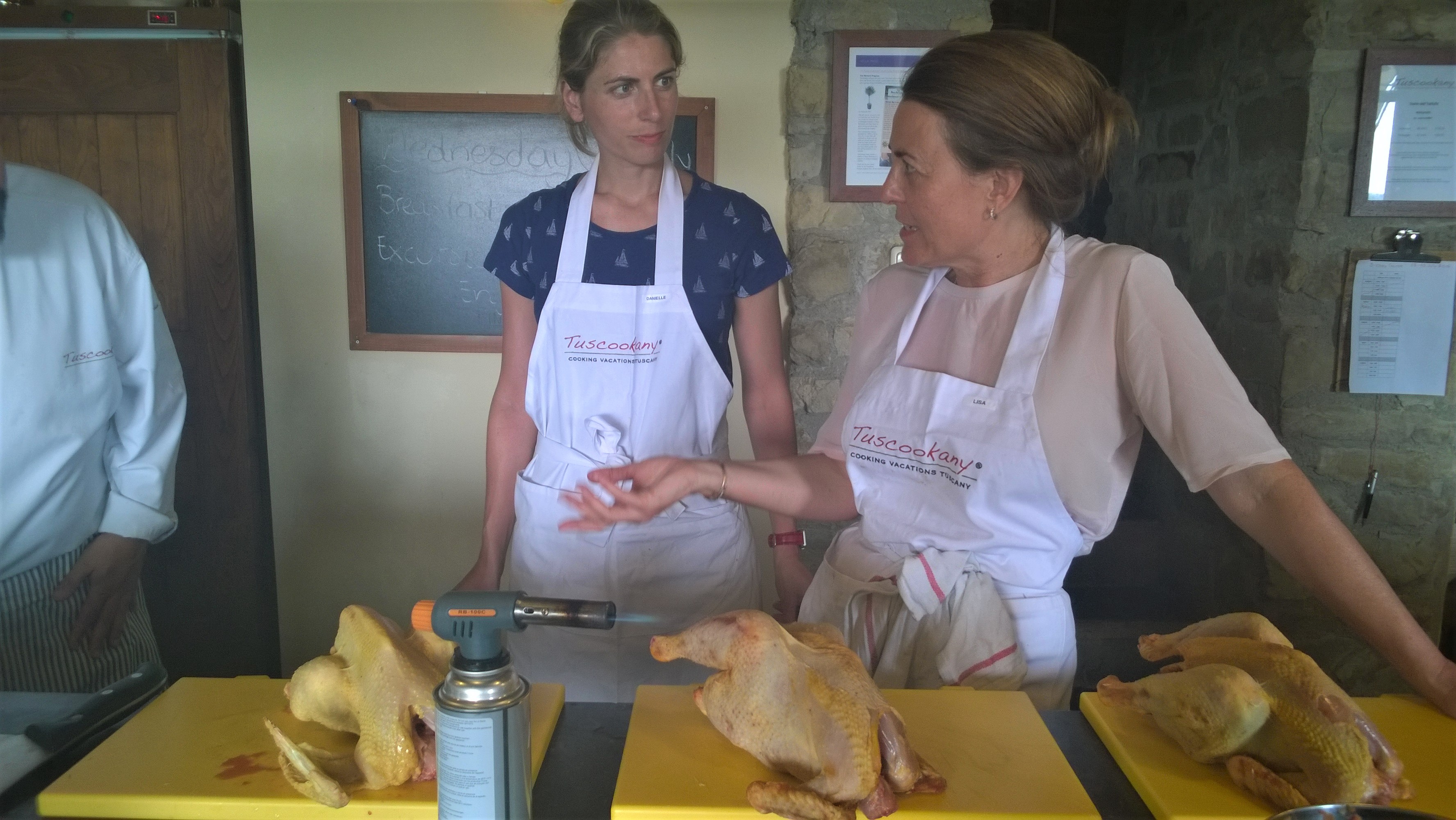
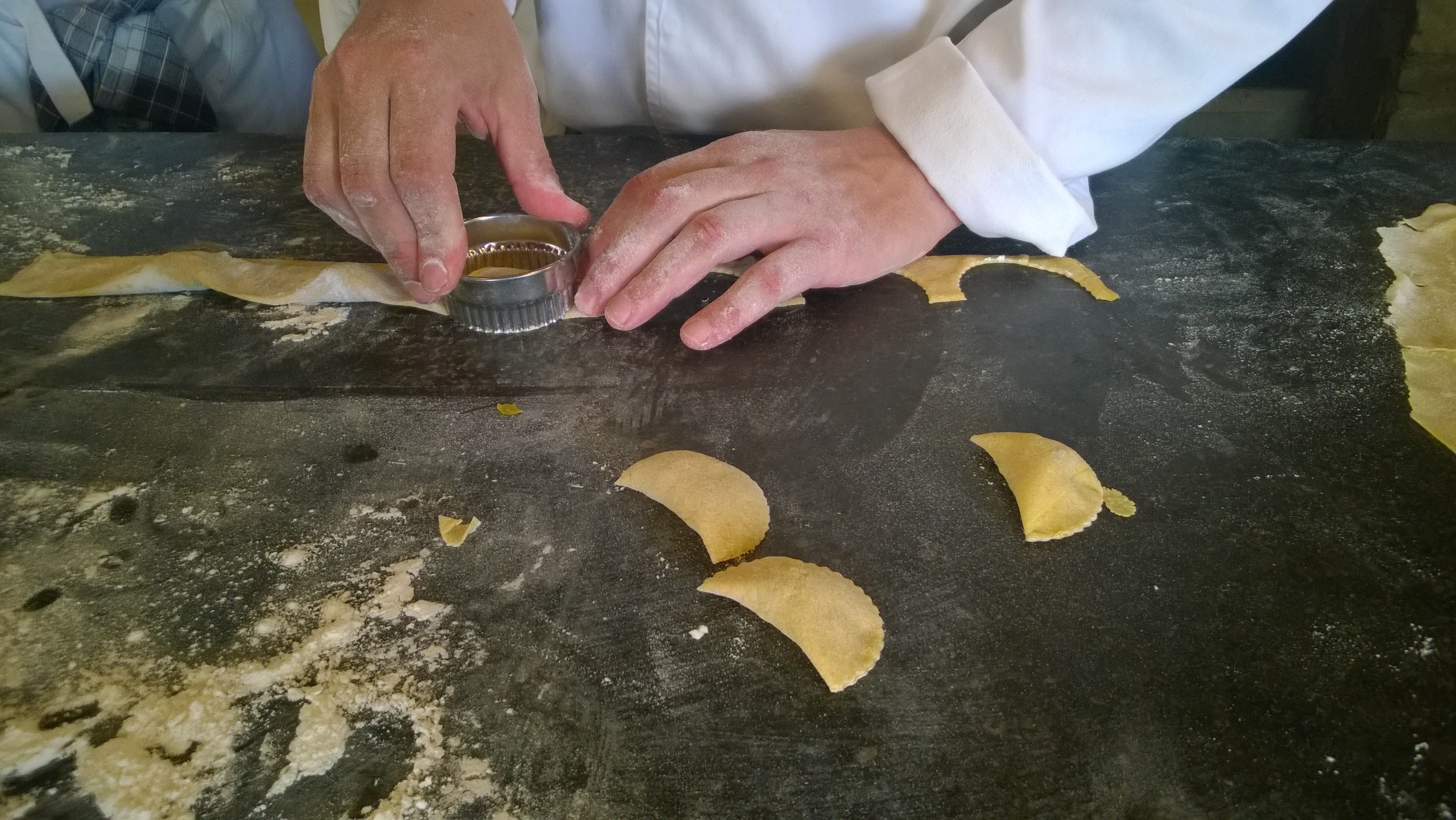
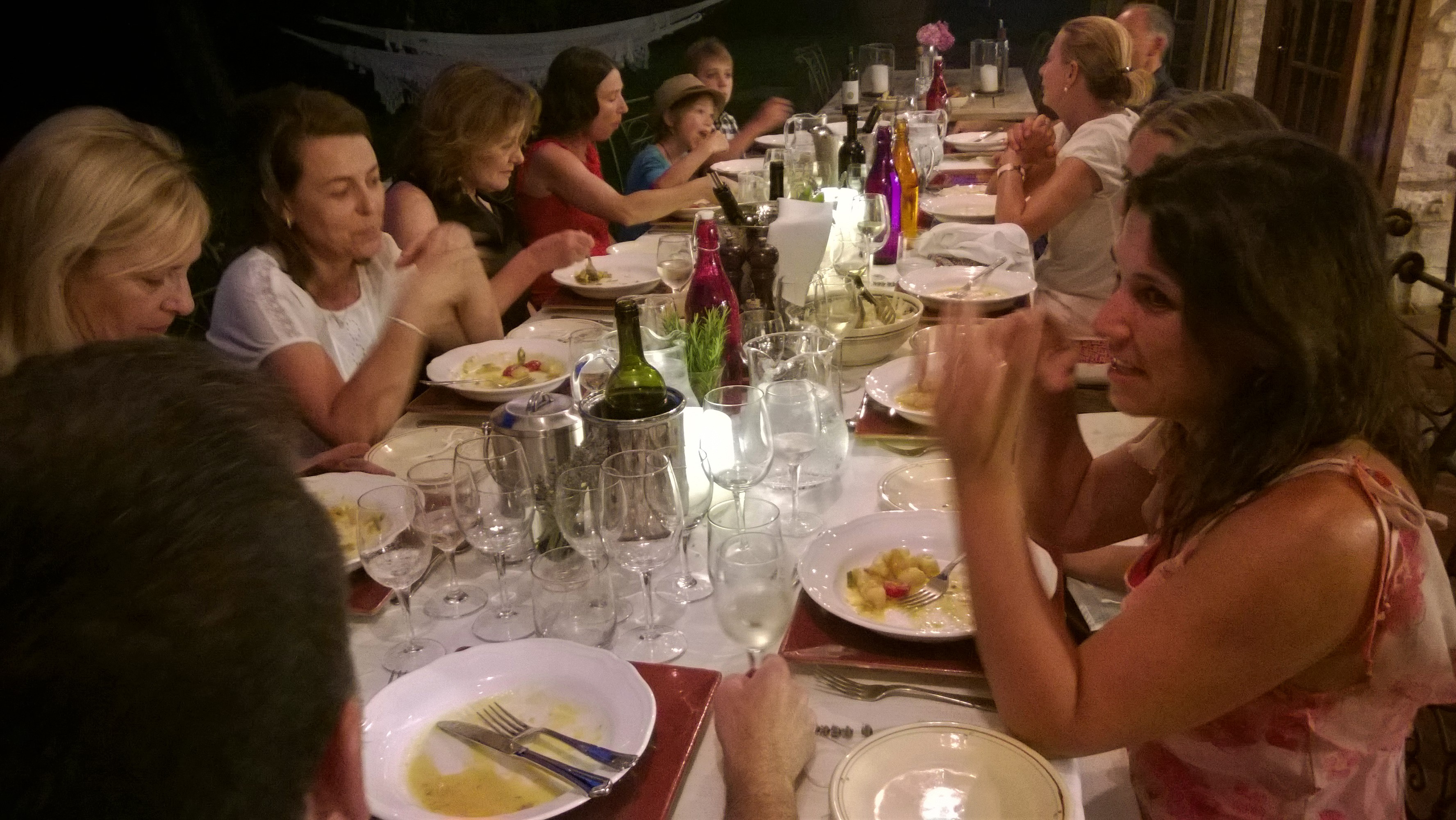
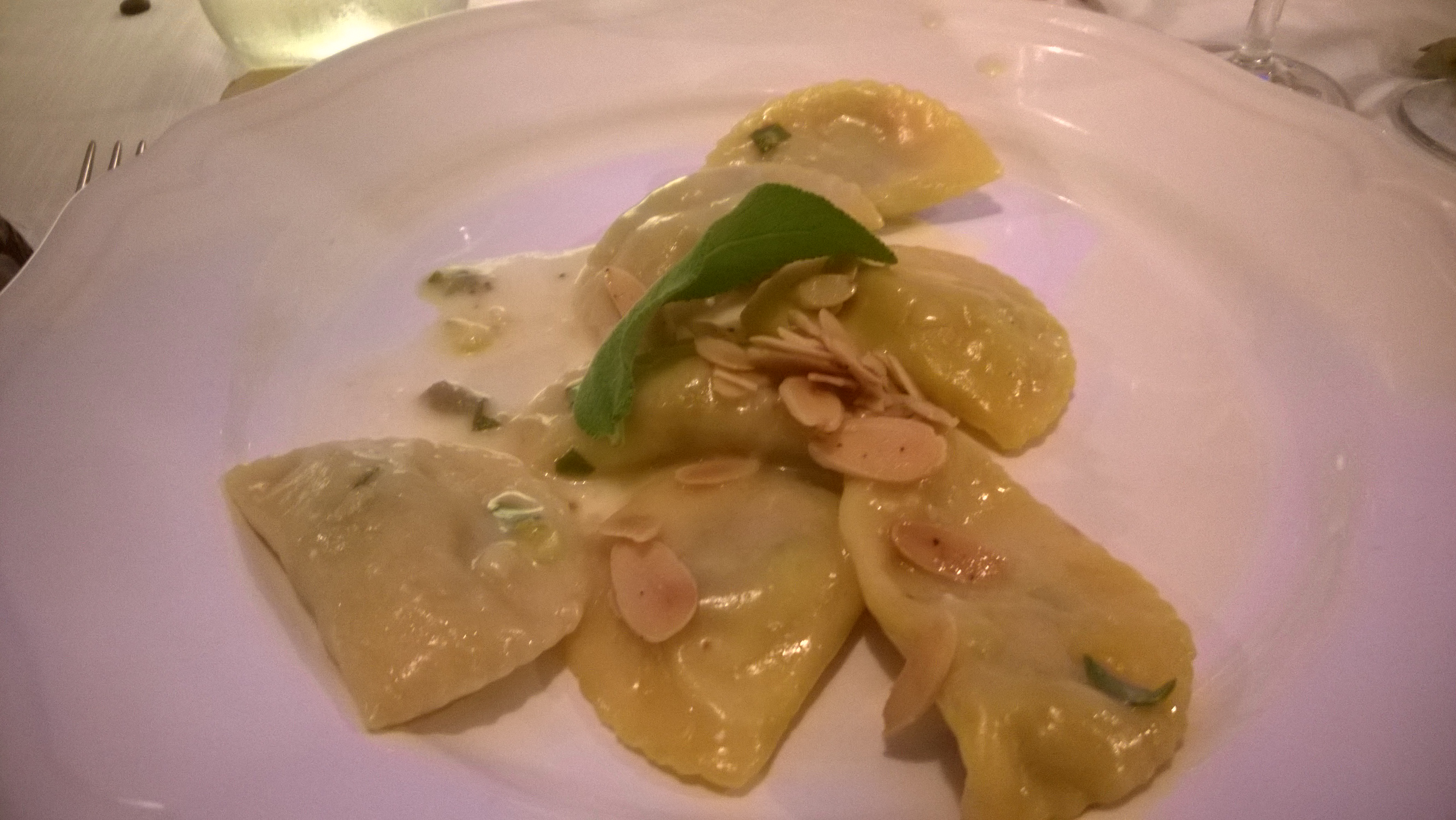
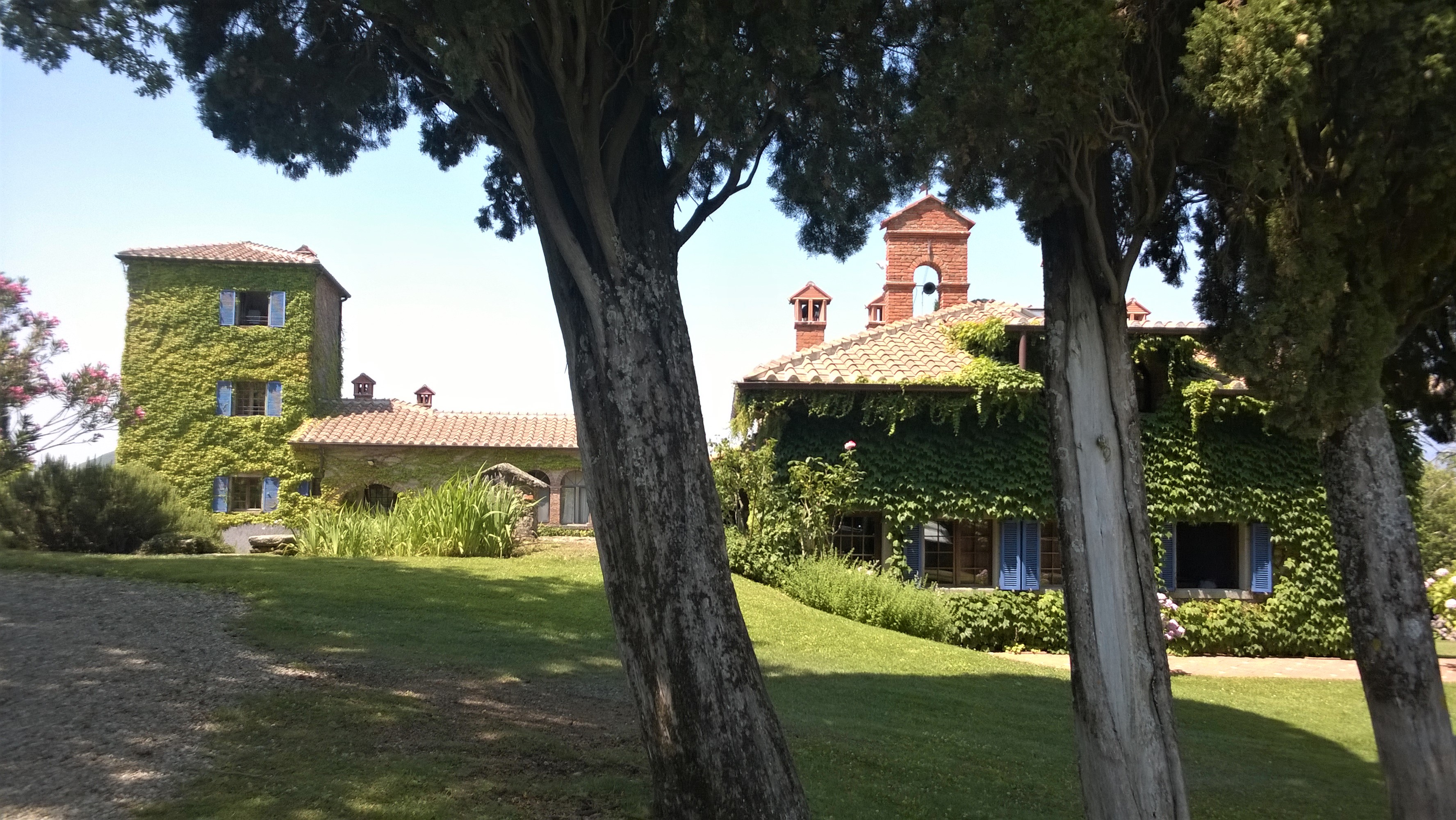
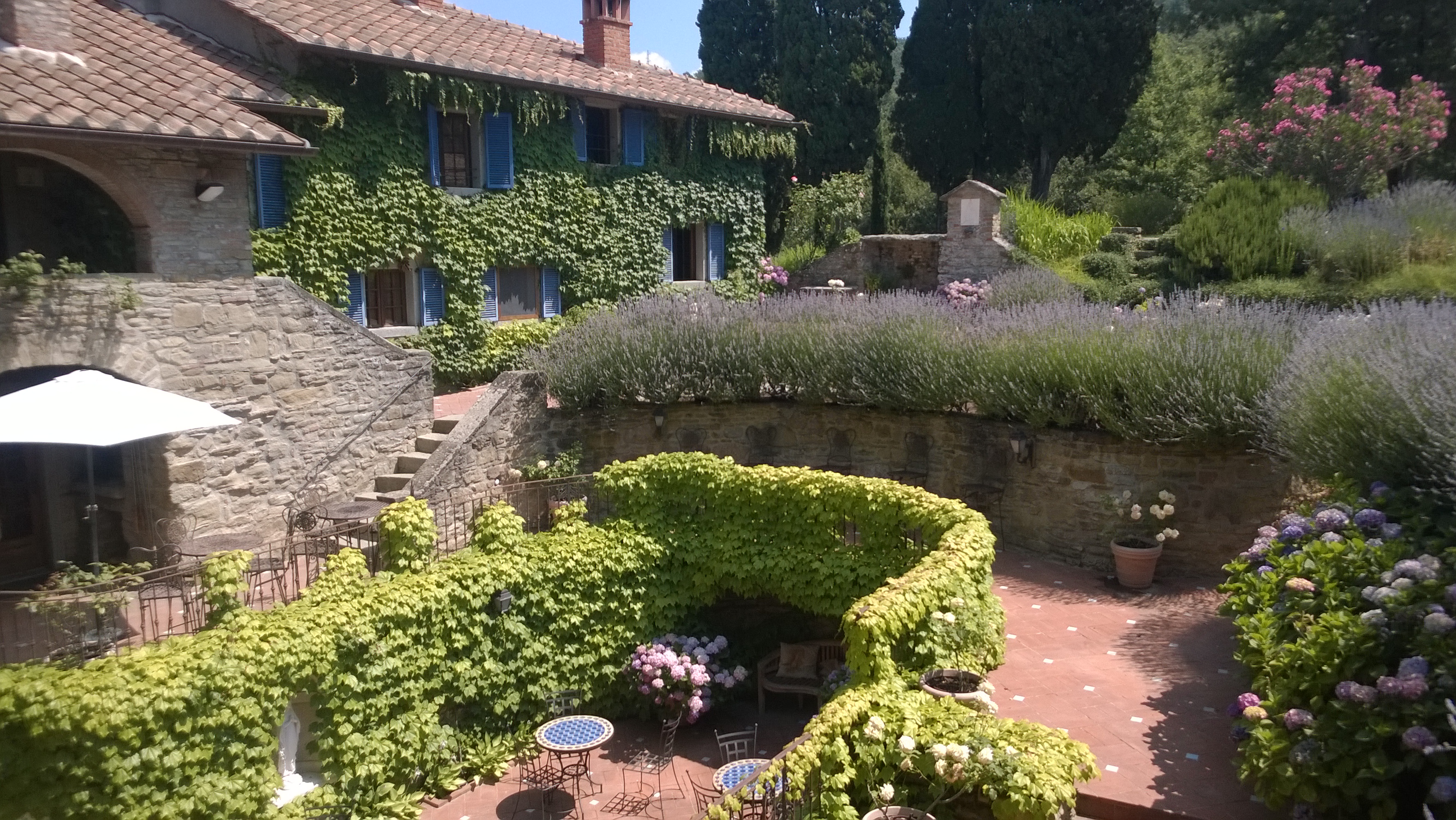
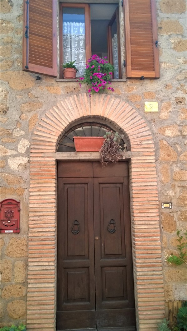
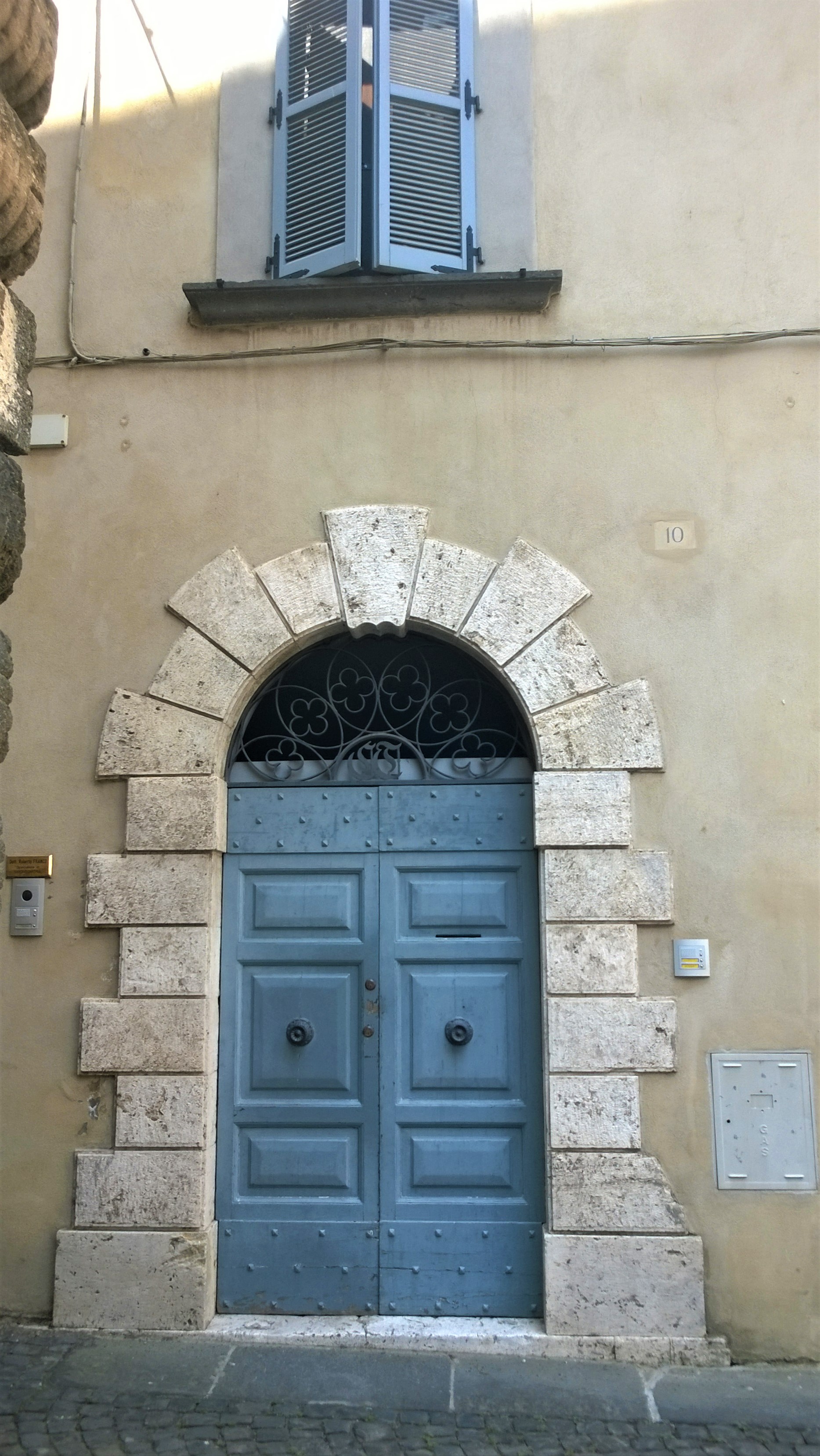
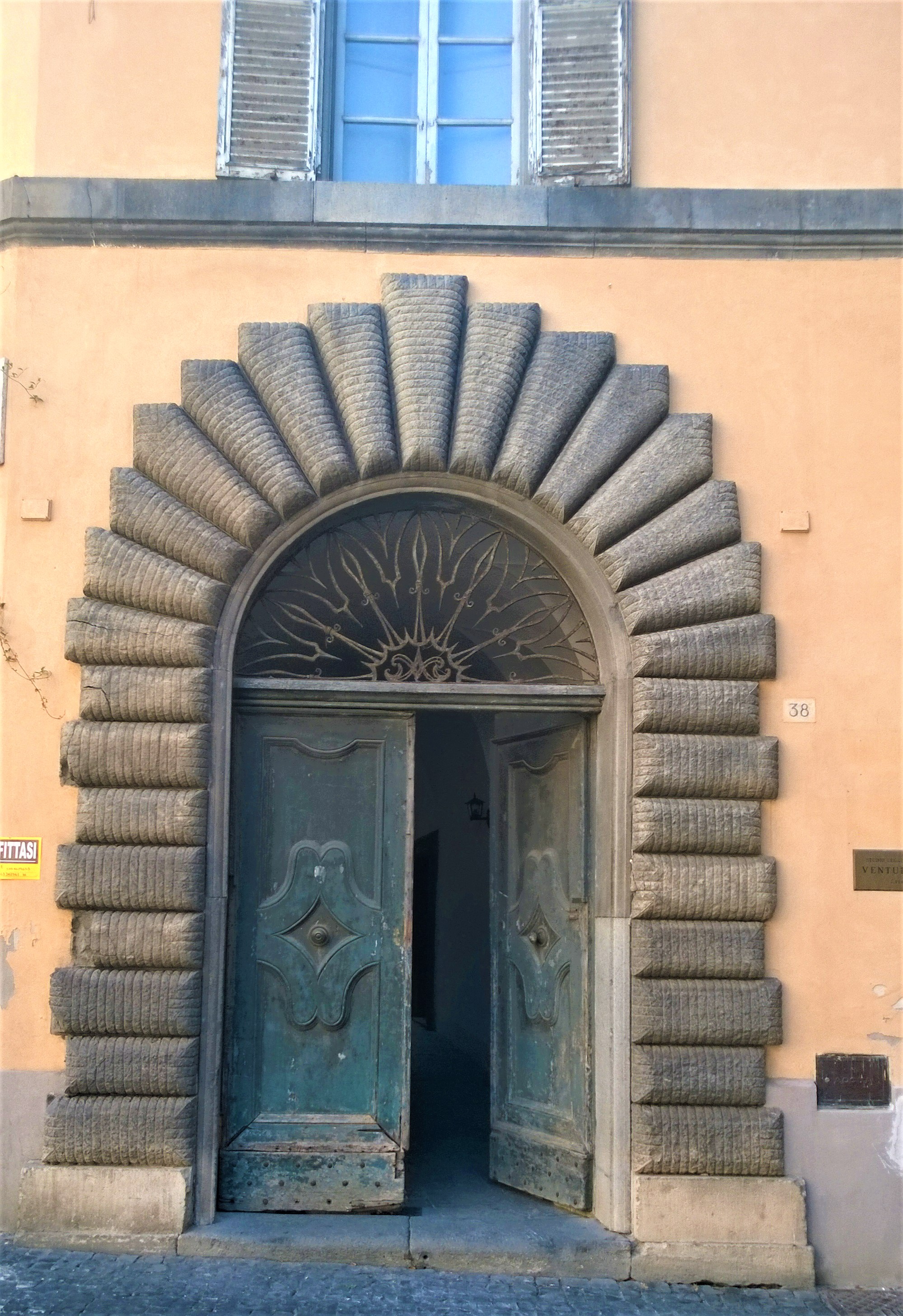
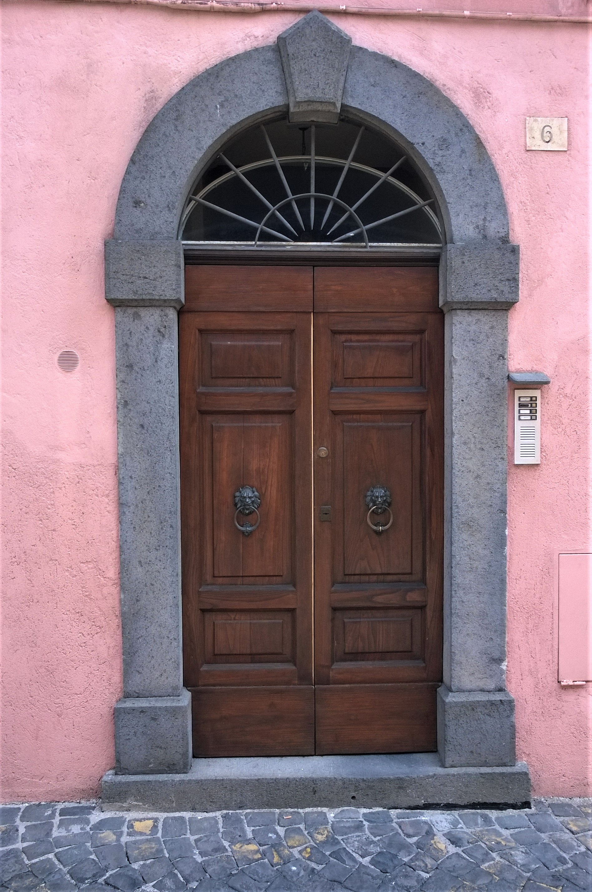
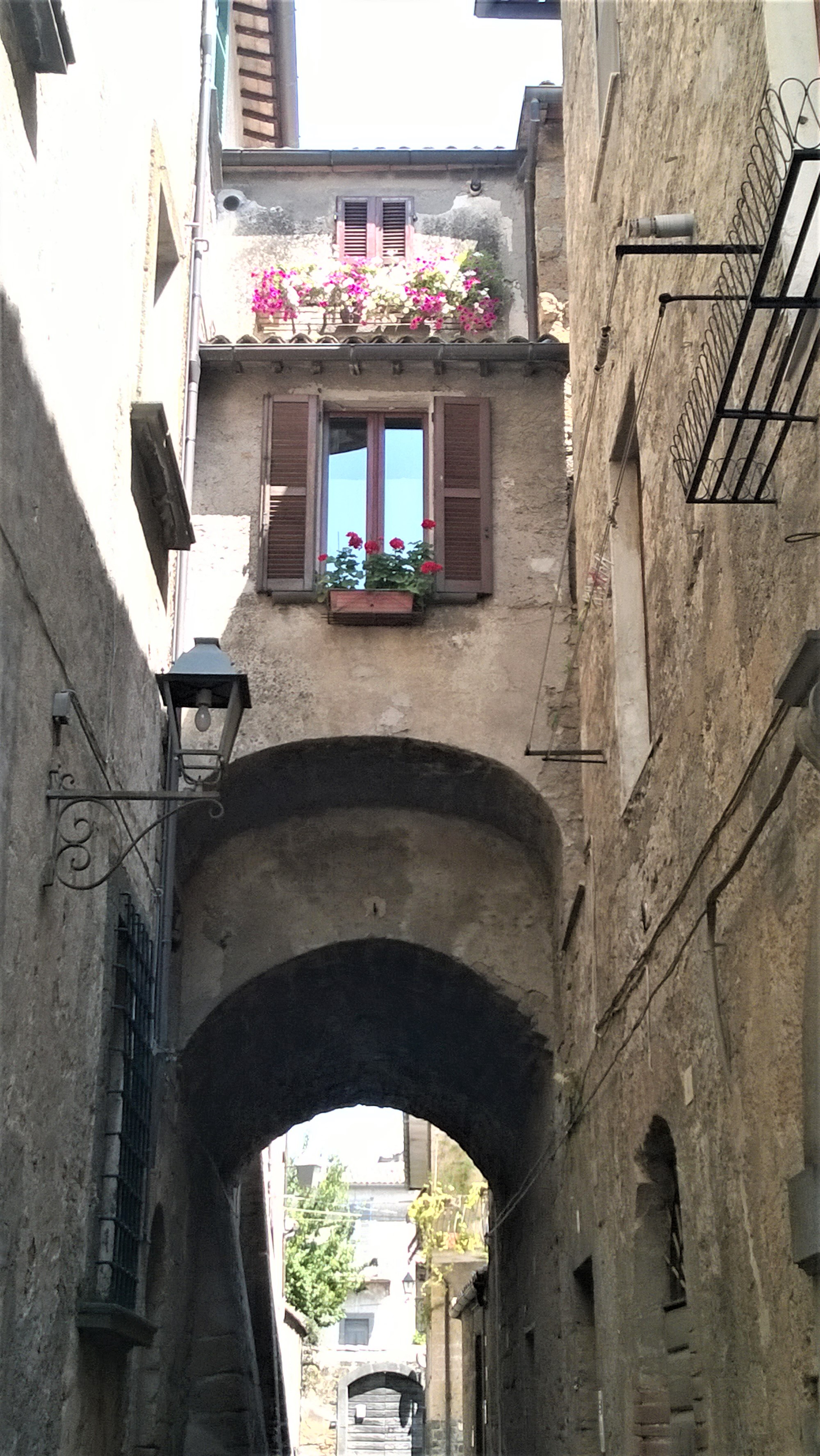
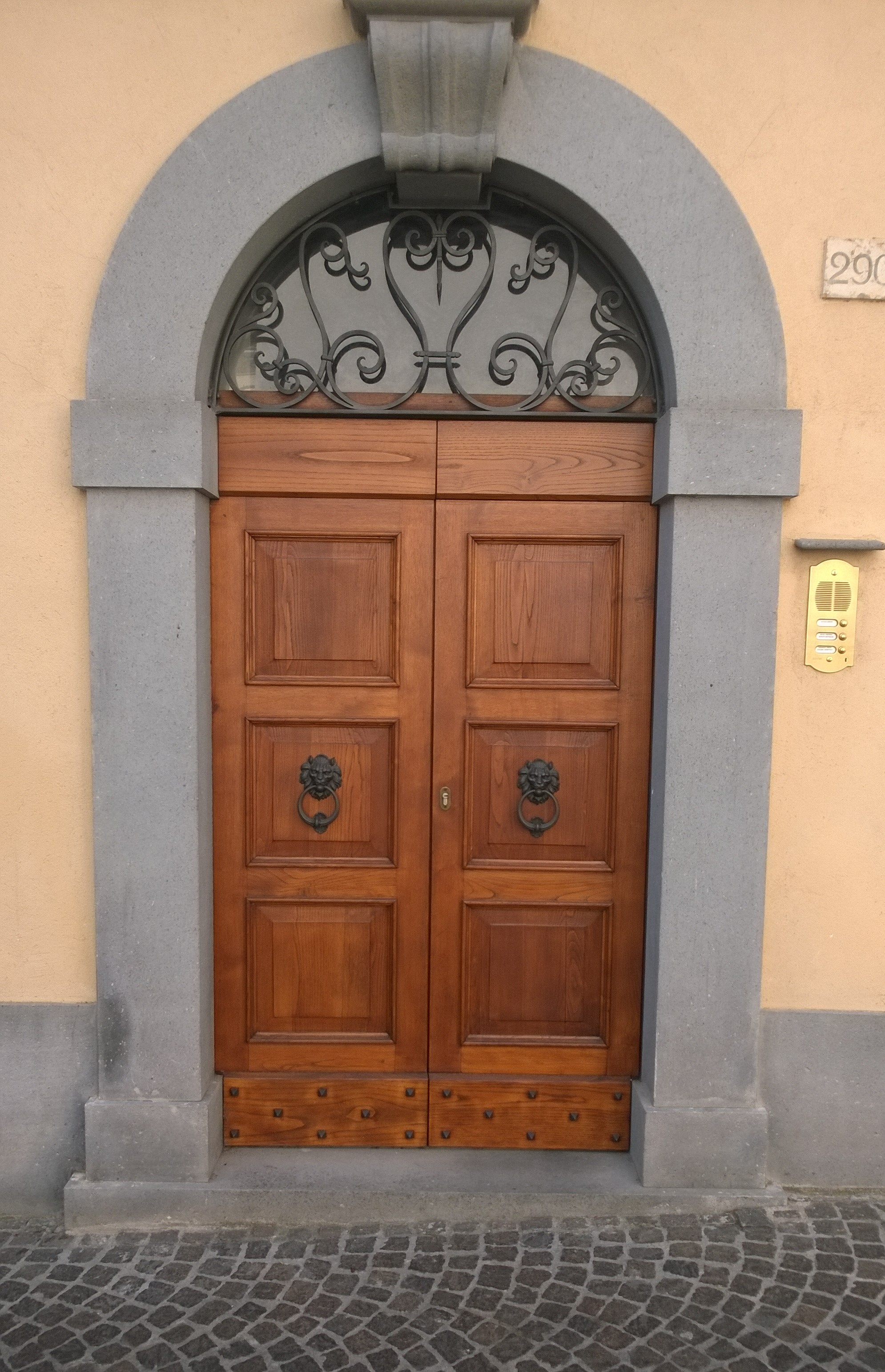
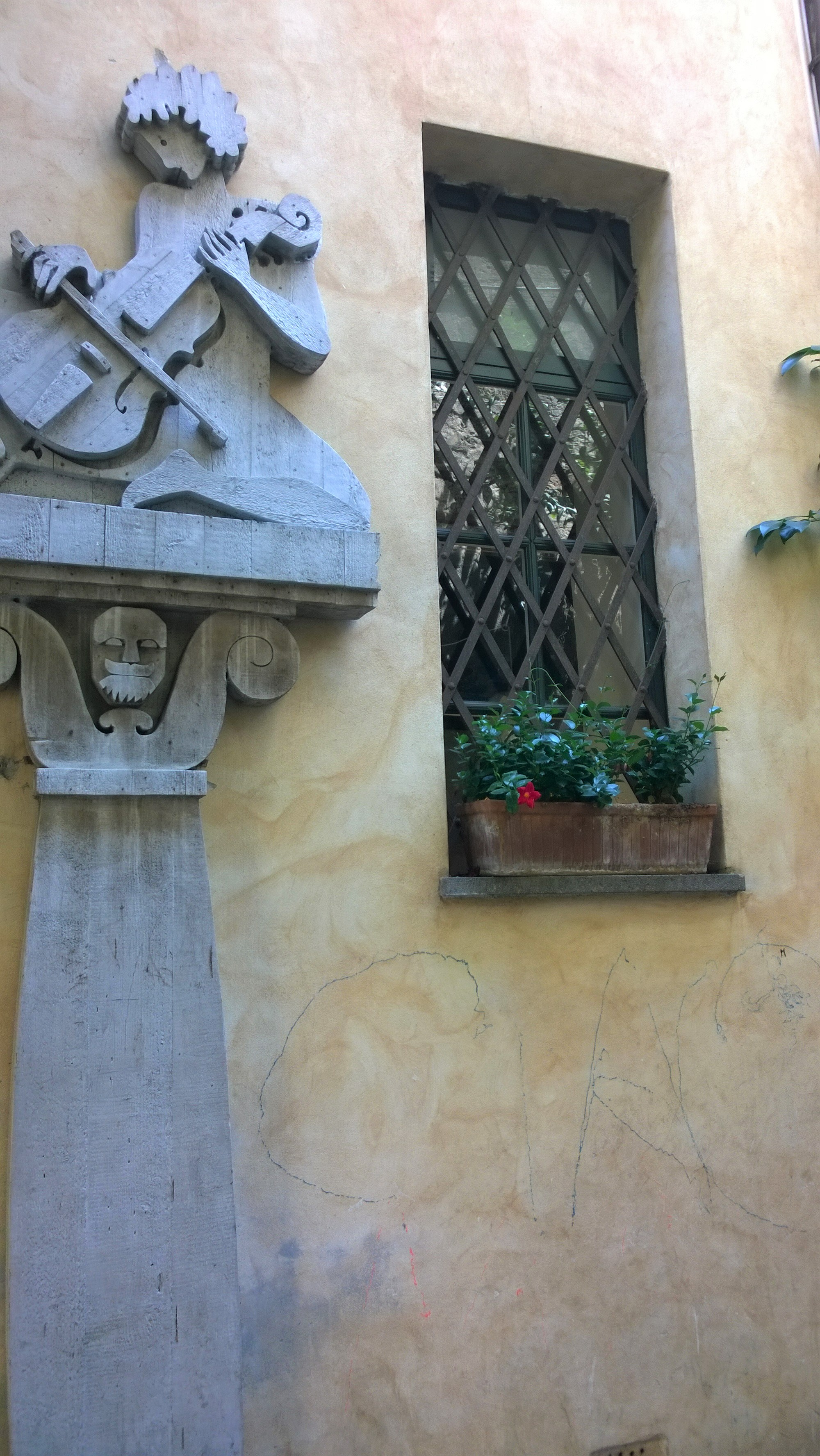
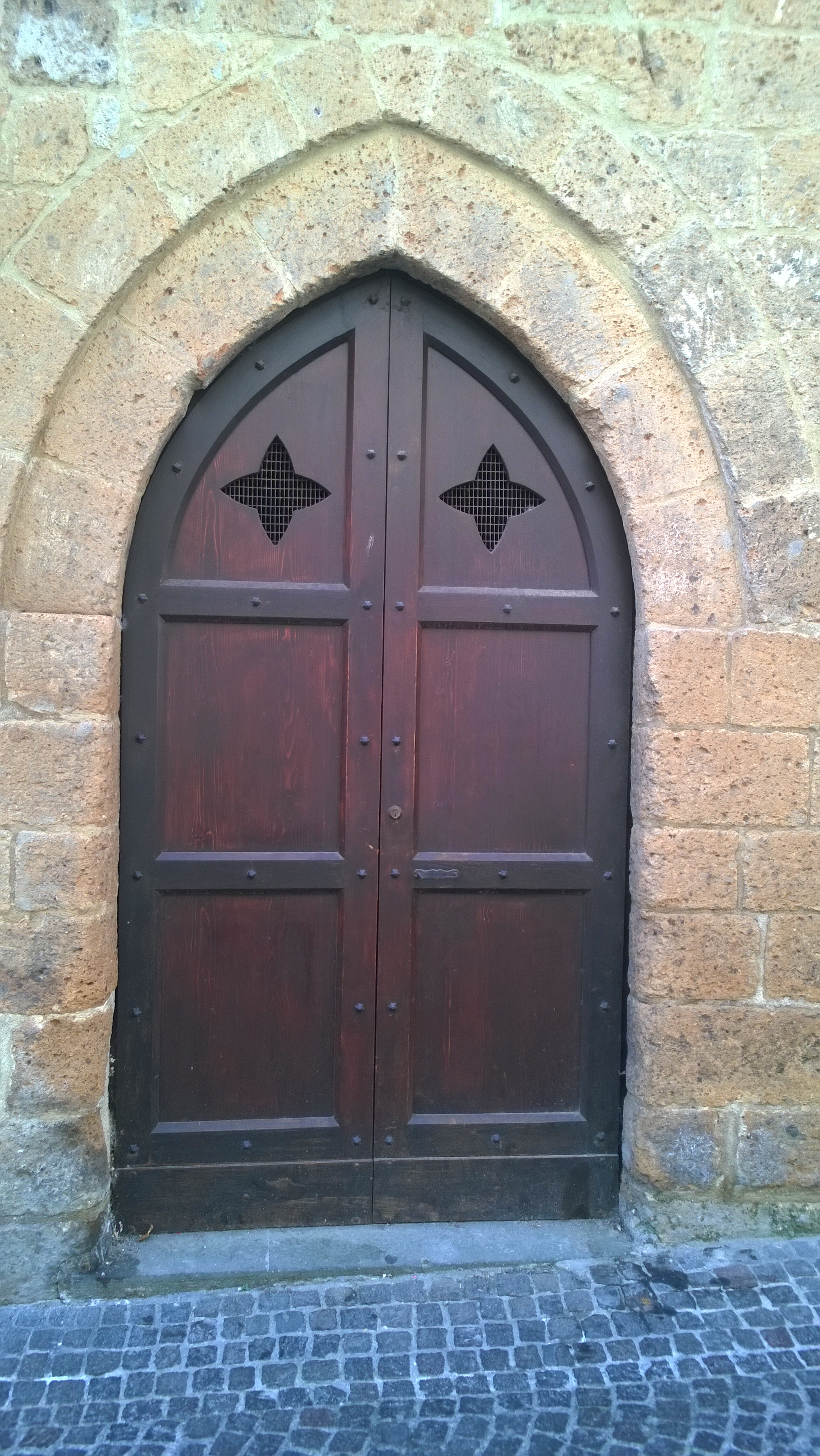
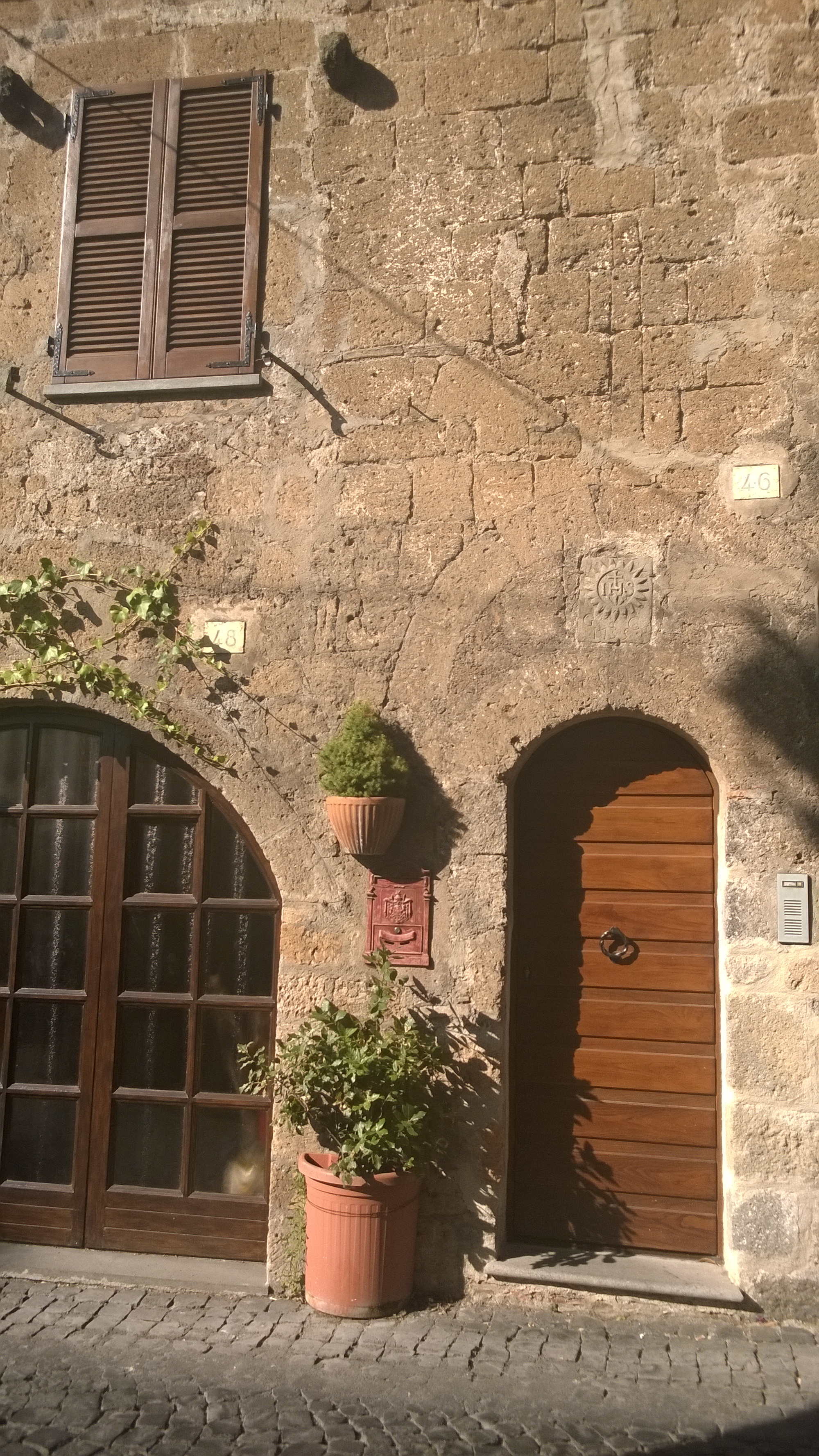
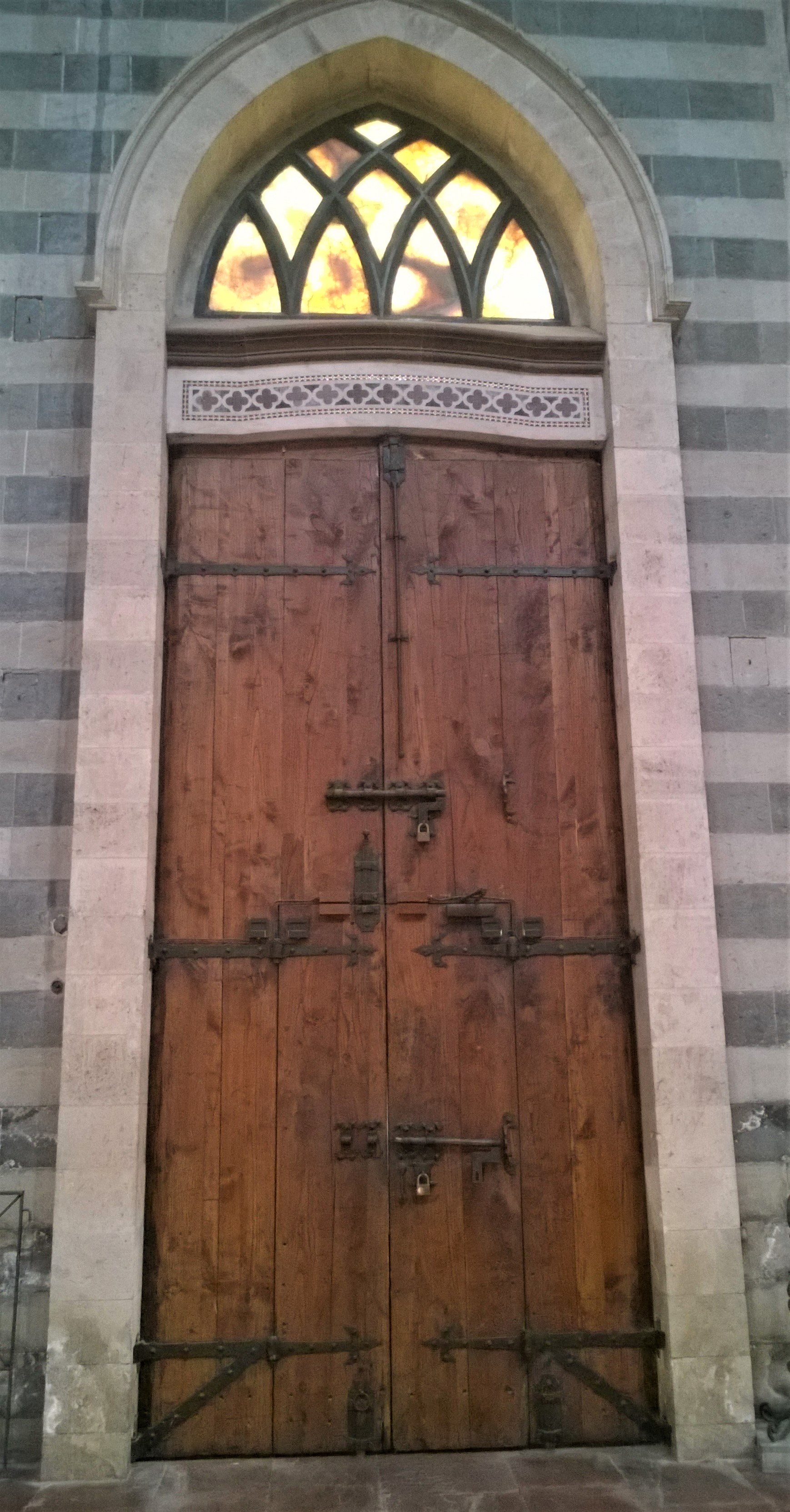
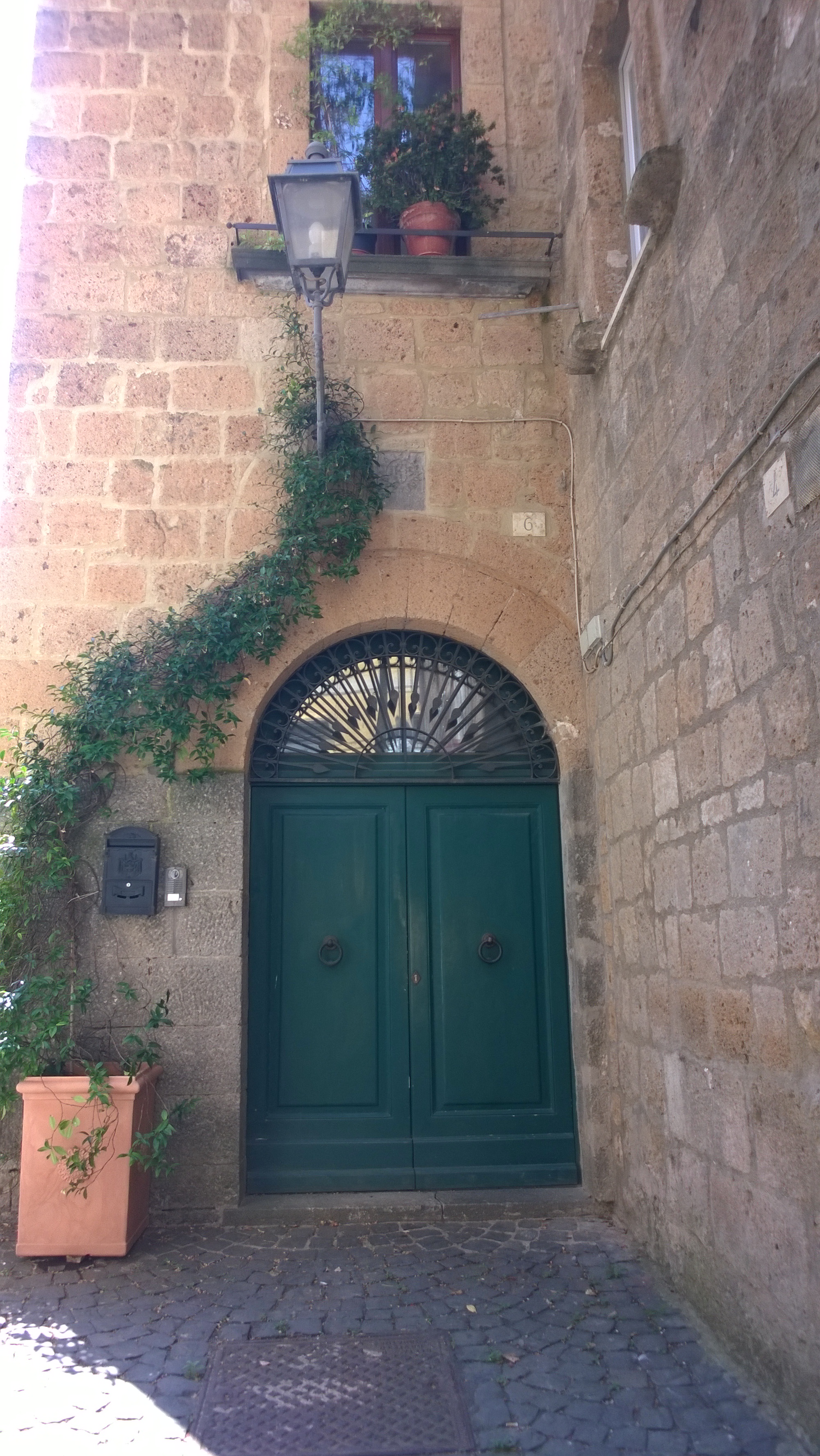
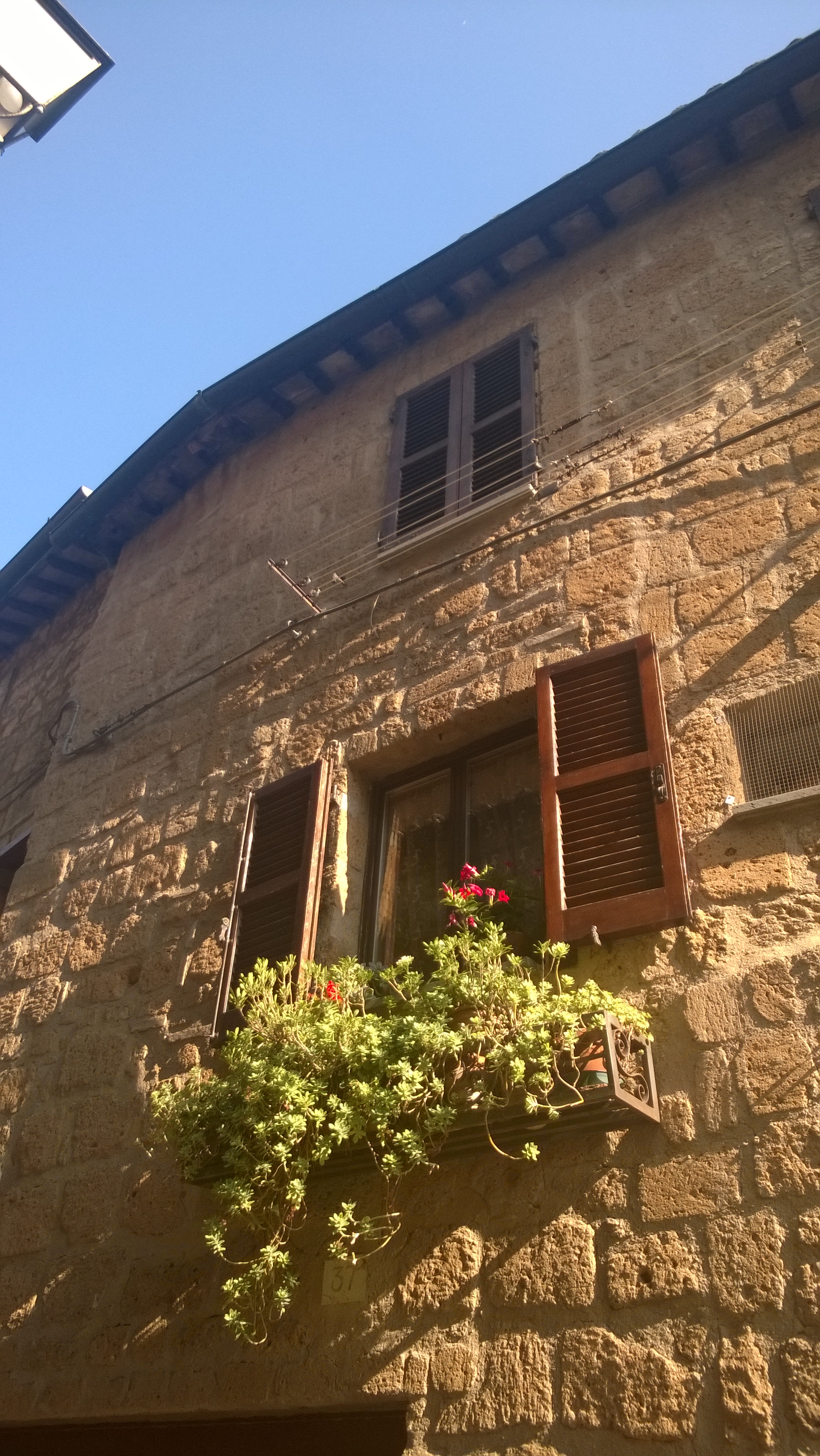
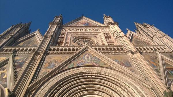
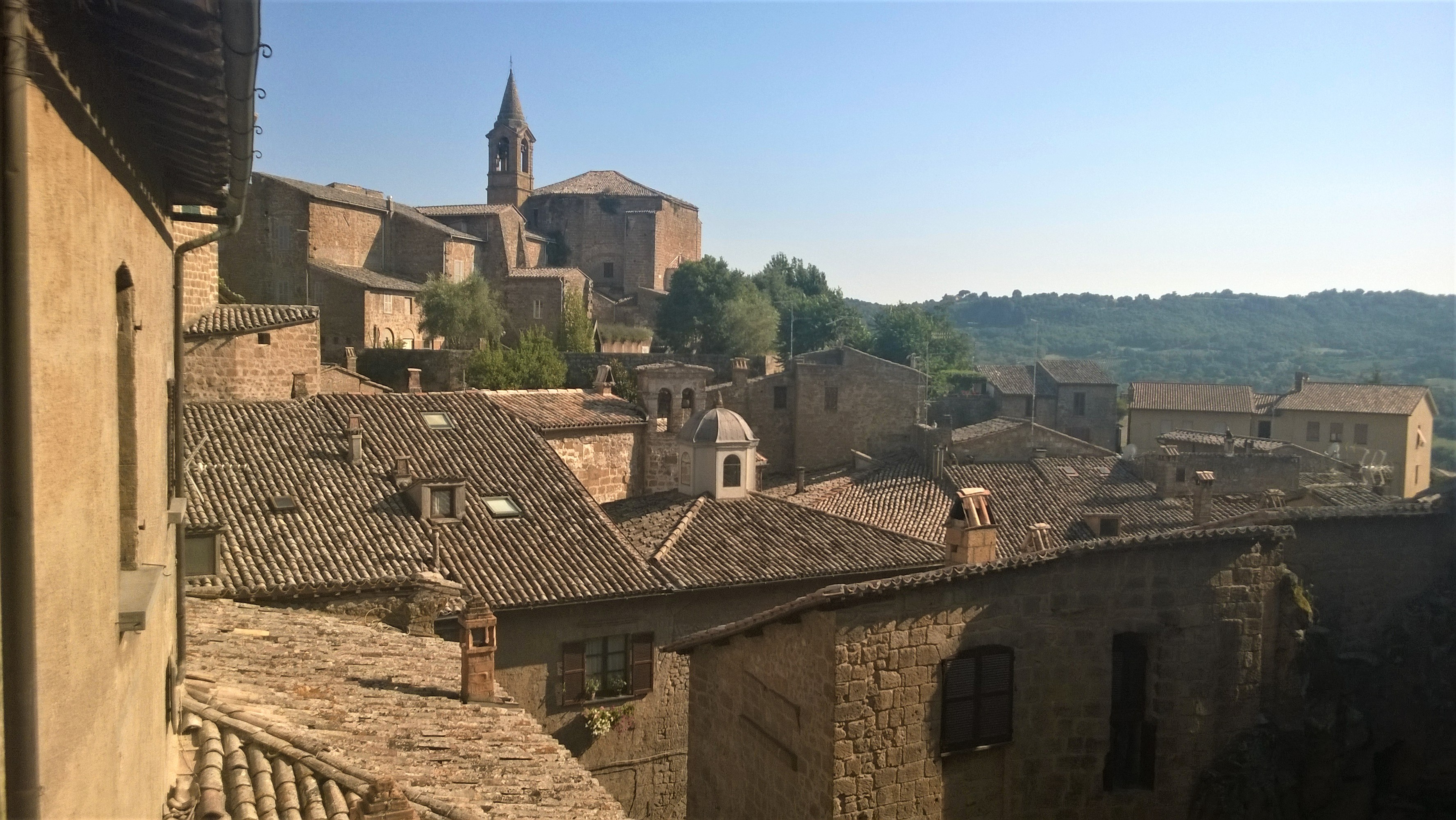
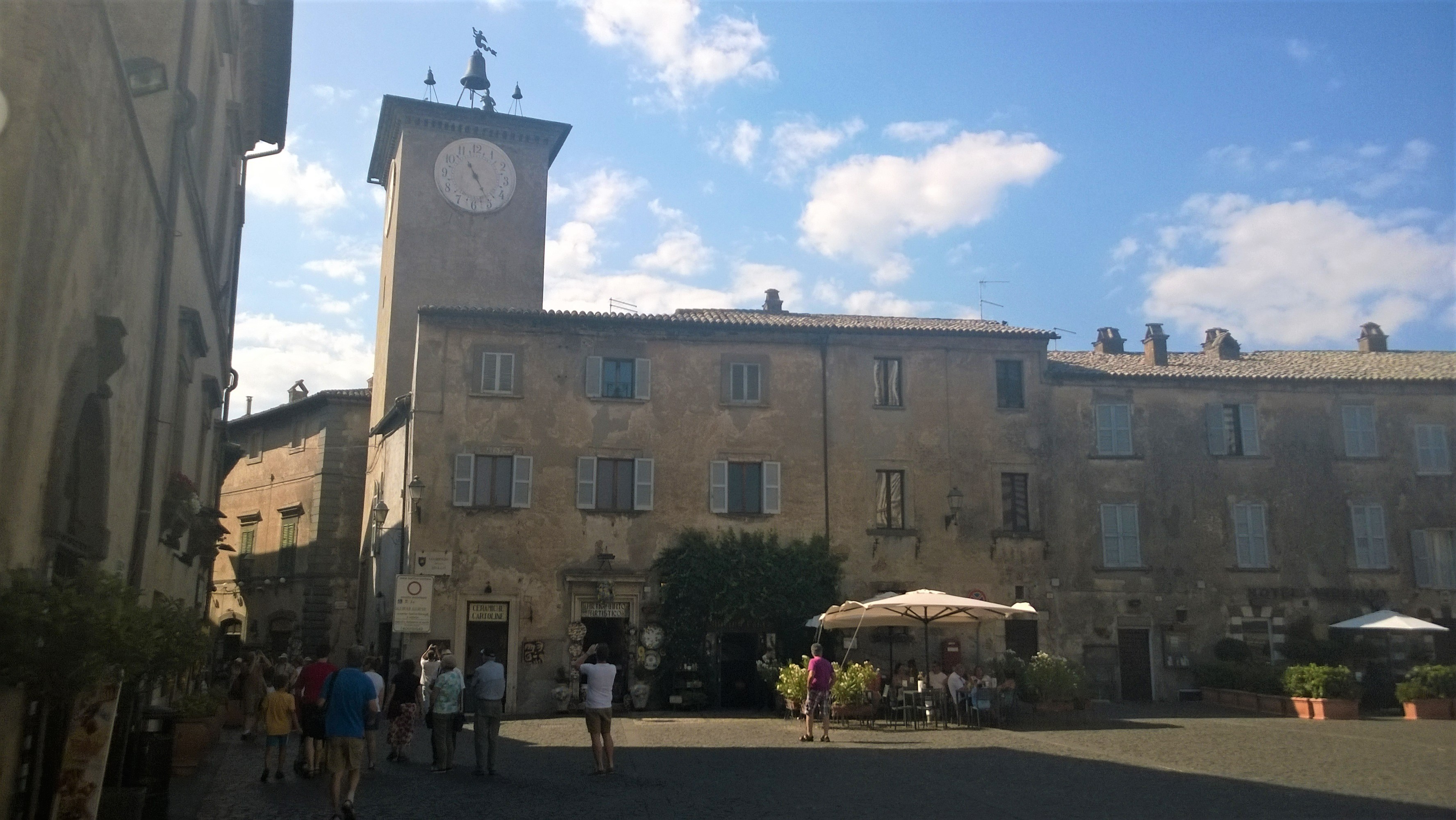
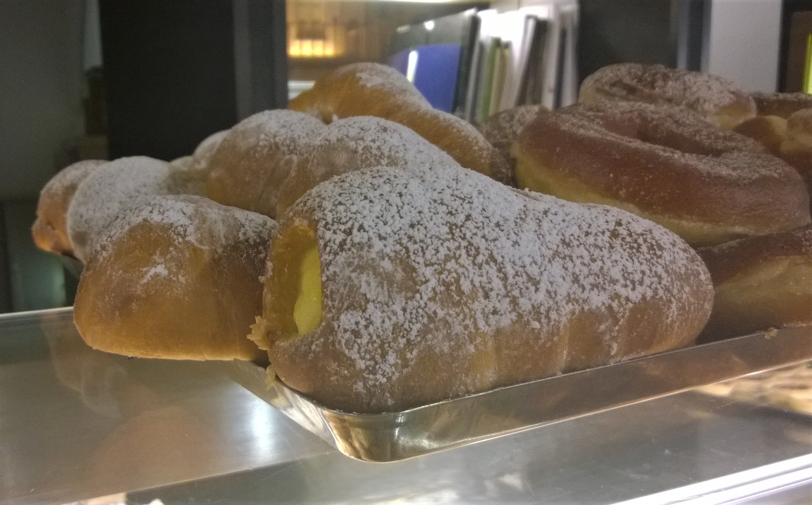
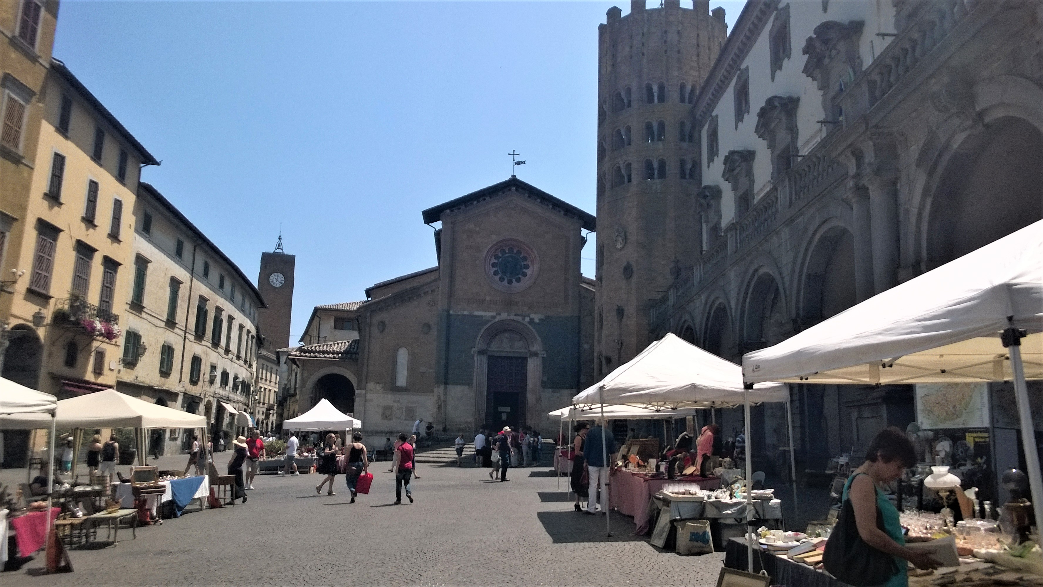
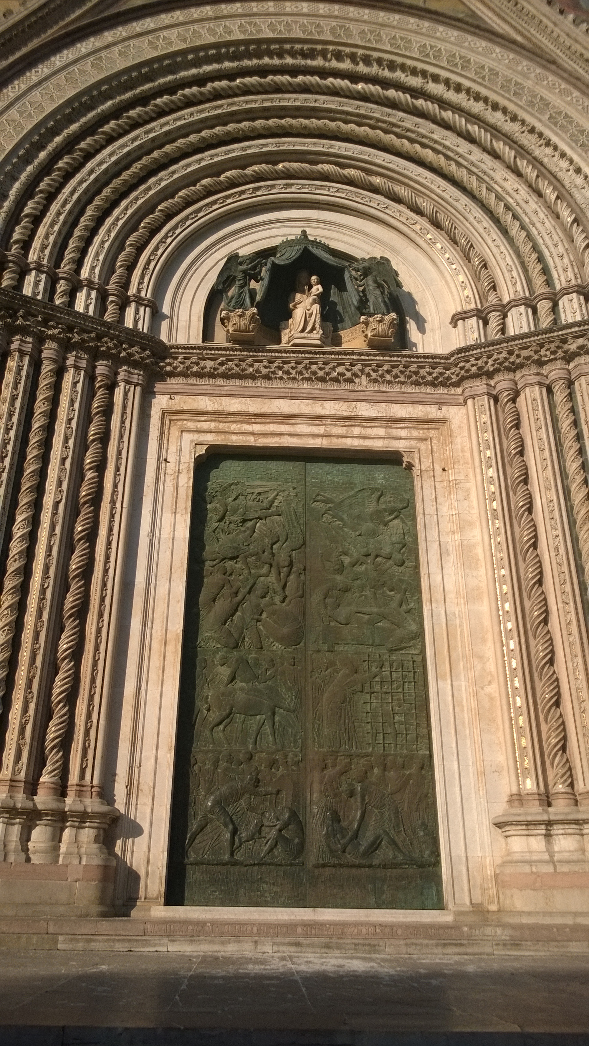
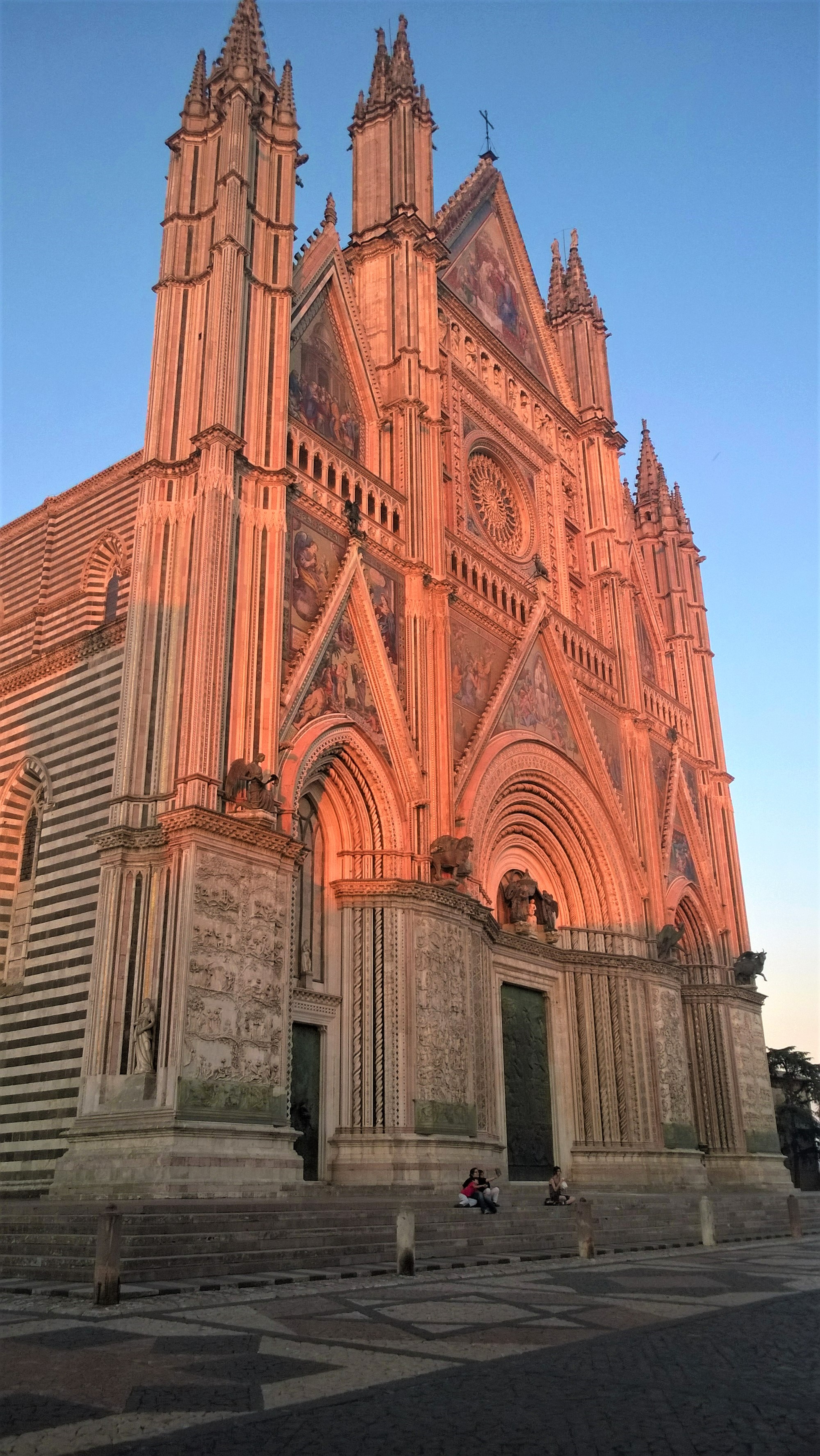
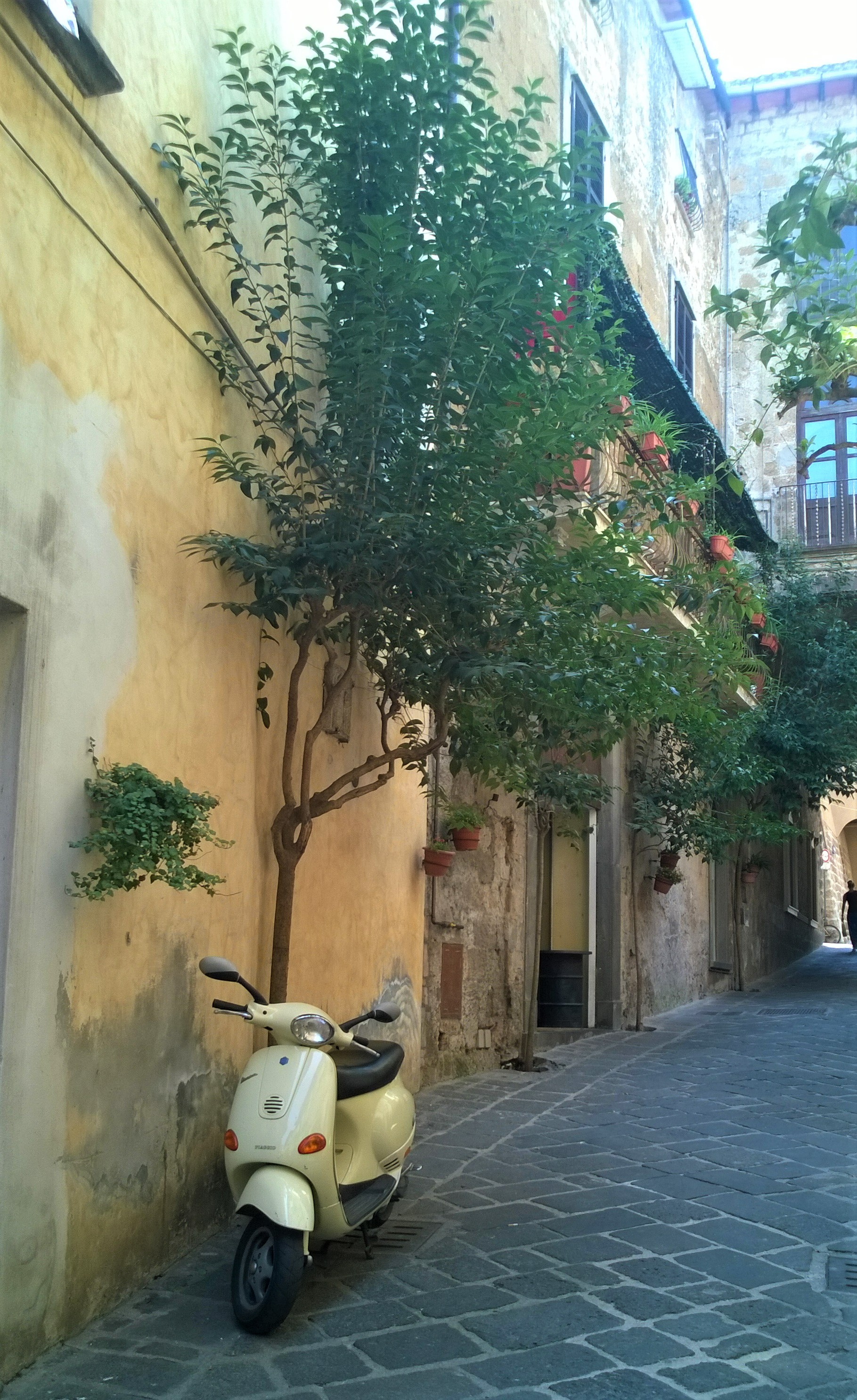
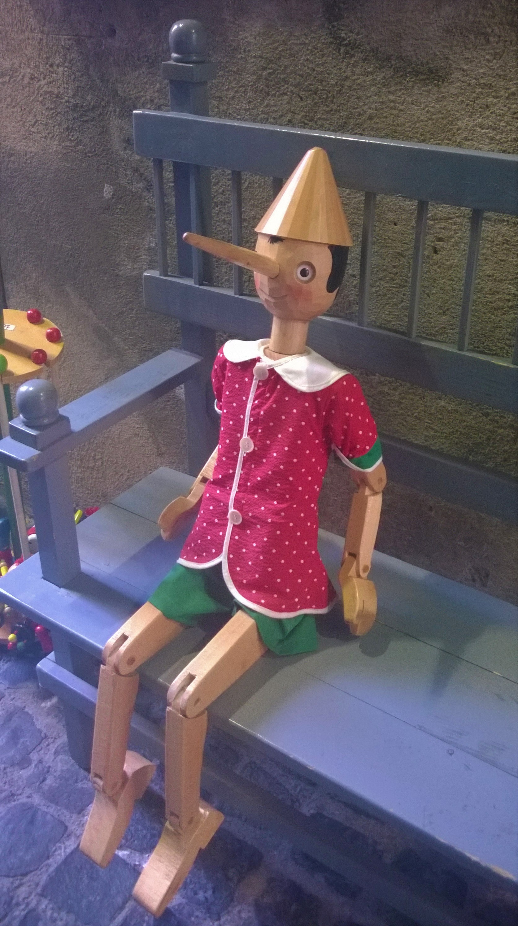
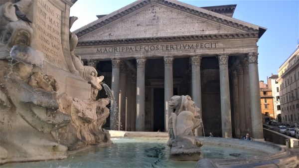
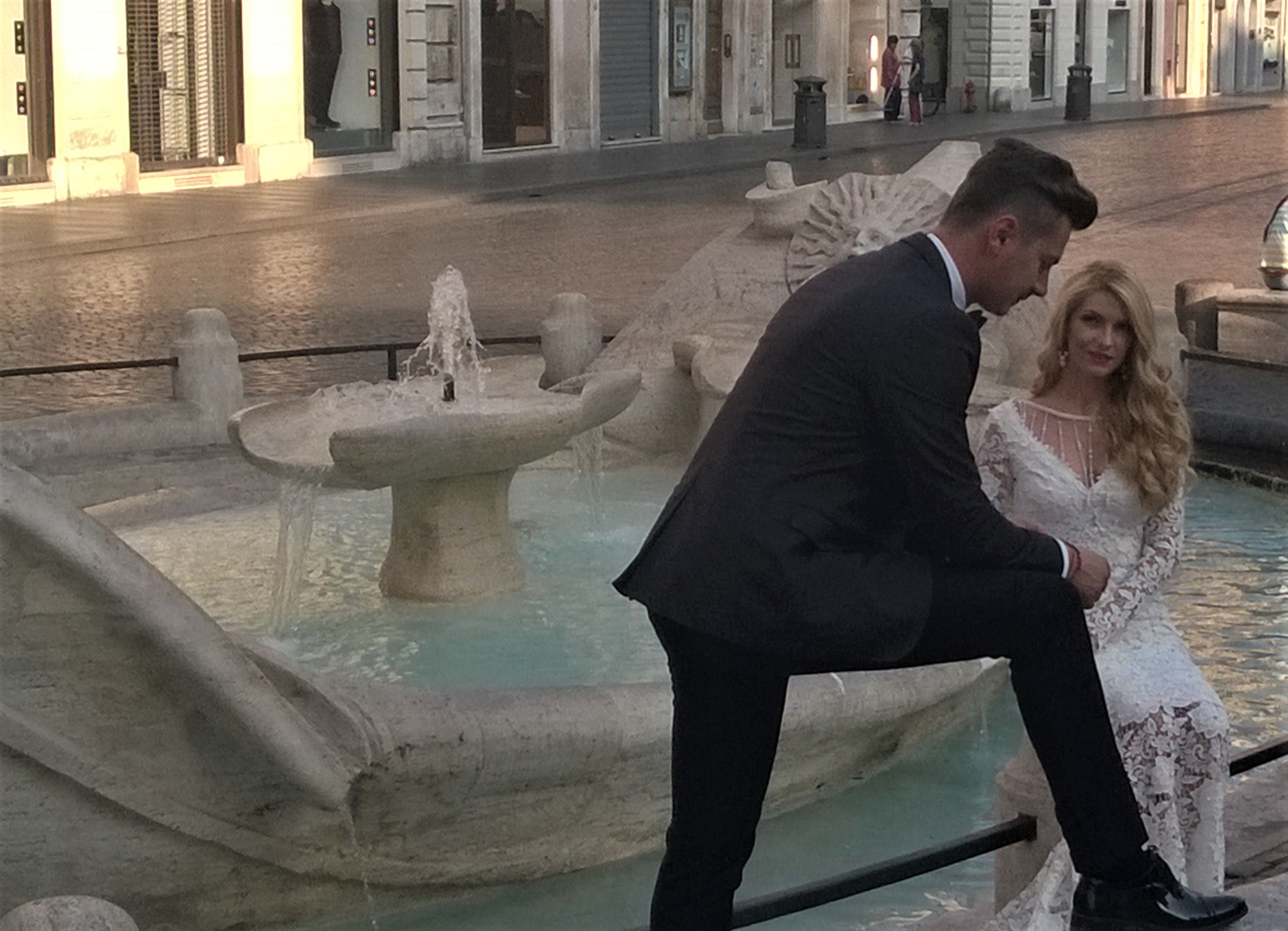
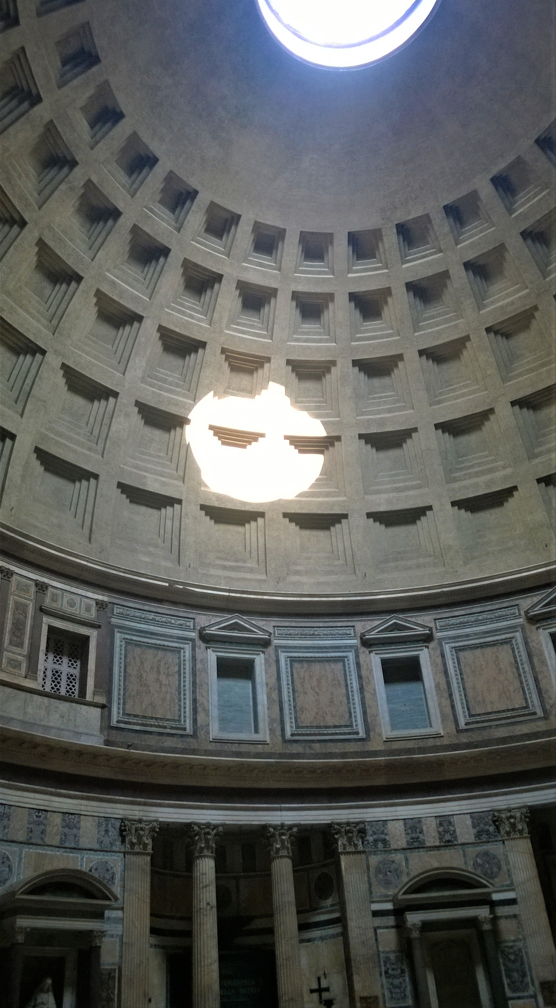

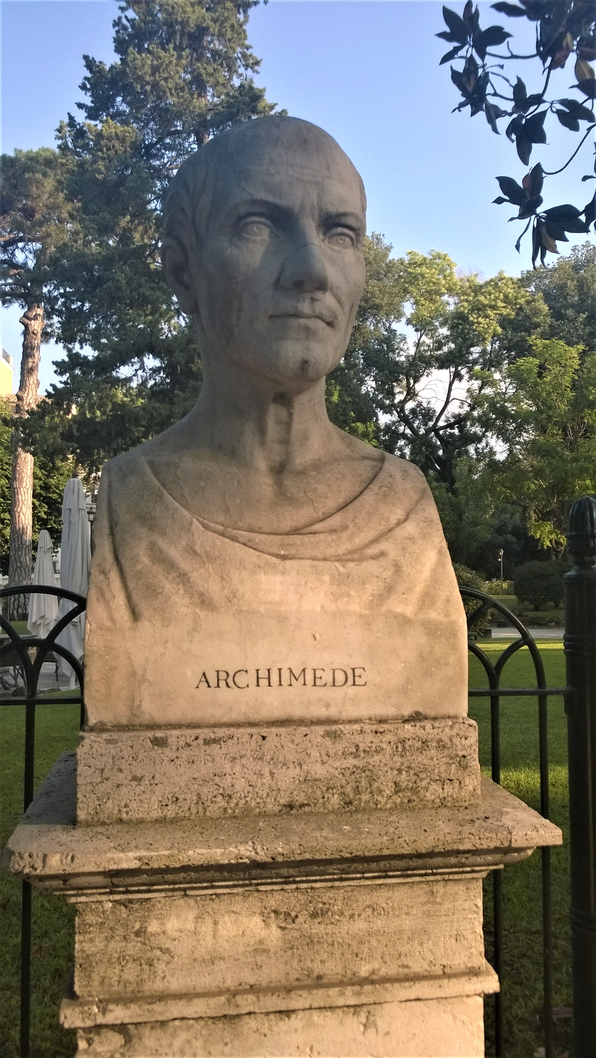
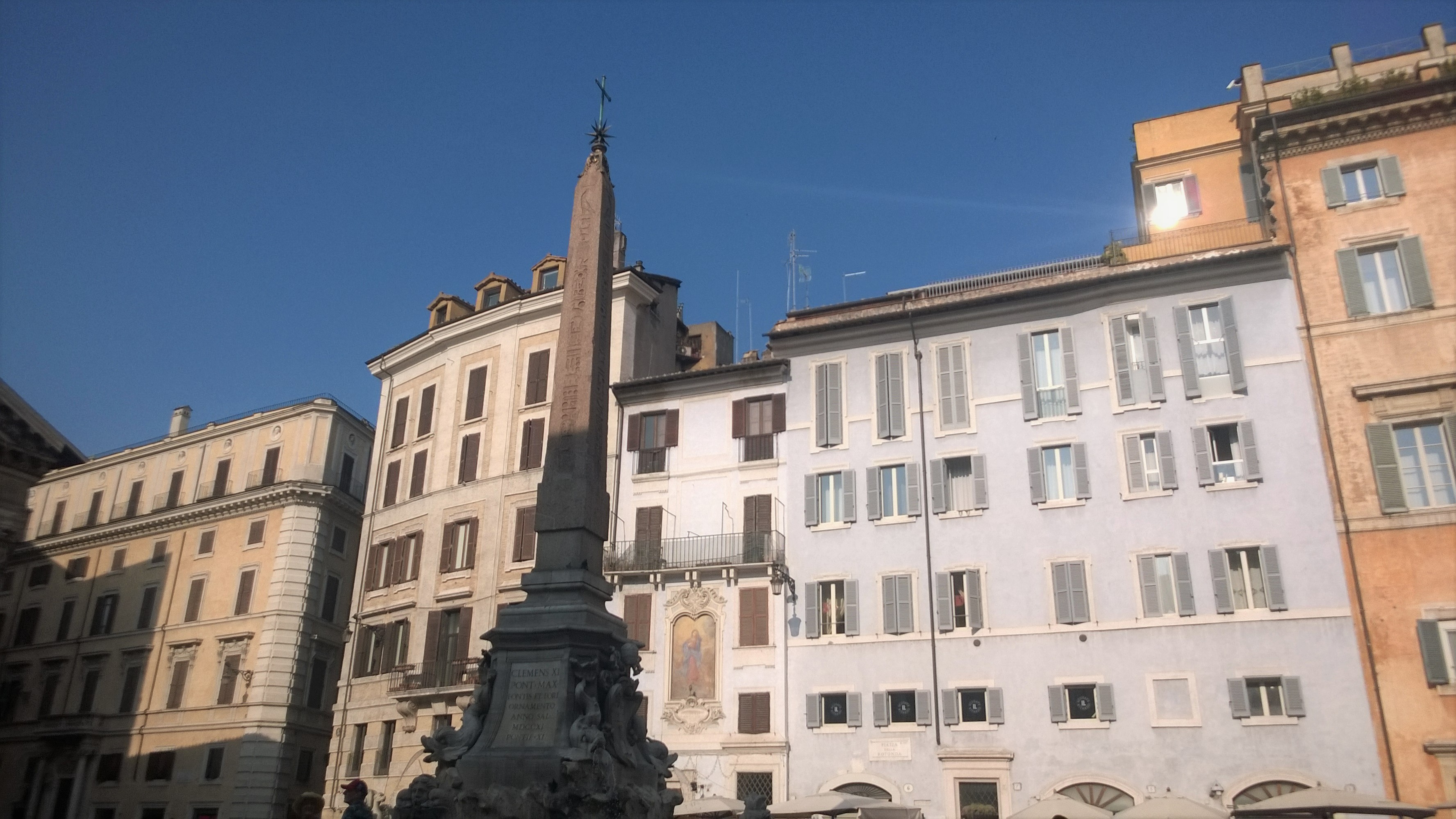
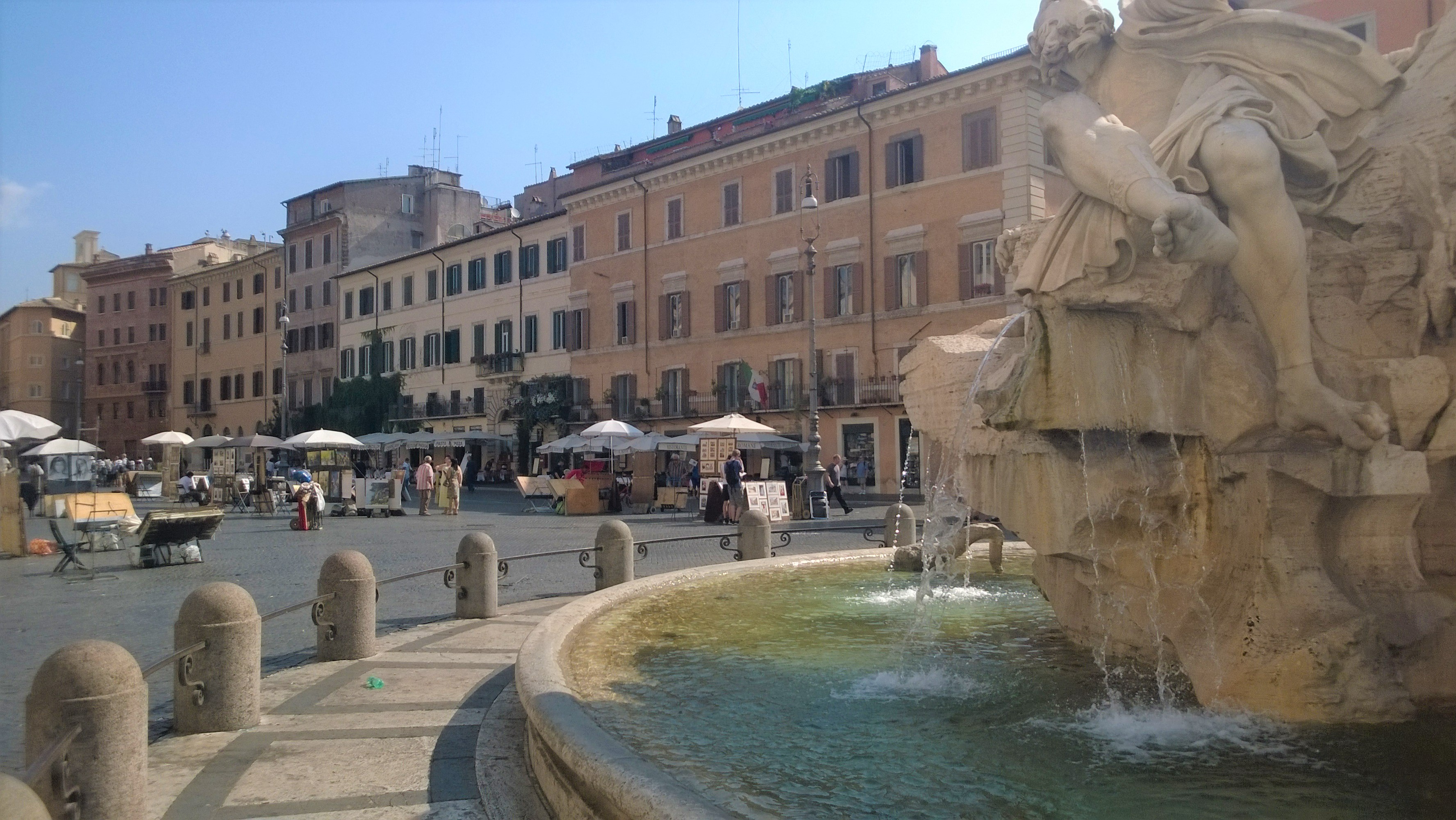
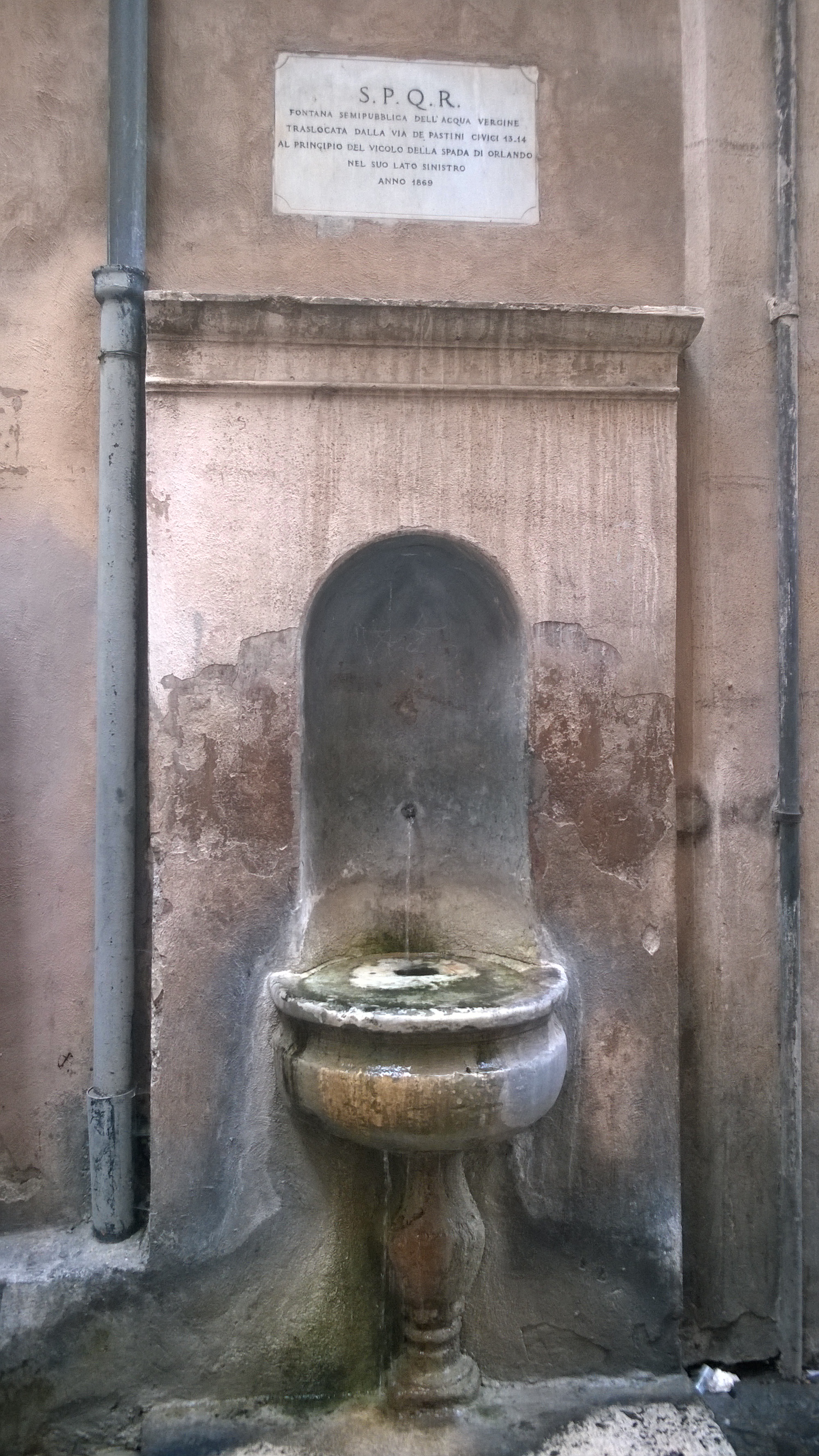
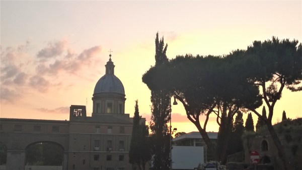
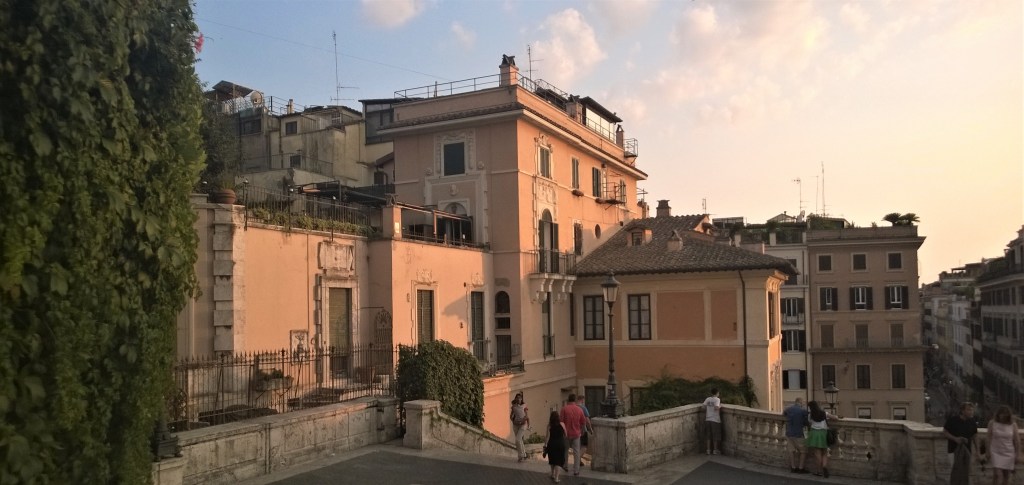
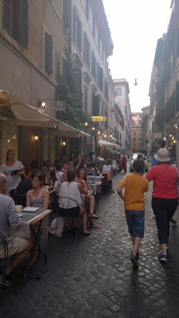


You must be logged in to post a comment.